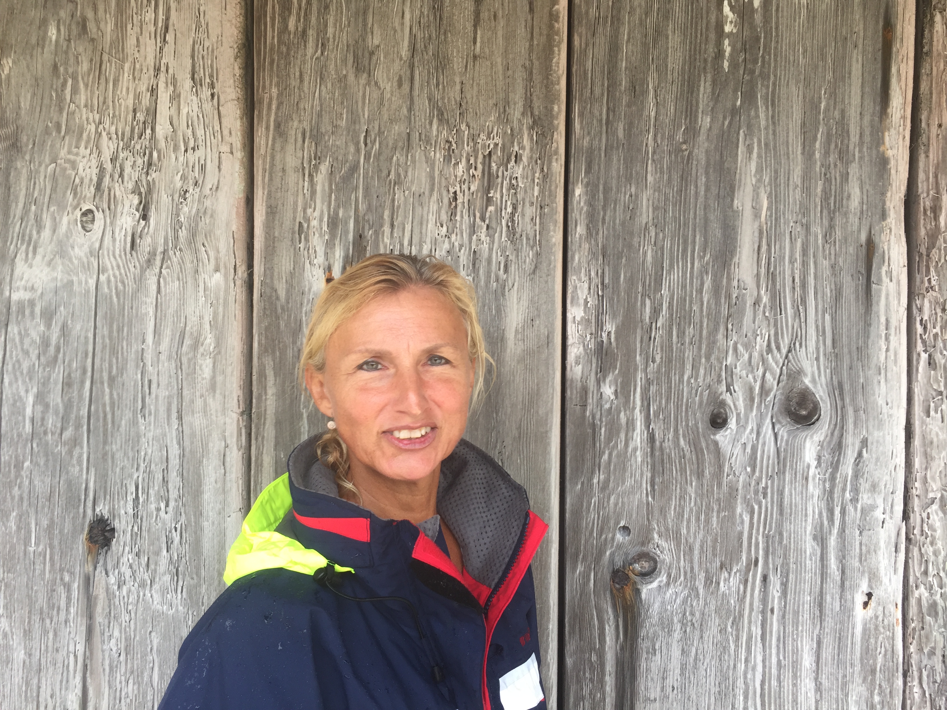
It is now Sunday, november 26th, our last evening in Noumea and we are staying in “hotel du Centre” with good internet so it is time to finish my update of New Caledonia.
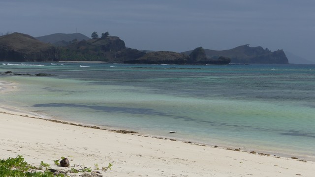
When Hannah and Wence left us in Lifou, on October 26th, we continued sailing to Ouvéa another island of the Loyalties group. Ouvéa was enlisted as a Unesco World Heritage site in july 2008.


New Caledonia was annexed to France in 1853. France was looking for a strategic military location and a penal settlement. The first convicts arrived in Noumea in 1864 after a 6 month journey from France. Till 1897 about 25000 convicts were sent to New Caledonia. NC status was changed after WWII from colony to a French overseas territory. In the late 70’s the independence movement became more popular and France agreed to talks with the pro-independence leaders. After a series of tumultuous events the UN General assembly voted in 1986 in favour of NC reinscription on the UN’s decolonisation list. In april 1988 the Ouvéa crisis erupted where a separist group took 27 people hostage and demanded instant independence. 19 hostage-takers were killed (Ouvéa memorial) and 2 military people died. In 1998 the Noumea Accord was signed between the French government and the independence parties. This Accord stipulated a 15-20 year period of growth and development ending with a referendum for independence. This referendum will be held in 2018. If the independence vote fails the Accord provides that 2 more referendums will be held in the following years. We are curious to see what will happen but many doubt the pro-independence vote will win. To be continued.


We have sailed around for about 1,5months in NC and there is still so much more to be discovered. Hopefully the weathergods are with us in April of next year and we can sail along the East Coast of Grande Terre up to the north with maybe some diving along the way. But now we are looking forward to be “landlubbers” for 4 months while we travel Australia and Vietnam.
Hier is nog een video van ons drie daags verblijf in de lagoon van Ouvea. We waren de gehele tijd gans alleen.
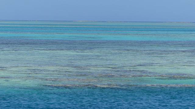
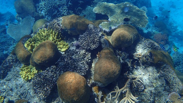
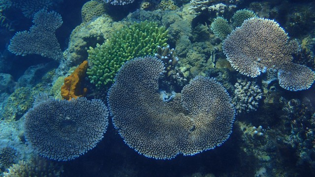
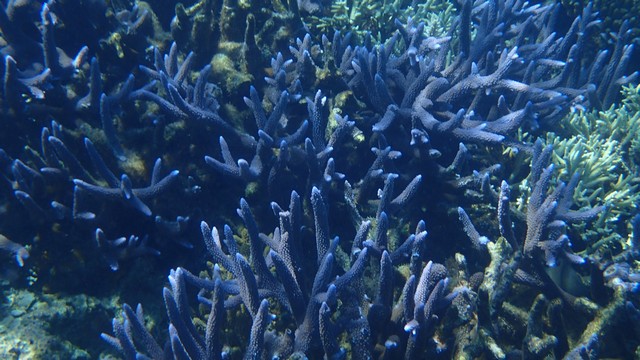
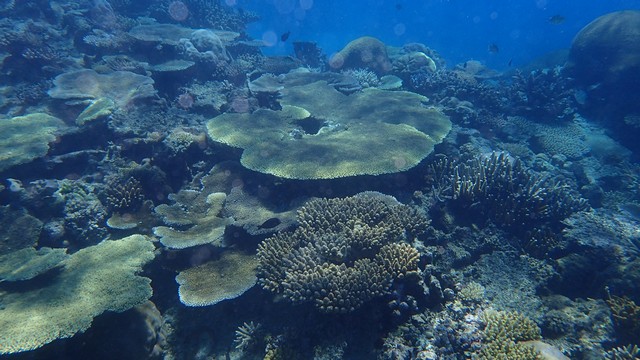
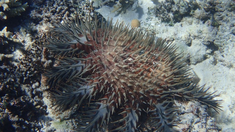
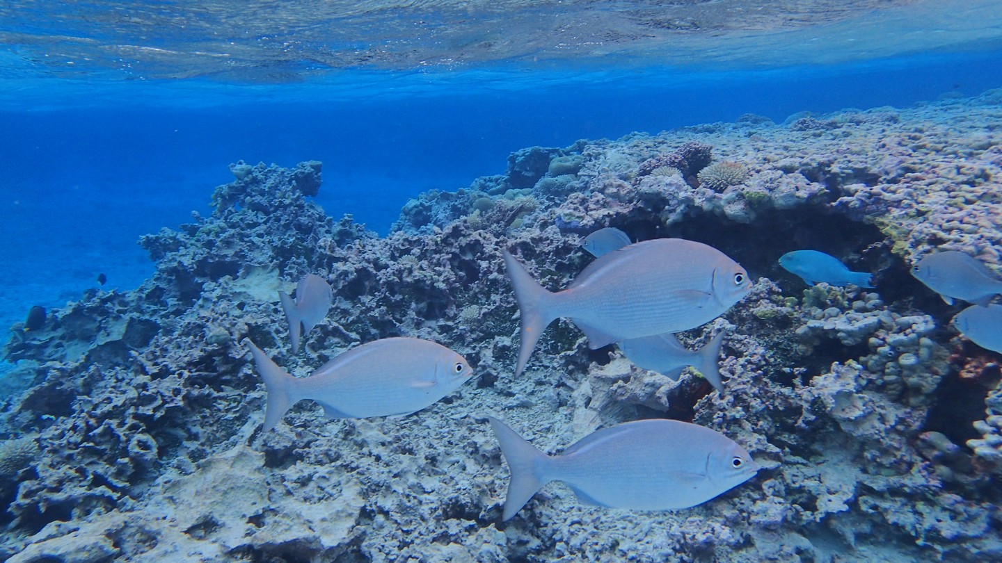
Je vraagt je misschien af wat al die donkere plekken in het blauwe water zijn. Welnu, dat zijn koraalhoofden, tete de corail in het Frans of coralheads aka bommies in het Engels.
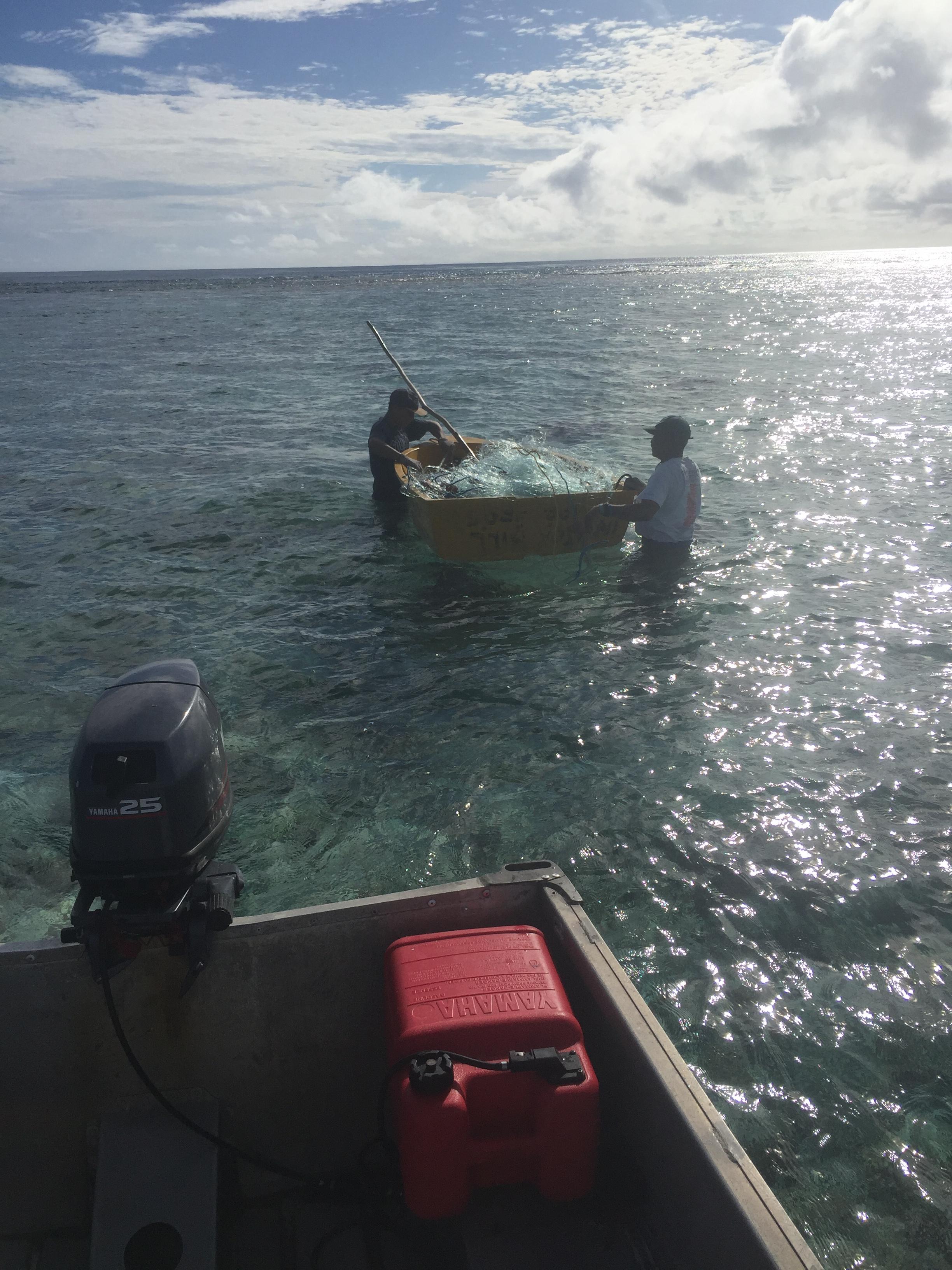
En wanneer je ankert in water met een heen en weer beweging, zoals eb en vloed in een nauw kanaal, dan draait de boot en zijn anker zich mee met de stroming. Soms kan het zijn dat je ketting dan rond een koraalhoofd vast komt te zitten, zoals hier het geval was:
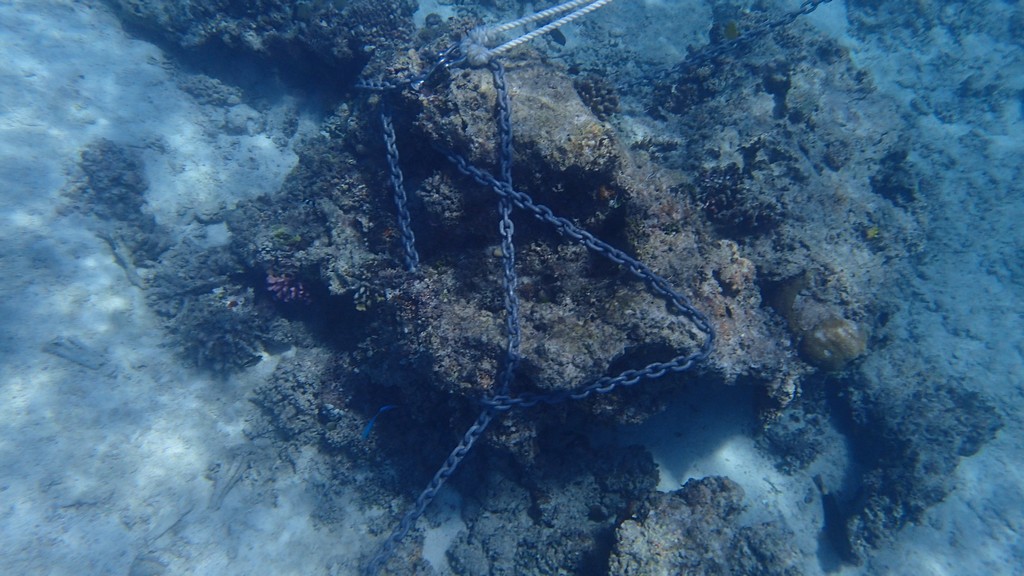
Gelukkig was het water zeer ondiep, 2 meter, en konden we zien vanop de boot hoe we moesten varen om de knoop te ontwarren.
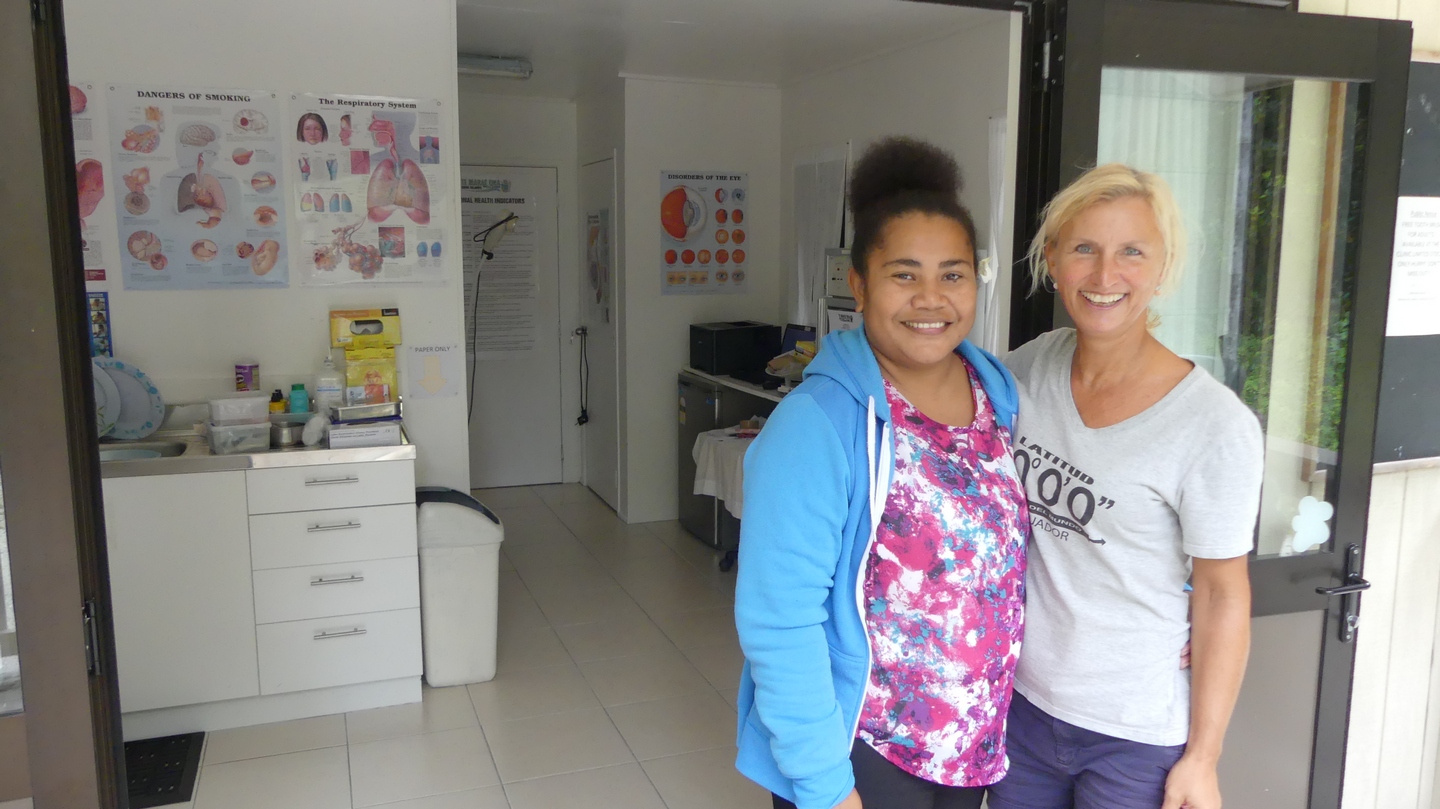
Today November 25th, 2017. Sanuk is on the hard in Noumea, we are getting her ready for her yearly “cyclone sleep”. In the mean time we are staying in a nice hotel not far from the boat yard. We are almost done :-), the sails are down, a lot of little repairs are done or will be done while we are away, the cabinets and bilges are cleaned and the walls are wiped down with bleach and vinegar to prevent mold.We will leave on monday for Australia where we will travel for 2months with a campervan . End of January we will go to Vietnam and maybe end of February to Myanmar…
We have free internet in the hotel so time to update our blog.
After 4 days of sailing (from Fiji) we arrived safe and sound in Noumea (New Caledonia). We did have a scare when about 2hrs before arriving our Autopilot gave up on us. Luckily we were almost there . We both were sooo happy it did not happen in the middle of our crossing. Luckily we found a mechanic(in Noumea) who found the problem in 30min. The next morning it was fixed with a new part. We stayed in the marina of Port Moselle to await our visitors, Hannah and Wence.

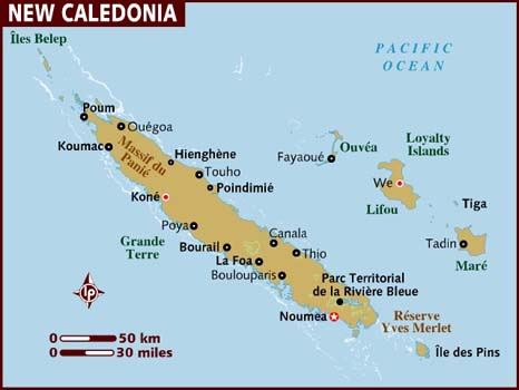
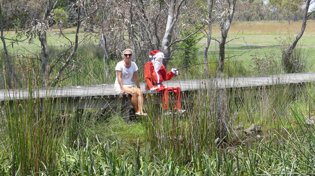
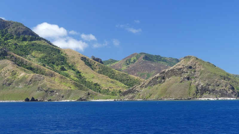
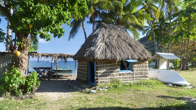
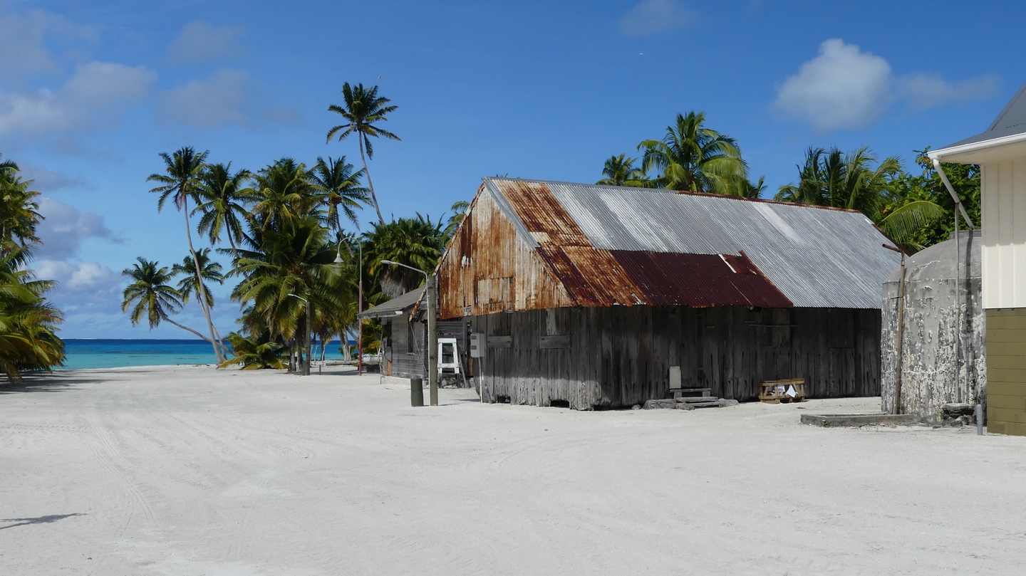
New Caledonia consists of the main island :Grande Terre, the loyalty islands : Maré, Lifou and Ouvéa, the Isle of Pines, the Chesterfield islands and Belep. We sailed from Noumea, towards Isle of Pines then on to Maré, a stop in Tiga and to Lifou where Hannah and Wence took the plane back to Noumea and on to Belgium. We (the captain and I) continued sailing to Ouvéa, Yaté (Grande Terre), Bay of Prony, Ile Amedee and back to Noumea. Unlike many of the other islands we visited in the South Pacific, Grande Terre is NOT a vulcanic island but was a part of the supercontinent Gondwanaland. It is speculated that Grande Terre separated from Australia 66million years ago. The Loyalty islands and the Isle of Pines are vulcanic.


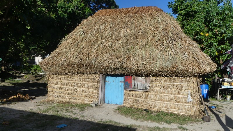
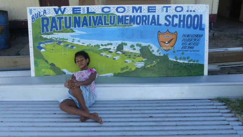
This blog took a while to post but here are some nice memories of Fiji and its people. We have since sailed to New Caledonia. Hopefully we can post on this before the boat goes on the hard for the cyclone season.
We left Savusavu on August 21 with clear skies and little wind. We had a week to sail around the Yasawa group of islands before we had a meeting with our insurance expert at Vuda Marina on Viti Levu.

Before we left the village we were able to print out the pictures and this was the best present we could give them.
We left Yasawa-I-Rara to sail to the Blue Lagoon where we had 2 days of rain 😦 and decided to move on to Naviti Island where the snorkeling should be excellent.
Too bad we did not see the boys and girls in uniform as we had to leave early the next morning to be on time for our meeting with the insurance expert in Vuda Marina on Viti Levu Island in Fiji.
We left Niue on friday July 14th (Bastille day) late in the afternoon to the tunes of great French music. We crossed the international date line and lost the 15th completely in a flash and arrived early monday morning the 17th in Neiafu, the Vavau group of Tonga.
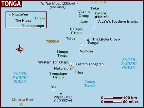
After a visit from the health inspector, customs and immigration officials at the dock and paying our duties we were cleared in and free to take a mooring in Neiafu harbour.

The kingdom of Tonga is the oldest and last remaining Polynesian monarchy and the only Pacific nation never brought under foreign rule. It is the first country west of the International Dateline and they call themselves “the place where time begins”. They are a very Christian nation.


The next day we motorsailed to the Coral garden anchorage and snorkeled…


Stay tuned for our next blog post where we talk about our incredible whale encounter !
Tussen Palmerston en Niue ligt Beveridge Reef: ongeveer een cirkel van 2 zeemijl (3,6 km) doormeter, vanbinnen 7 meter diep koraal met daarrond een brede zandbank van 2 a 3 meter diepte en daarna het rif met zijn brekende golven… Vanop volle zee zie je enkel het opspattend witte schuim van brekende golven die vanuit het niets opduiken, uitgezonderd aan de westkant een 200 meter strook waar de golven niet breken: de pas.
Onze GPS gaf aan dat we tegen 17:00 uur aan het zuiden van het rif zouden komen, en de zon ging onder om 18:20. Onze Navionics kaarten gaven het rif enkel aan als een ondiepe vlek zonder detail, hetzelfde voor OpenCPN (we hadden geen satellietfoto van het rif), maar we hadden wel een nauwkeurig verslag met tekening en gps coordinaten van ene zeker MrJohn VI.
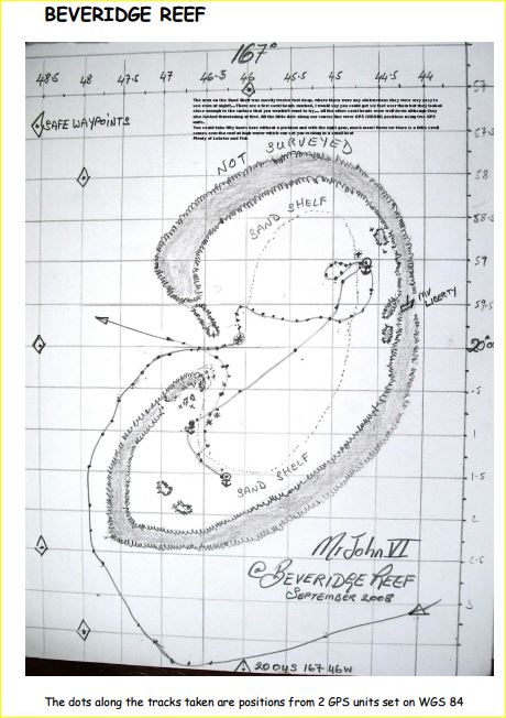
Vanwege een wijde boog kwamen we aan de pas ongeveer bij zonsondergang, en hoewel er een driekwart maan stond was de zichtbaarheid slecht. In retrospectief hadden we moeten omkeren en doorvaren naar Niue – en nadien hebben we er ook een nieuwe regel van gemaakt: geen navigatie op nieuw terrein in de buurt van land na zonsondergang – en we vaarden dus enkel op gps een ons onbekend rif in. Ilse deed me beloven dat als er iets misging ik niet zou zeggen: het spijt me, ik kon er niets aan doen. Er stond weinig stroming, een 15 knopen wind met kleine deining, maar het bleef wel blind varen. Met drie knopen over de grond volgden we de koers van MrJohn, en eens binnen hebben we zo snel mogelijk het anker uitgegooid en gewacht op de zon van de volgende dag (zo ergens midden in de atol). Maar de weergoden waren niet met ons: zelden meegemaakt maar 360 graden rondom ons waren er grijze lage wolken waaruit af en toe een bui viel.
Toch was het water zo ontzettend helder dat we ons konden verleggen naar de zandbank aan de rand. We passeerden heel veel koraalkolommen en hoewel ze er benauwend hoog uitzagen in het heldere water bleven ze allemaal 2 tot 3 meter onder het oppervlak. Sanuk heeft 1m20 diepgang.
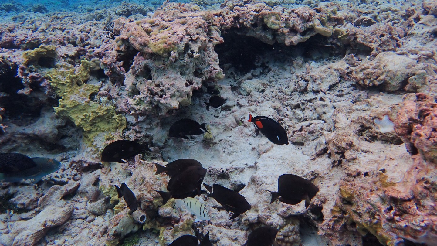
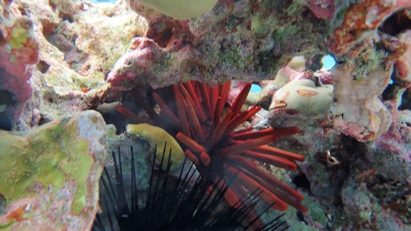
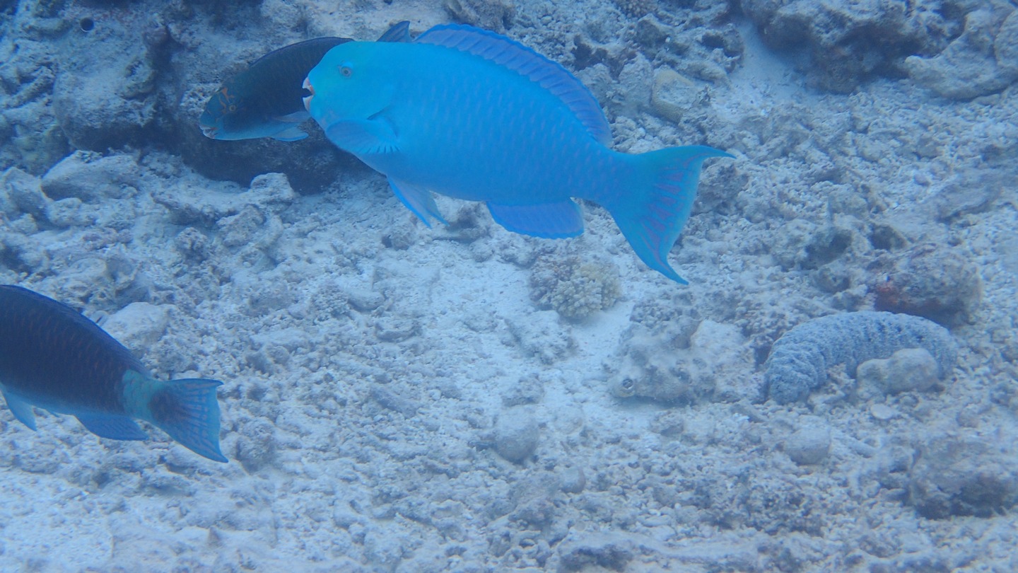
Op onze eenzame parkeerplek in de oceaan hebben we tijdens onze twee dagen ter plaatse toch eens een straaltje zon gehad zodat we spectaculaire foto’s hebben kunnen maken van deze heel speciale plek. Met Flipper zijn we naar de rif gevaren op zo een 300 meter, en hebben we massa’s vissen en mooi koraal gezien. Ondanks het slechte weer was het een van de beste snorkelingvaringen.
Maar het blijft toch wel een dubbele bedoening: heen en weer tussen Sanuk en het rif mag de motor van flipper niet uitvallen, want dan drijft de wind je weg, en met roeien kom je niet terug aan de boot. En er is ook geen andere boot in de wijde omgeving, enkel zee. Daarom dat Ilse toch wel opgelucht was toen we terug door de pas vaarden, op weg naar onze volgende bestemming op 150 zeemijl: Niue, een van de kleinste landjes van de wereld.
Palmerston bereikten we na exact 3 dagen varen. De tweede dag hadden we een kanjer van een MahiMahi mannetje aan de lijn, maar helaas wou hij wel even tot aan het trapje komen, maar niet verder. Hij schoot van de haak vooraleer ik de tijd had om de gaffe erin te slaan. Mijn strategie voor de volgende keer is bijgesteld: als een vis aan de trap is, schiet ik hem met mijn speerpistool door de kop, dan kan hij niet meer weg vanwege de weerhaak en is hij waarschijnlijk ook naar het vishiernamaals (in de visvolksmond den frigo). Ilse was er niet goed van, zo een schoon manneke, zeker 80 cm en 12 kilo, en toch liever naar de haaien dan bij haar!

Enfin, we kwamen aan om 10 uur en we radiooten kanaal 16 : “This is sailing vessel Sanuk Sanuk Sanuk for Palmerston Yacht Club, Palmerston Yacht Club. Do you copy?”
We waren op zoek naar Bill, de eigenaar van de Palmerston Yacht Club want we hadden een vracht mee voor hem van zijn vrouw die we op Aitutaki waren tegen gekomen: 16 dozen met gerief, vooral bananen, papayas en watermeloen (denken we). Maar het was ene Bob die antwoordde dat hij ons ging opvangen en naar een meerboei begeleiden. Hij kwam een half uurtje later af met zijn bootje door de lagoon en de kleine pas naar ons, net buiten het koraalrif. Hij toonde ons aan welke boei we konden afmeren en ging daarna de douane halen.Ik gaf hem nog de boodschap mee dat we veel gerief hadden voor ‘deputy mayor Bill’. Nog een klein halfuurtje later kwam Bill zelf naar ons gevaren, met de Health Inspector, de Douane en de burgemeester. Omdat we reeds ingeklaard waren in de Cooks eilanden was het papierwerk snel geklaard en vertrok het gezelschap terug, samen met Bill en al de dozen. Eerst had hij ons nog meegegeven dat hij ons om terug 13:00 kwam halen voor de lunch.
Op Palmerston word je de gast van een gastgezin. Bij ons was dit dus Bill, de eigenaar van de Yacht Club Palmerston.
Hij had een stevige lunch voor ons klaarstaan: rijst, lamskoteletten, saus, tarotwortel en als toetje ijscreme van mango. Hij vertelde honderduit en om 2 uur kwamen de kinderen van de school toe: twee jongens, 10 (?) en 14 Ngariki, en een meisje van 16 Juliana. Zij aten ook, en namen ons achteraf mee op een bezoek van het eiland.
Er wonen 58 mensen, onderverdeeld in drie families. We waren snel rond op het eiland want het is ongeveer twee op een kilometer groot. Het is zeer verzorgd, met wegen in wit zand afgeboord met cocos boomstammen. Er staan zelfs lantaarnpalen met led lampen (ongetwijfeld het resultaat van een actie van een of andere NGO).
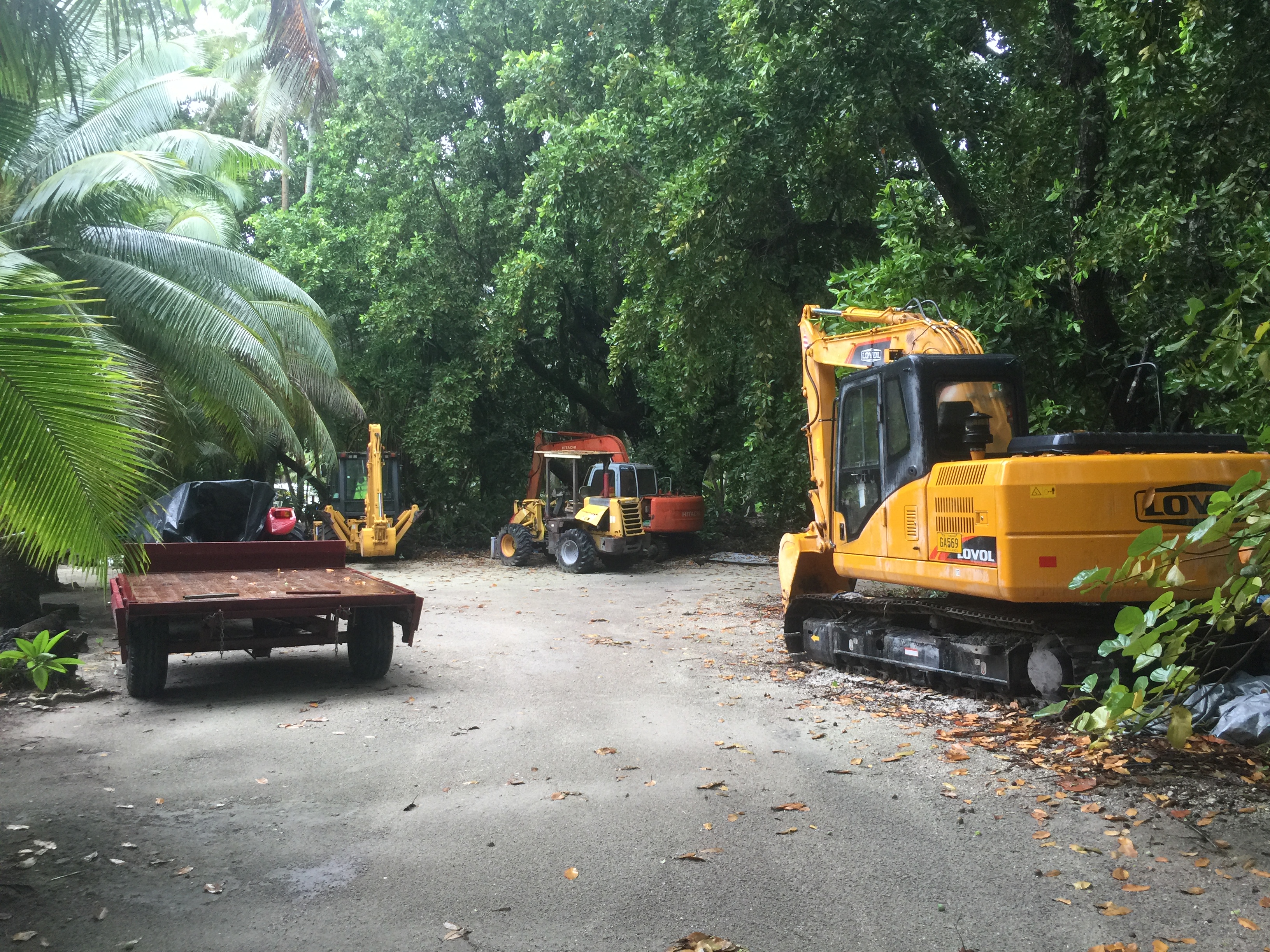
Er zijn geen autos op het eiland, wel een quad en nogal wat brommertjes. Het laatste heeft meer met status dan met noodzaak te maken want je bent echt in geen tel te voet op je bestemming. Ook de afdeling van openbare werken heeft een indrukwekkend machinepark staan, van een bulldozer tot een graafkraan. Zag er allemaal nogal nieuw uit.
Dat brengt me meteen op een delicaat onderwerp, namelijk ontwikkelingssteun. Palmerston, en de Cook eilanden bij uitbreiding weten handig op de internationale hulpverlening in te spelen. Als er een project is dat in aanmerking komt voor steun, dan komt het erop aan om een voorstel in te dienen bij de juiste kanalen, en de kans is groot dat er een geldschieter gevonden wordt. Daar hebben we mooie voorbeelden van gezien, zoals de electriciteitscentrale met zonnepanelen park, de school, het hospitaaltje, de dienst openbare werken. Maar ook de bijna onvermijdelijke buitensporigheden zoals 4 leraren voor 15 leerlingen op school, de zeer royale voorraad gezondheidsmiddelen die gratis verdeeld worden, de gratis voedsel of kleren giften van de Cook administratie of vanuit Nieuw Zeeland, het feit dat niemand belastingen betaalt maar wel op een maandelijks pensioen van 400EUR kan rekenen… Zo zijn er nog wel meer voorbeelden maar dit doet niets af van de charme van de mensen die er wonen.
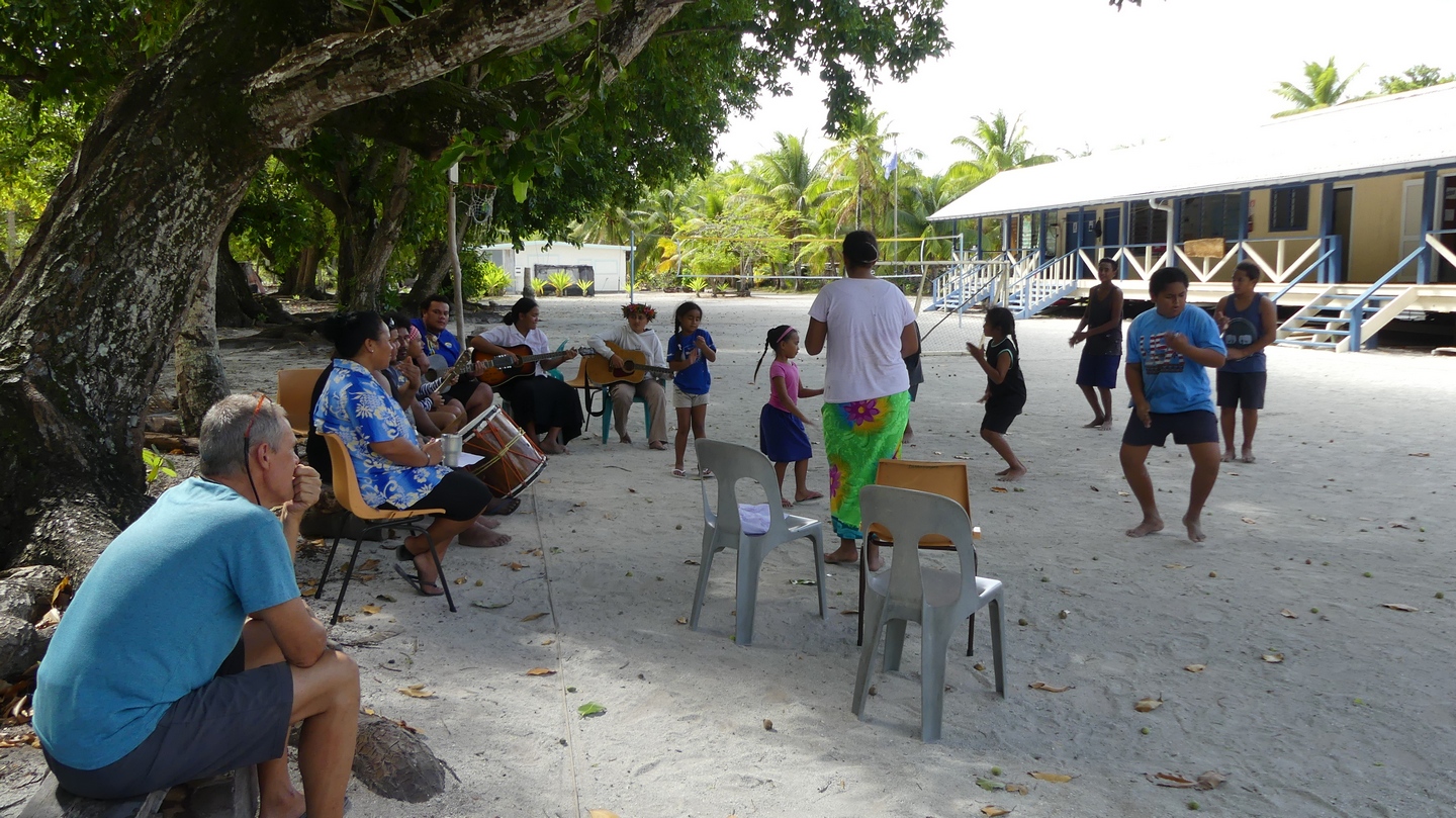
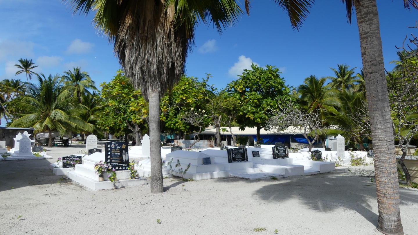
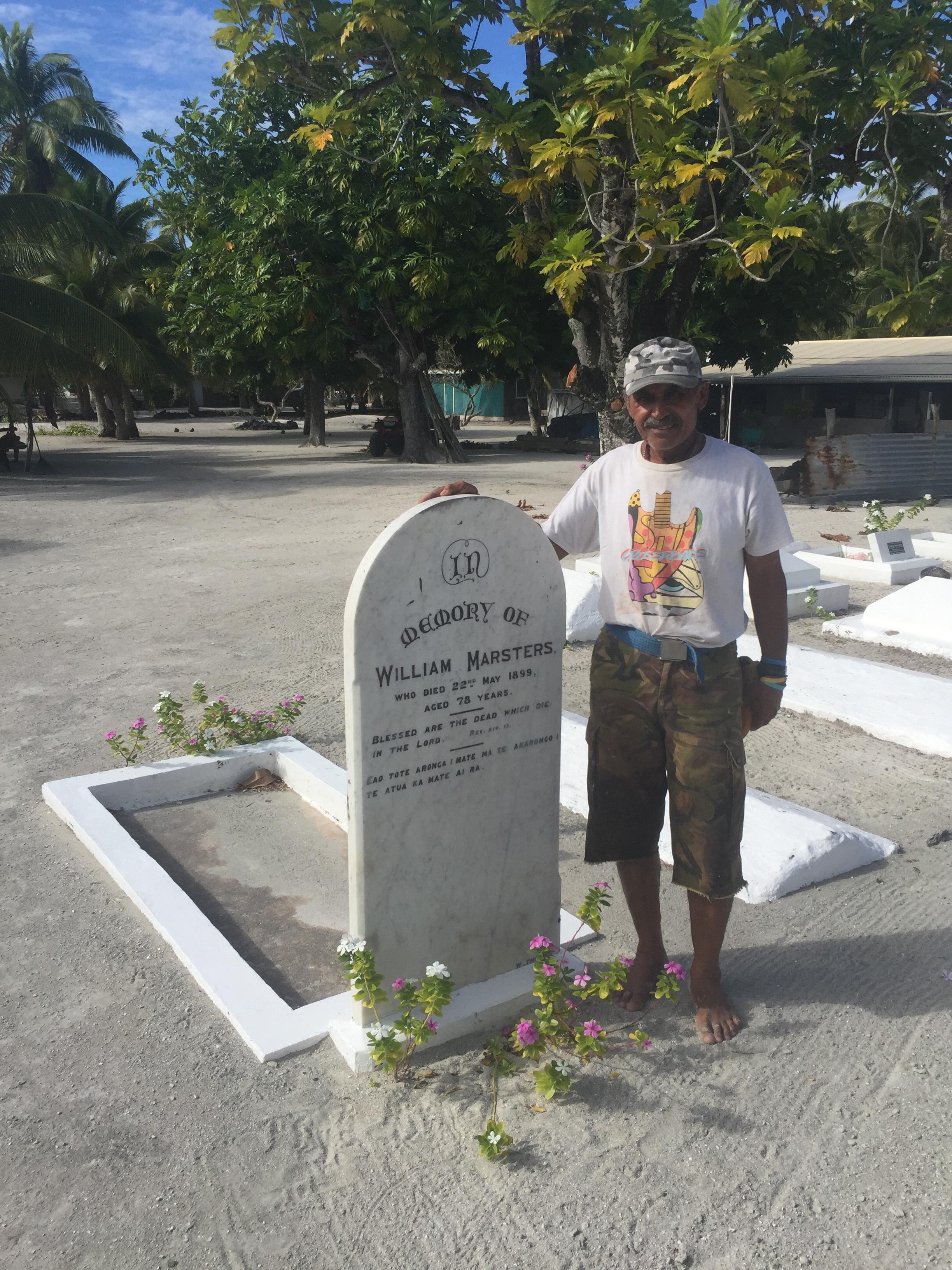
Zo werden we bijzonder hartelijk overal ontvangen waar we langs wandelden. We woonden een oefensessie bij van volksdansen door de leerlingen van de school (van 4 tot 18 jaar) , een les graveer vaardigheden, een vis-sessie op het rif, het bouwen van een nieuwe hut, we bezochten de begraafplaats van de allereerste Marsters (1894), en zijn eerste huis dat er nog steeds staat, ondanks verschillende orkanen die reeds over Palmerston zijn gepasseerd.
Ik heb Bob ook geholpen door twee nieuwe moorings voor hem te leggen. In drie duiksessies (mijn fles en twee die Bill gevuld had liggen) ben ik erin geslaagd om op 16 meter diepte een ketting om en door een koraalblok te leggen, met een schakel vast te leggen en vervolgens de schakel met ijzerdraad te blokkeren. Aan de ketting vertrekt dan een drie centimeter dik touw naar boeitjes aan de oppervlakte, om een zeilschip toe te laten de mooring op te pikken.
Klinkt gemakkelijk, maar het was mijn eerste keer als mooring legger, en het uitzoeken van een geschikte blok koraal is moeilijker dan het er vanop de oppervlakte uitziet. Maar ik heb vertrouwen in mijn werk, en Sanuk heeft twee dagen aan de nieuwe mooring gelegen, bij een gematigde westenwind die ons met het achterschip het koraal liet zien. Ik zou immers niet graag moeten lezen op het internet dat er een schip aan een mooring is losgebroken en op het rif is versplinterd!
Na vier dagen zijn we dan opnieuw vertrokken naar onze volgende bestemming: Niue.
Als bewijs van de vrijgevigheid van de Marsters kregen we visfilets mee van twee grote papegaaivissen, een stuk tuna, twee pakken diepgevroren spek, een versgebakken taart van Bill zijn dochter, 24 eieren, twee amuletten gemaakt door Bill zijn zonen en 2 sarongs gemaakt door zijn vrouw.Van ons kant waren we blij dat we hen ook kunnen helpen met wat steun aan de school en een lading nieuwe muziek, documentaires en films.
Ook al was ons bezoek kort, het is een stop die we niet snel zullen vergeten!
We arrived in Niue thursday, july 6th early in the afternoon. From a distance at sea, it looks like a dark and foreboding place. Unlike other coral islands, Nieu rises up from the sea as a black massive rock, hence it’s nickname ‘Polynesian rock’.


We took a mooring and radioed the Niue Yacht Club for customs and immigration. Stefan was picked up about an hour later at the dock and another hour later we were checked in.
We immediately went ashore although this involves some work. You cannot just leave your dinghy at the dock because of the waves pounding against the unprotected harbor wall. This could cause damage if you would leave it there for some time. So Niue has engineered a system where the dinghy is hoisted out of the water by a crane to which you can attach to your boat. The 8 days we were in Niue this worked great although on some days it took some acrobatics to get in and out of the boat because of the large waves.
We were immediately charmed by the island. We had dinner at an Indian restaurant, good food for a small price. The Indian had wanted to immigrate into New Zealand but ended up in Niue and liked it so much that they decided to stay.


It took Captain Cook in 1774 three tries to get on land in Niue. He was not welcomed by the natives who all had painted faces and red teeth and he therefore called it “Savage island” which stuck for centuries until it reverted to Niue. He was able though to plant the flag and claim “Savage Island” for the Queen.
Niue (which means “behold the coconut”) is made up of limestone with cliffs rising up 30m from the sea. It is the largest raised coral island in the world. Niue was once ruled by kings but it became part of New Zealand in 1901. NZ is responsible for foreign affairs, defense and the necessary economic and administrative assistance. Just when we arrived the departure tax had gone up from 34NZD per person to 80NZD. This fee has to be paid by every person leaving Niue. Niueans are not happy with this increase imposed by NZ and fear that it will impact tourism. The future will tell.
Niue suffered a devastating blow in January 2004 by Cyclone Heta. Winds of up to 300km per hour damaged 90% of the buildings. The hospital was completely blown away… The population before Heta was about 2500 but declined to as low as 1100 and is now, 13 years later, 1900 souls. Niue tries hard to get its expatriates back, mostly from NZ and Australia.


Niuean is the official language but most people also speak english, their second language. Besides fishing and agriculture, tourism is one of the main economic pillars of Niue. Niue is famous for its limestone caves and many chasms, crystal clear seawater (up to 50m visibility) and diving. We tried to do all ….


After one full week in Niue the winds changed and made the anchorage very rolly. Time to leave for Tonga. We dropped our mooring Friday July 14 after checking out and paying our departure tax. We really enjoyed the friendly people of Niue and its beautiful caves and chasms.
Before leaving Aitutaki we decided to participate in a lagoon cruise and yes the sun was out so we could admire the different shades of blue of the lagoon and it’s motus. We visited Akaiami motu, once a refueling stop on the famous Coral Route in the 1950’s-60’s for waterplanes on their route from New Zealand to Tahiti. We had a barbecue lunch on One Foot Island, awarded one of the leading beaches in Australasia region. We did some snorkeling but were disappointed after being spoiled in the Tuamotus. The lagoon cruise is definitely a must if you want to see all aspects of Aitutaki.


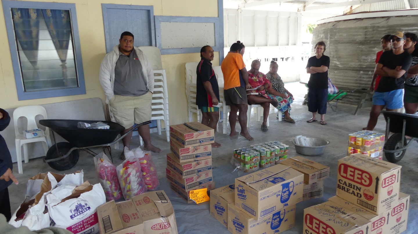
June 25, Sunday , we checked the weather and the wind was good so it was time to leave for Palmerston. Bill’s wife (whom we met in the visitor centre) asked if we could take “something” for her family to Palmerston which we gladly accepted. This “something” turned out to be 16 cartons with bananas and papayas and 4 more bags with watermelons, a suitcase, and a bag of candy … a good thing we have a catamaran and lots of hull space! Two days and 236NM later we arrived at lunch time in Palmerston and took one of the moorings guided by Bob Marsters.


The history of Palmerston is unique. In 1862 William Marsters from Lancashire settled here with his 3 wives and 26 children. He divided the island and motus into sections for each of the 3 families with strict rules of intermarriage. Today 58 people are living on the island all connected somehow to William Marsters, except for some people employed by the Cooks Government (nurse and teachers). The island has no airport and the supply ship only comes when it is profitable to come by, so once every 2-3 months. Since 2015 they have 24hr electricity supplied by a solar power station sponsored by the Cooks government. Before that they only had a generator who supplied 6hrs electricity in the morning and 6hrs in the evening. There is internet and one TV channel since 2014, so life is changing….
The welcome was incredible. We were invited into Bill’s house for lunch and after saying a blessing we had rice, fish, lamb, corn and tarrot root. For dessert there was ice cream. Not only the first day but every day we were invited for lunch prepared by Bill because his wife was in Aitutaki with one of their daughters, Caroline. The other children, Juliana (16), Ngariki (14) and the youngest son (10) ate after returning from school around 2-3PM. Ngariki gave us a tour of the island, showed us the school (15 children between 6-18 years old), the infirmary with an enthousiastic nurse from Fiji, the wreck from the Riri and the old cemetary. There are no paved roads on Palmerston but the sand roads are raked clean on a daily basis. No cars but at Bill’s house they had 2 motorcycles and we did see one quad…times are changing. There are no stores on Palmerston and thus everything has to be ordered from Rarotonga to come with the supply ship. Every house has serveral huge freezers to make sure they have enough food till the next ship arrives. Most of the families live from fishing. They sell their fish (mostly parrotfish) to hotels and cooperations in Rarotonga for about 15NZD a kilo. But they remarked that there is less and less fish to be caught…is this temporary or a trend? They are aware of the climate change and see more and more coral bleaching because of the warm water. The population of Palmerston is aging. A family with 9 children had just left the island a couple weeks before. Although Palmerston is for some a paradise I can fully understand that for others (especially youngsters) this is too limited and they move to NZ, Australia or Rarotonga in search of a “better” life. A lot of them do come back for visits or to grow old.


The unconditional generosity and “do good” attitude of the Marsters (In Flemish we say “doe wel en zie niet om”) is so remarkable that this short stop of 4 days will be fondly remembered.
