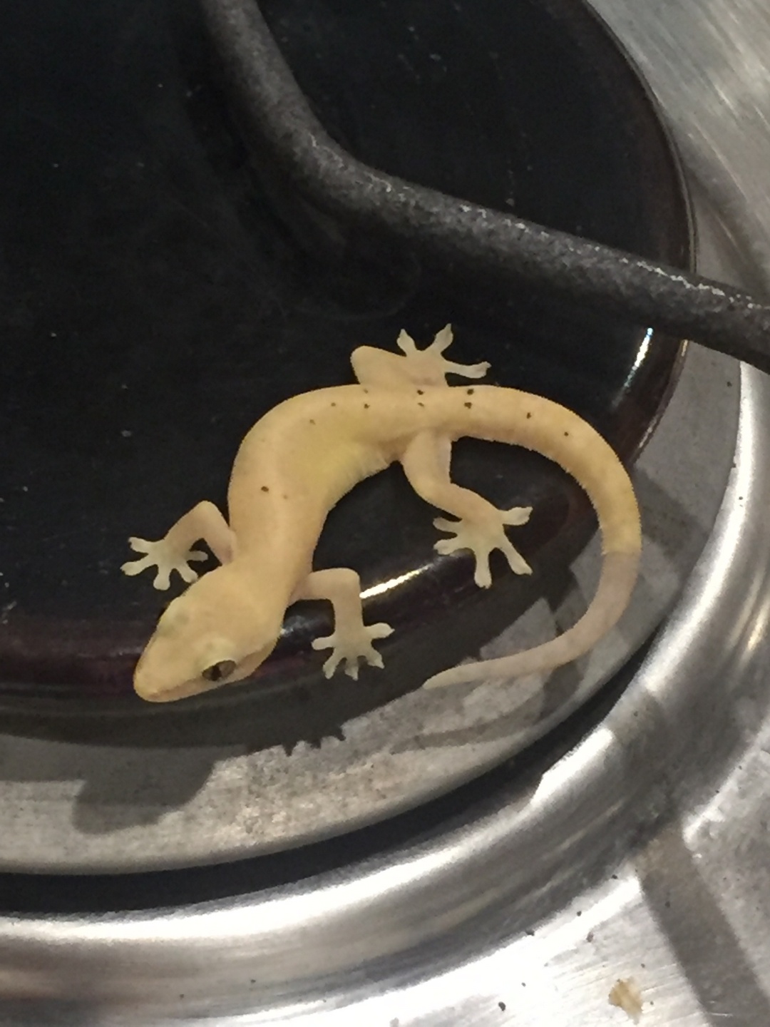
s’nachts komen de hermietkrabben uit hun (at)hol
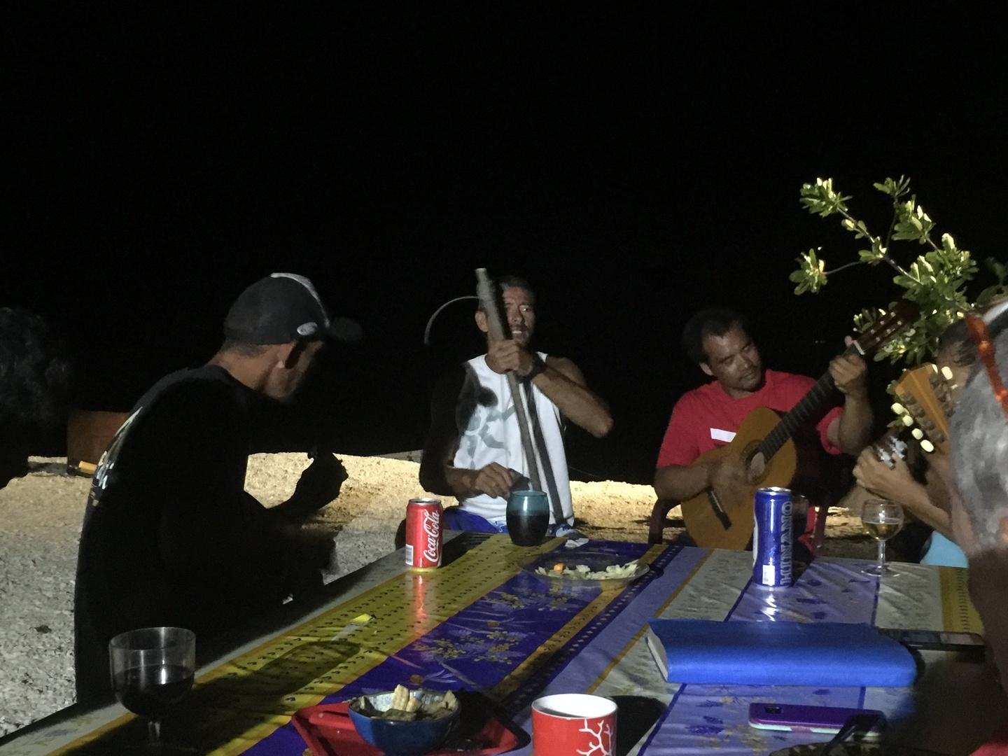
Barbeque bij de Lau’s
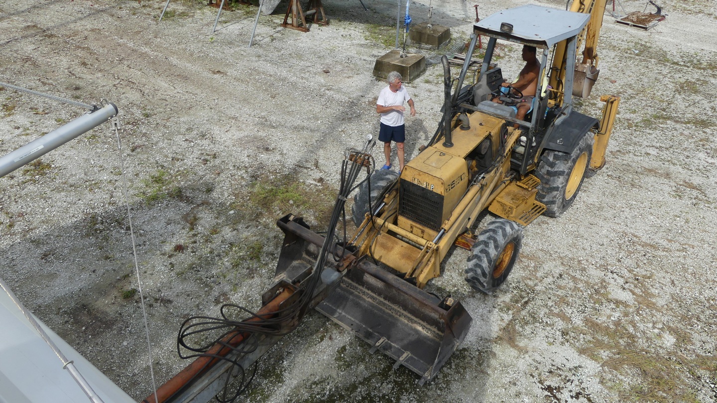
De admiraal aan het werk
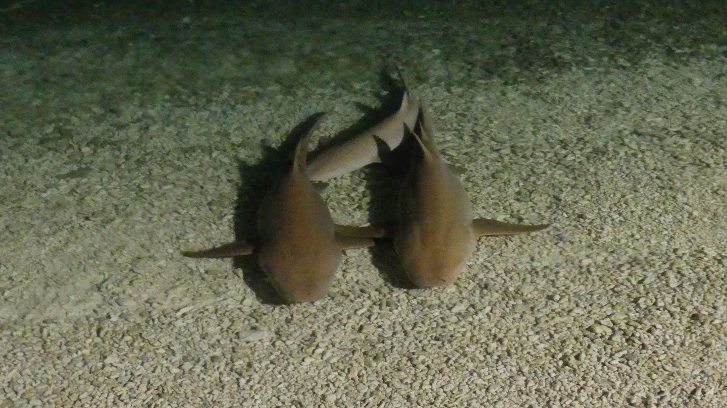
Opgelet inktvis, of je wordt overreden door een catamaran:
s’nachts komen de hermietkrabben uit hun (at)hol
Barbeque bij de Lau’s
De admiraal aan het werk
Opgelet inktvis, of je wordt overreden door een catamaran:
De voorbije weken zijn er enkele geweest van onderhoud. Maar het einde is in zicht. We zijn nu op zee onderweg van Papaeete, Tahiti naar Raiatea zowat 120 zeemijl varen of een goede twintig uur.
Daar gaan we nog even een technische stop doen om de electronica na te kijken, en daarna vertrekken we naar ons laatste Polynesisch eiland(Bora Bora) waar we uitchecken uit FP en op weg zijn naar een nieuw land, de Cook Islands.
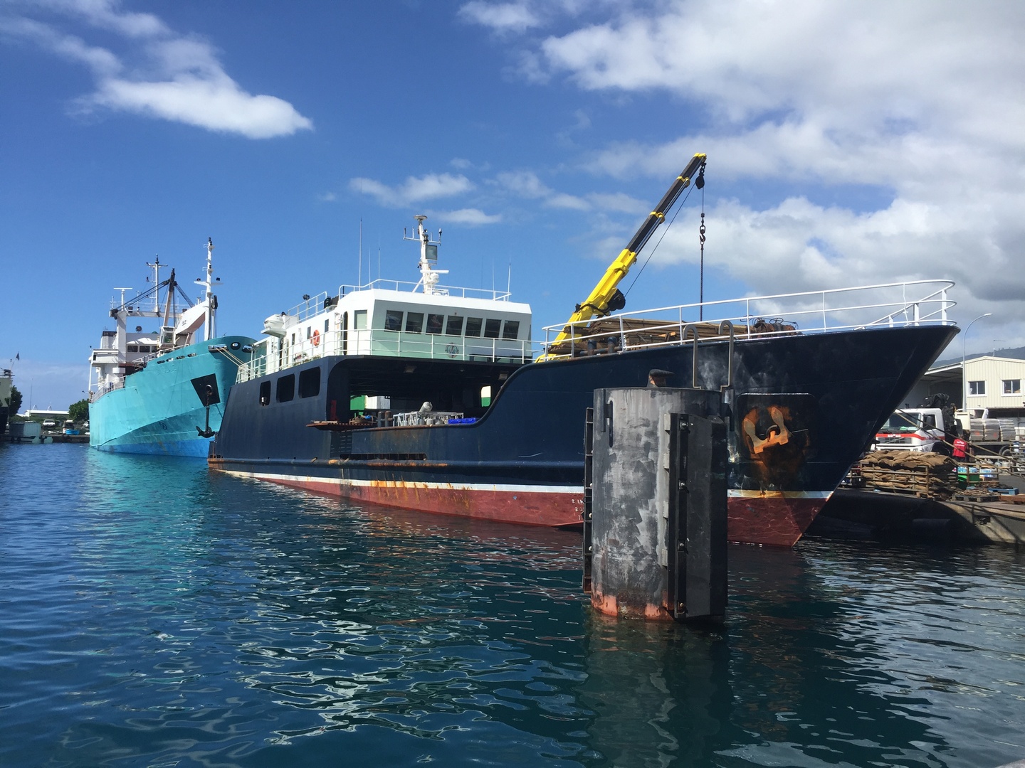
We hebben de voorbije weken vooral aan de boot gewerkt. De reis van Papeete naar Apataki waar de boot lag hebben we met de pakjesboot Cobia III gedaan. Langzaam aan met een redelijk wilde zee heeft het twee en een halve dag geduurd. Ik had de indruk dat we met Sanuk rapper zouden gevaren hebben, maar ze hadden last van de hoge golven. En wij ook een beetje, het is een ligreis geworden.
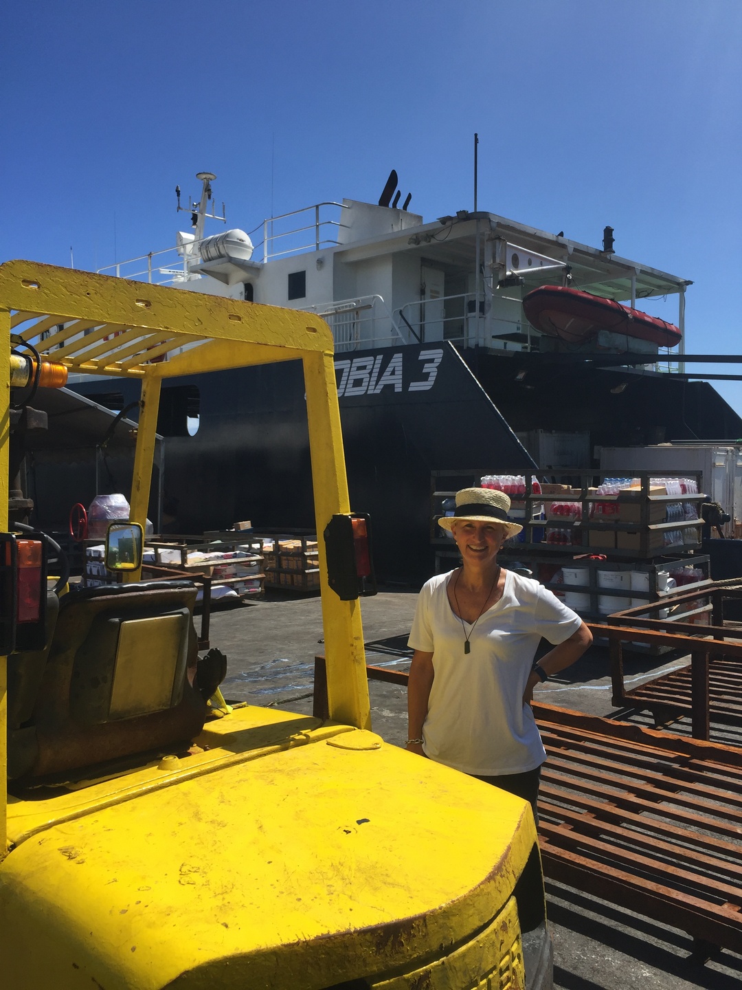
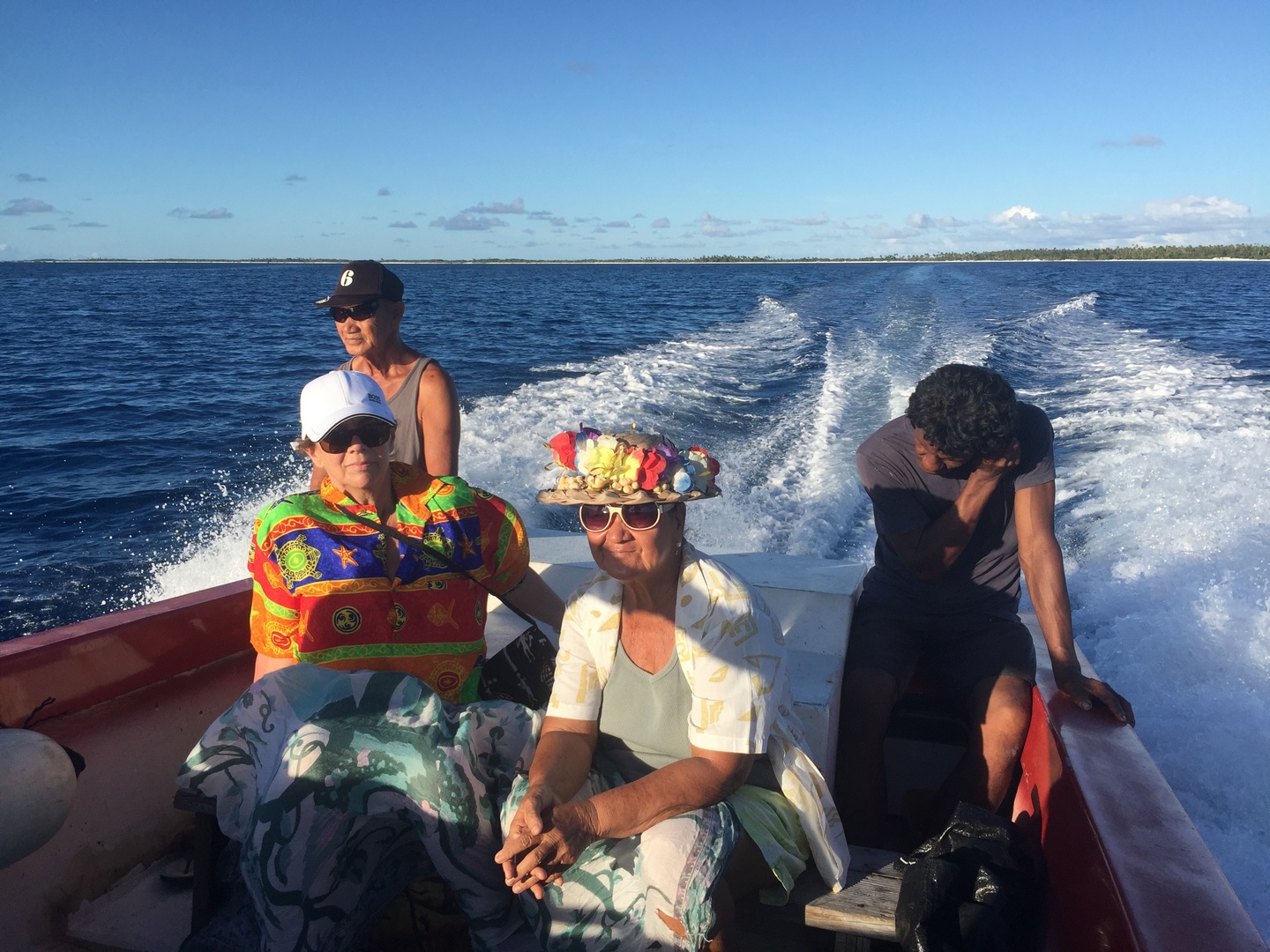
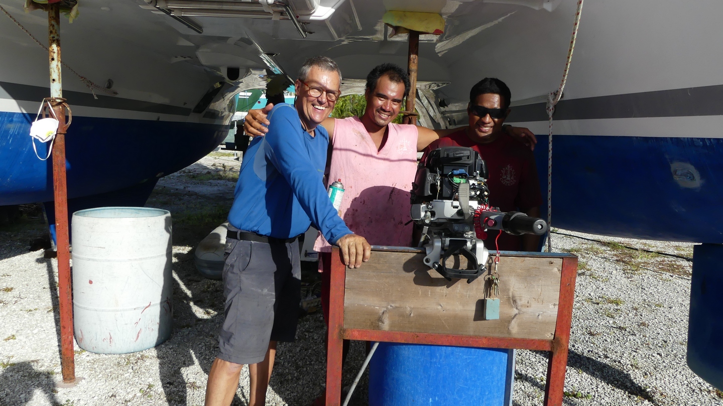
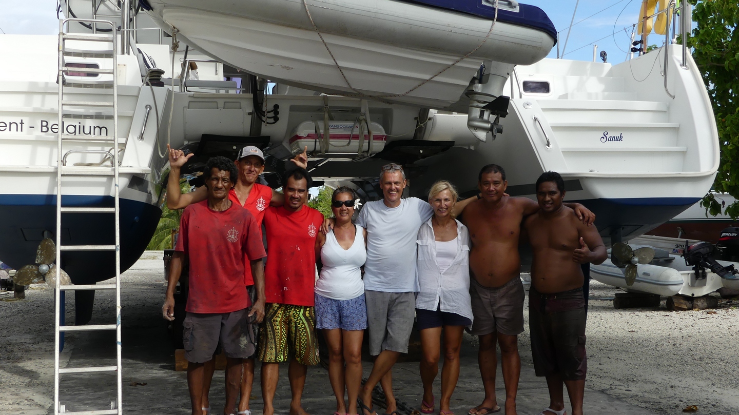
Maar om 02:00 uur kwamen we aan in de haven van Apataki dorp, en daar stonden enkele van de eigenaars van Apataki Carenage, de familie Lau, ons op te wachten. Samen met onze 150kg bagage zijn we naar het verblijf van de Lau’s in Apataki dorp getrokken, en de volgende dag met de boot naar de Apataki Carenage zelf, waar Sanuk op het droge ligt.
Een korte rit van twee uur, maar we kwamen wel doornat aan vanwege de wind die op de kop stond. Gelukkig zat onze bagage onder een zeil en was alles droog gebleven.
We waren blij terug op onze Sanuk te zitten, ook al was het dan op het land en niet in de zee.
Alles zag er op het eerste gezicht goed uit, niet te veel zwarte schimmel. We hebben een dag genomen om al het gerief weg te steken, en dan zijn we aan ons takenlijstje van 3 bladzijden begonnen.
De saildrives kregen nieuwe seals, de versnellingskoppelingen kregen terug een ruw oppervlak (lapping the cone drives noemt dit in het engels). Nieuwe olie en filters in de drie motoren, de nieuwe trampoline werd gemonteerd, het nieuwe code 0 zeil werd opgehangen.
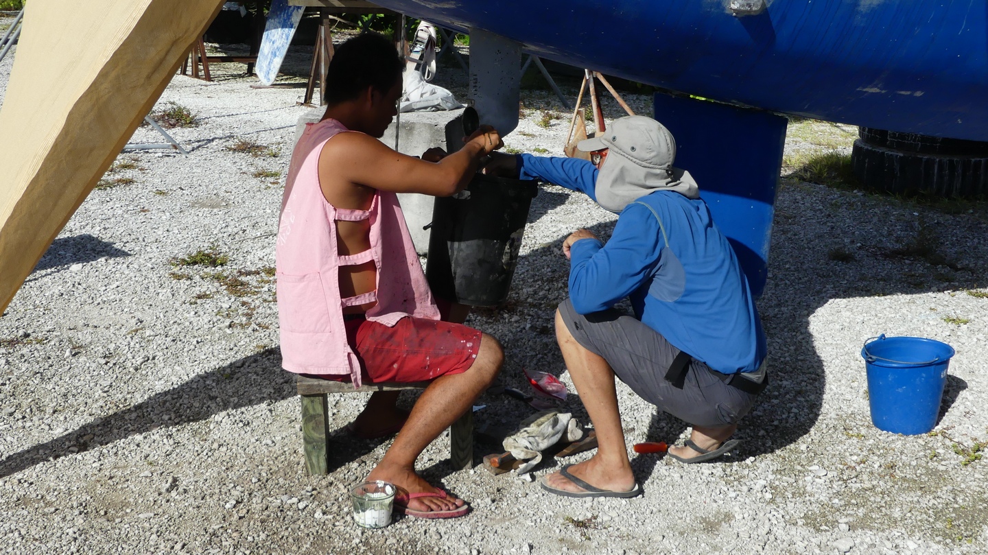
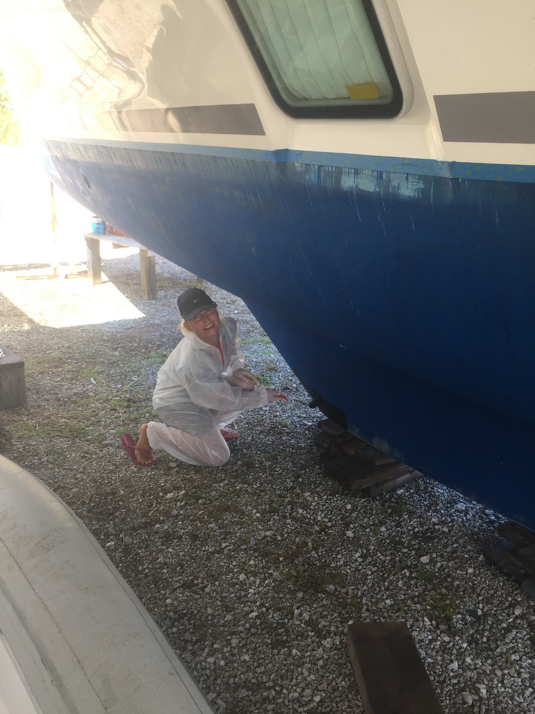
Ilse hield zich bezig met de buik van Sanuk een nieuwe anti-aanslag luier aan te doen. Zestien liter Micron 66 anti algenverf, en
hij zag er weer blauw uit, onze Sanuk. De onderste laag is zwart, en daarboven blauw, zodat we kunnen zien wanneer we door de eerste laag zitten.
Er was echter een serieus probleem met de stuurinrichting: de roeren zaten muurvast. Het bleek dat langs het afsluitdeksel van de nood-roeren er regenwater naar binnen kwam, en dit viel op de
connectie van de verbindingsstang tussen beide roeren. Ik ben erin geslaagd om de geroeste kop van zijn pin af te trekken, en los te vijzen van de verbindingsstang.
Met geduld en vooral fosphor zuur kwam er elke dag wat meer beweging in, en op het einde was de verbinding van de kop in zijn houder terug soepel. Dan nog laten trekken in een oliebad, terug monteren en het stuur was beter dan ooit. In retrospect was dit probleem al een jaartje aan de gang, maar ik dacht dat het aan de stroefheid van de roerstang in zijn houder lag, maar dat bleek dus mis. Ik ben heel gelukkig
dat ik dit gevonden heb en met de hulp van Tony Lau heb kunnen oplossen.
De dagen zijn bloedheet in de Carenage, het is 32 graden en de zon schijnt ongenadig van 8:00 tot 16:00. Enkel in het uurtje ervoor en erna is het nog licht en is de temperatuur flink lager.
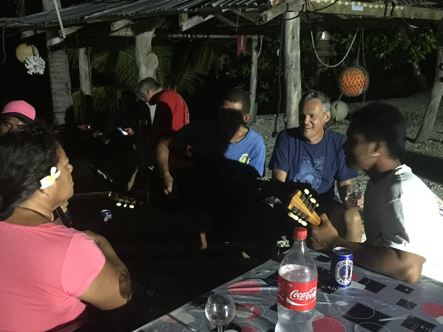
Dus om 6 uur s’avonds is het donker. Dan nemen we een heerlijk doucheke, en koken een warme maaltijd. Daarna lopen we nog even langs bij de familie Lau, of komen we samen met andere
zeilers die ook aan hun boot aan het werken zijn in de Carenage.
Er liggen eind april nog een 20-tal boten, waarvan er drie a vier bewoond zijn. Iedereen werkt om zo snel mogelijk van de muggen, de hitte en windstilte af te zijn er terug op het water te liggen. Voor ons was dat twee weken, en hoewel dit lang is hebben we toch geen dag stil gezeten. Er is hier trouwens toch niets anders te doen behalve werken, veel drinken, wat eten en veel slapen. Meestal lagen we om 21:00 uur al in onze nest van een zalige slaap te genieten. Ik sta ‘s morgens op rond 6:00 uur, maar Ilse blijft graag even liggen tot 8:00 uur. Ik geniet dan van wat personal time: wat naar podcasts luisteren (er is daar internet, maar wel traag – grootte orde van 20Kb/download snelheid), wat luisteren naar audioboeken of wat lezen.
Enfin, de dag kwam dat Sanuk te water werd gelaten, en dat we klaar waren om te vertrekken. De meeste werkjes waren bijna af, maar aangezien het moeilijk is om gerief in Tahiti te bestellen en naar Apataki te laten leveren, besloten we om zelf nog met de boot naar Tahiti te varen om alles af te werken.
Maar eerst zijn we dus langs Rangiroa atol gepasseerd, waar we met een andere Apataki boot – You Neva Know – nog een weekje bleven. Ilse en ik hebben er duikles genomen, zodat we beide nu
niveau A bereikt hebben van het franse / Internationale systeem. Dit betekent dat we mogen duiken met begeleiding tot 29 meter diepte. (Normaal is het 20 meter, maar vanwege de temperatuur van het water en de goede zichtbaarheid is dit in Frans Polynesie 29 meter) Na vier duiksessies werden we goed bevonden om ons brevet te halen. De eerste drie lessen waren in ‘het aquarium’, een ondiepe plek
(9 meter) waar we oefeningen deden, maar de laatste twee lessen waren in de pas. Met een bootje gingen we buiten op zee, daalden af tot zo een twintig meter en kwamen dan met het hoogtij terug in
de pas gedreven. Als hoogtepunt was er een dolfijn die ons nieuwsgierig kwam bekijken en die we konden strelen, en een schildpad die zich met de heen en weer golf-stroming over de bodem liet
drijven en ondertussen van het koraal at.
Maar natuurlijk waren er ook ontelbare vissen en redelijk wat (ongevaarlijke) haaien. We zijn in elk geval blij dat we nu op de volgende eilanden zullen kunnen duiken.
Op het einde van de week was onze kookgas echter ver op. Ik maakte een misrekening ivm aantal volle flessen, en dus waren we aangewezen op wat er restte van de barbeque gasfles. Daarom zeilden we door
naar Tahiti, waar we na een tweetal dagen aankwamen in de ons bekende marina, het was immers onze derde keer.
Een beetje ongelukkige timing want het was net lang weekend van OLHV, maar de maandag kon ik toch in aktie schieten om de overgebleven of nieuwe taken aan te pakken.
Een boot is gemaakt om te varen, en de 6 maanden op het droge deden hem/haar geen deugd: de watermaker klaagde van een te hoge druk en de startbatterijen van de motoren die niet mee worden opgeladen
door de zonnepanelen bleken ook de geest gegeven te hebben. Enfin, een kredietkaart lost de meeste van deze problemen op, en voila, hier zijn we nu op zee naar ons volgend eiland aan het varen:
Raiatea, waar we reeds twee maal waren met respectievelijk Emma/Seba en Katie/Karel, maar waar nu een electronica specialist ons opwacht om samen eens door het systeem te lopen.
Het is sinds Colombia van kwaad naar erger gegaan met onze electronica: eerst liet de radar het afweten, dan twee van de 4 GPSsen, dan de AIS, en nu heeft de dieptemeter kuren: we denken dat hij
nog de juiste diepte aangeeft, maar hij pinkt steeds. Ik denk dat het een zaak is van corrosie: ergens is het netwerk slachtoffer van roest. We zullen het maandag waarschijnlijk weten. [Update na bezoek van de ‘expert’: het is waarschijnlijk geen corrosie maar de dieptemeter is end-of-life. We gaan moeten zien of we een nieuwe hier kunnen vinden (weinig waarschijnlijk), of we een nieuwe bestellen in de VS (10 dagen wachten) of we zo doorgaan met een manke meter. ]
Dus de sfeer aan boord is opperbest, we zijn beide blij dat we veel werk verzet hebben, en dat we weer reizen.
We hebben leuke mensen leren kennen in Apataki/Rangiroa/Papeete (Cheeky Monkey, Cap a Cap, YouNevaKnow, El Nido), we zijn enkele keren op restaurant geweest, en we hebben een mooi aandenken
aan de Polynesische eilanden gekocht, het staat Ilse bijzonder mooi…
April 17th, Papeete, Tahiti, it feels good to be back in 28degrees temperatures and closer to the boat! Our shopping possibilities were limited because all stores were closed because of Easter monday, except the Carrefour supermarket and a chinese supermarket where we could find the foodsupplies to take to Apataki tomorrow on the Cobia 3 !
Flashback to March 26th,2017: We did not stay very long in Dunedin since time was running out and we still wanted to see more of the East Coast.


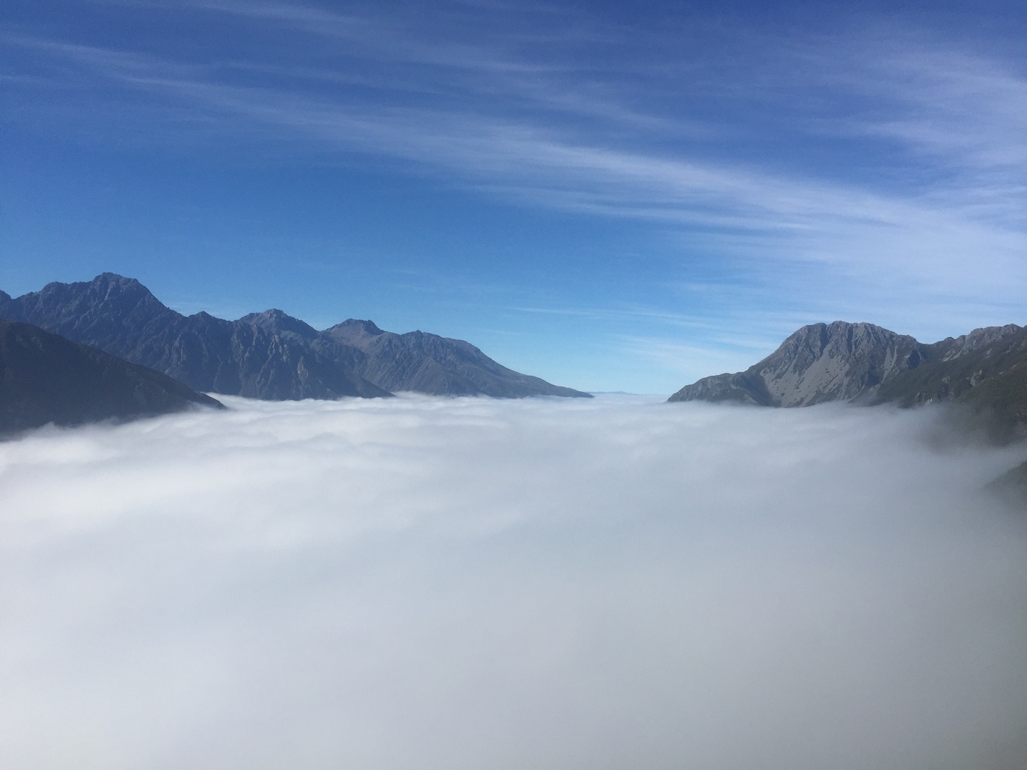
We continue driving to Mount Cook village in the rain and low clouds 😦 and spent a day at the Sir Edmund Hillary Alpine Center watching a 3D movie on Mount Cook, a documentary on the local mountain rescue team and the digital dome planetarium.

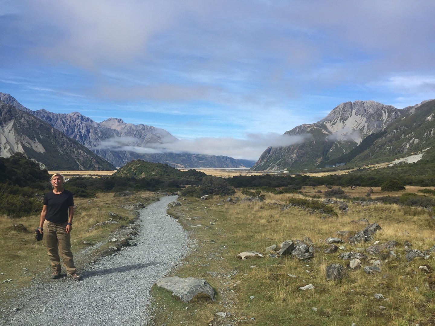
The next morning it was not raining but there were still a lot of low hanging clouds over our campsite. We were not sure what walk to do and decide to go to the outlook and take a decision on the way. Rainjackets, pants and backpack with some water we go on our way. When we come to a marker with the several walks we decide to take “Sealy Tarns”, only 5.2KM(one way), 3-4HR return walk, we think that is not too bad… Later we read the description of the walk,”The Sealy Tarns Track begins gently until you reach the foot of the Mueller Range. The track zigzags steeply up to Sealy Tarns.” The track consists mainly of 2200steps which have to be climbed! This was definitely one of the most challenging walks we did and we were not prepared! But the reward was incredible…


The return walk was not easy as well since it was so steep our legs were shaky. But we enjoyed the scenery so much that we did not care and arrived all happy under blue skies at the campsite. We drank and ate something. Felt stupid not to have prepared this walk better, we had no suncscreen nor a hat with us …we should know better, in the mountains the weather can change rapidly! This walk was definitely one of the highlights of our trip to NZ! We continued our route out of Mt.Cook National Park (also UNESCO world heritage) and went to Tasman glacier view and Tasman Lake…


The scenery along the drive from Mt.Cook village to Lake Pukaki and Lake Tekapo is really incredible.


In the visitor centre of Omarama they told us to go see the Clay Cliffs and the pictures convinced us to go. This is definitely a hidden gem in NZ! We did not have the blue skies which would have made it even more beautifull but they were incredible. We had to drive 12km on unsealed road and pay 5NZD a the gate because they are on private property, but it was worth it!


The next day we start out with rainy weather but as we continue our drive the clouds give way to sun and by the time we arrive at Rakaia Gorge it was perferct! We see a perfect camping spot but decide to do the Rakaia Gorge walkway first since the weather was so nice.


We lost our good camping spot but were happy we did the walk under blue skies as the next day it was drizling again…
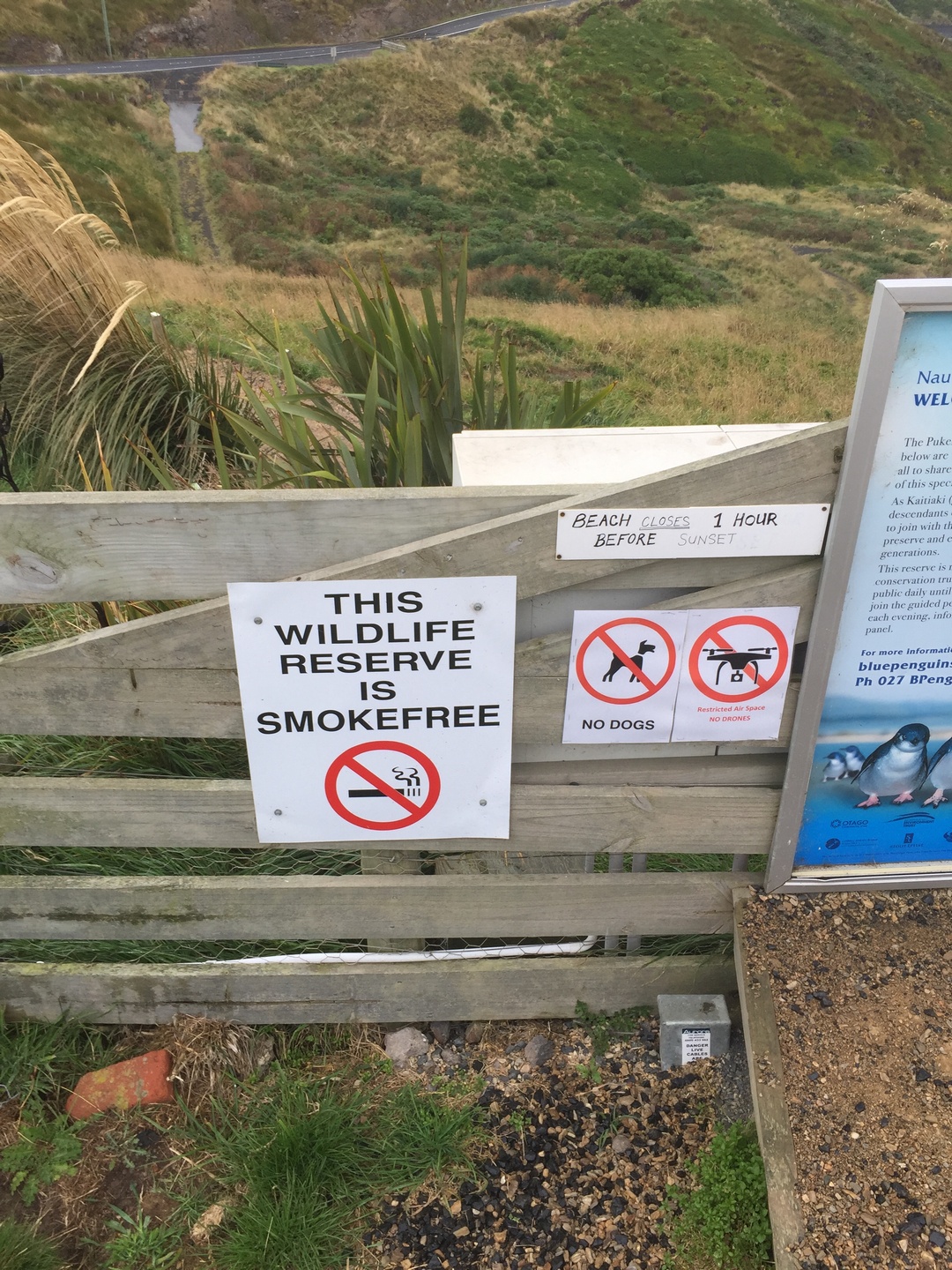
Because we did not see any penguins nor an albatross in the Otago Peninsula (Dunedin) we decided to drive along the coast to Oamaru because the Rough Guide said this is a unique place to see the Yellow Eyed Penguin and the blue penguin since there is a colony within walking distance from the town centre!


We then decided to go see the blue penguin but we were informed that they only show up around 7PM, almost dark…We were at the rendez-vous a little after 7PM together with a lot of other penguin enthousiastics. We waited and waited, Stefan got a blanket, it was cold and windy, started to drizzle but we persevered and around 8PM a whole bunch came tumbling with a wave on the beach 🙂 Really funny how they then walk up the hill to their burrows. Unfortunately because it was already dark and you can not use a flash and they are far away I did not get any good enough picture…The blue penguin (Korora) is the smallest of the penguins. Cold and wet we returned back to Burnie, happy we did at least see the penguins!!
Our drive to Chrischurch was with continuous beautiful scenery and very variabel weather. Summer was over, leaves were turning to yellow and orangy colours and a lot already falling. We camp at Lyttleton harbour and the next day we decide to drive to Akaroa along a scenic route, Summit Road which traces the 600m high Akaroa crater rim. We stopped many times to take pictures and walked 30min to a viewpoint, all just in time to see the clouds roll in.


Akaroa is a little town with french roots. The first settlers came from France and a lot of the street names are still in french. It is a popular KIWI holiday destination.

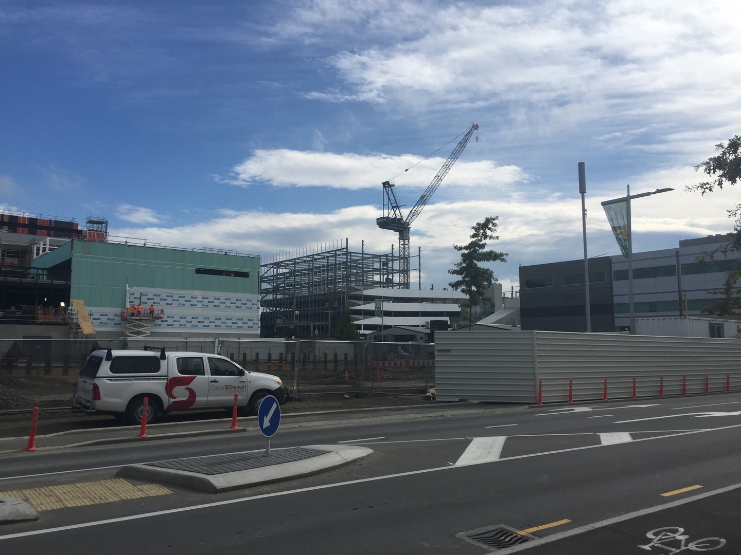
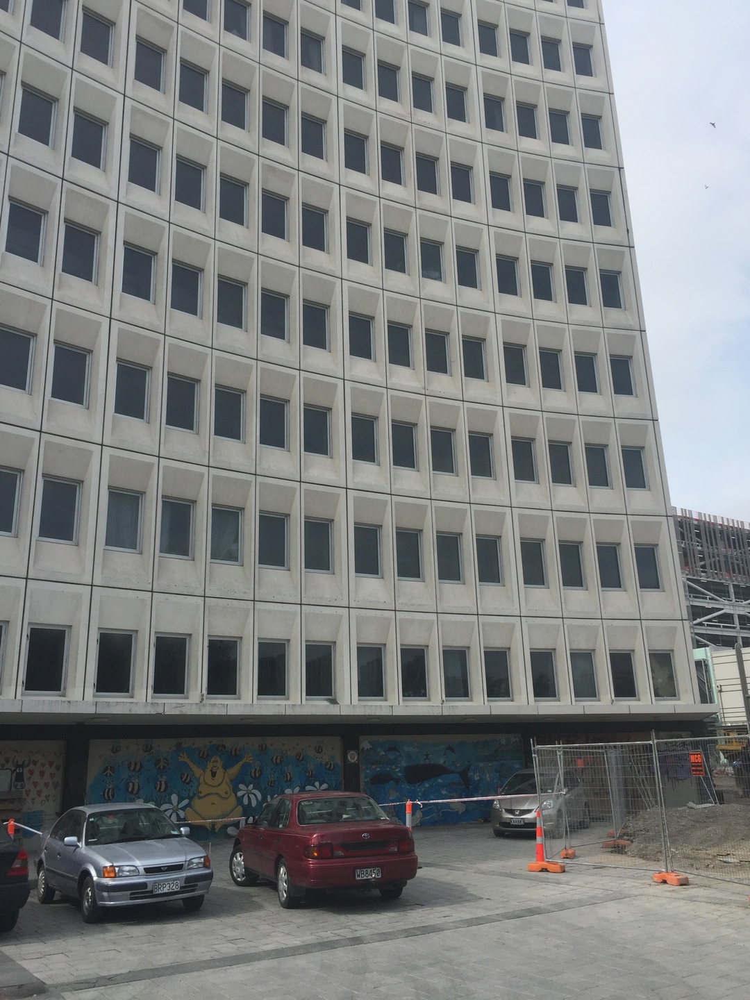
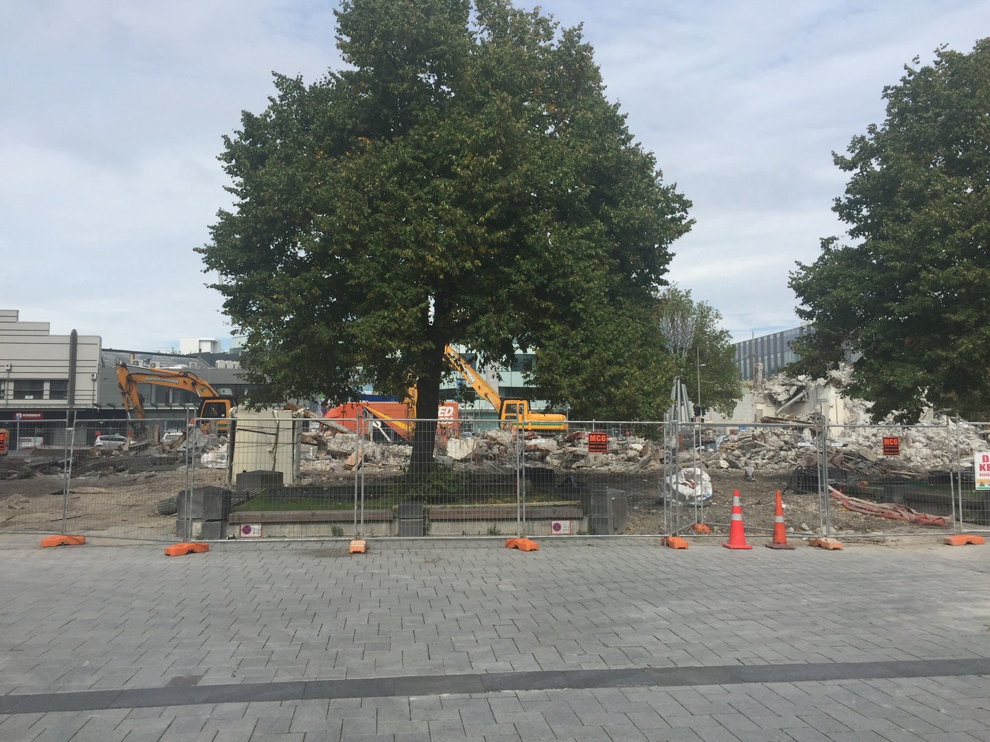
Arriving in Christchurch was a surprise. We could not believe the destruction still visible from the earthquake that hit the city in February 2011! 6 years later and still so many buildings waiting to be torn down, rubble and cranes everywhere. Stefan felt sad seeing the city like this while I could sense a dynamism in the newly created parts of the city. We did not stay very long because it was already April 3rd and we had to be in Auckland by April 8th to show Burnie to a potential buyer.
Earthquakes occur very frequently in NZ because it is situated in the collision zone of two plates, the Indo-Australian and the Pacific tectonic plates. About 14000 earthquakes occur in and around the country each year and about 150 to 200 are big enough to be felt. We did not feel once the earth rumble.


We hurried back to Auckland passing by Wellington in the pouring rain from the storm Debbie and managed to sell Burnie to a french couple travelling for 2months in NZ. We rented a little camper and drove north of Auckland to Whangarei. Visited Aislado (NZ) in Marsdens Cove Marina, An and Ivan on Vaguebond in Town Basin at Whangarei. Drove to Russel ,where we had an excellent meal at the Duke of Marlborough, and stopped in Waipoua Kaori Forest to see the largest living Kaori tree from NZ. Cyclone Cook passed by…but we arrived safely and saturated with lots of nature scenery in our heads at our friend’s house late April 14! So nice to finally have the luxury of staying in a nice house, sleeping in a bedroom, toilet and bathroom next door 🙂 !

Thank you so much Sylvia, Vaughn and Zara for your hospitality, help and friendship! We hope someday to welcome you all in Ghent !!! 🙂
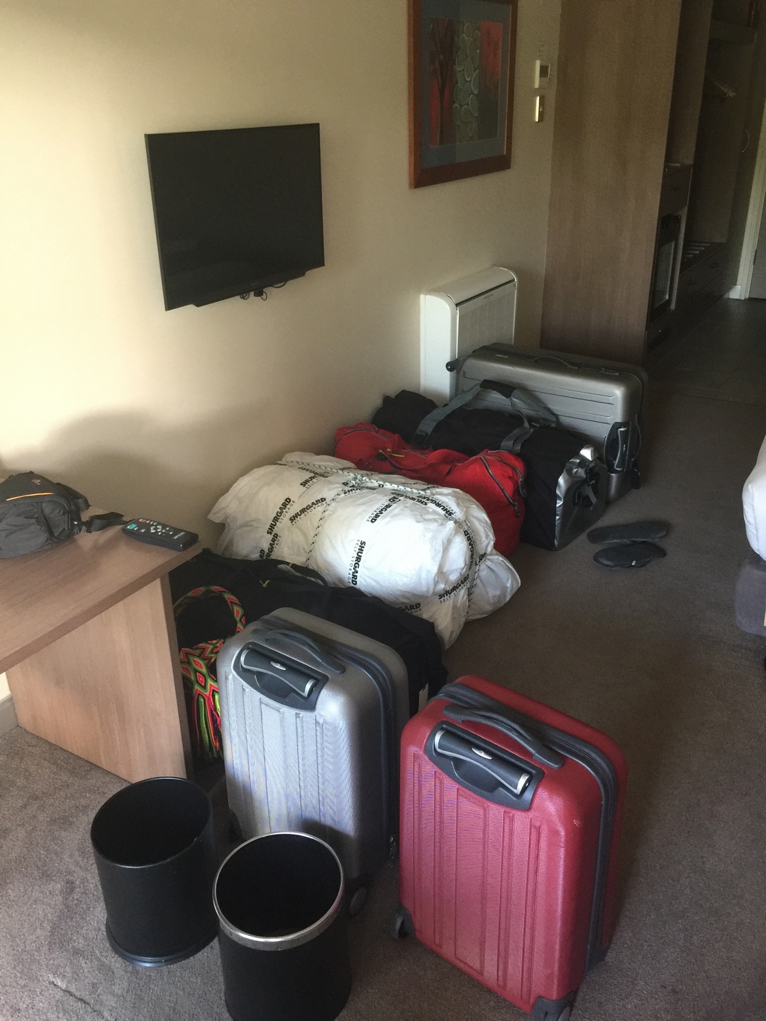
April 16th, we are in the Holiday Inn near Auckland airport since we have to be there at 7 AM the next morning for our flight to Papeete ! We have 5 bags and 2 check-in pieces ! Hopefully it will go smoothly 🙂
Flashback to March 19th 2017: The next day was just perfect blue skies and we could admire Milford Sound (Piopiotahi) in all its beauty.We could not have planned any better.


While we were in Dunedin we did the self guided street art tour and it was really a lot of fun with great artworks ! Maybe a good idea to have a similar project in Ghent!


Next blog on our way to Christchurch and back to Auckland.
In Oamaru, someone has triggered the steampunk locomotive animation
ChristChurch
I just love what this artist does: Phil Price
Wat kan er nu zo grappig zijn aan dahlia’s?
Update zondag 16 april: we zijn goed en wel in Tahiti geraakt met onze 7 valiezen.
Enkel Air New Zealand deed moeilijk bij check-in omdat we geen vertrek ticket uit tahiti hadden, maar een supervisor kwam dan met de verlossende mededeling: just check them in. Ook was onze handbaggage 12 en 13,5 kg ipv 7kg, maar dat zagen ze door de vingers!
Het is wel raar dat we twee keer paaszondag meemaken: een keer in Auckland, en dan vijf uur later doen we het nog een keer over omdat we over de dateline gevlogen hebben. 22 uur terug in de tijd.
Dinsdag gaan we met de Cobia III varen naar Apataki.
Over de natuur en de natuurparken:
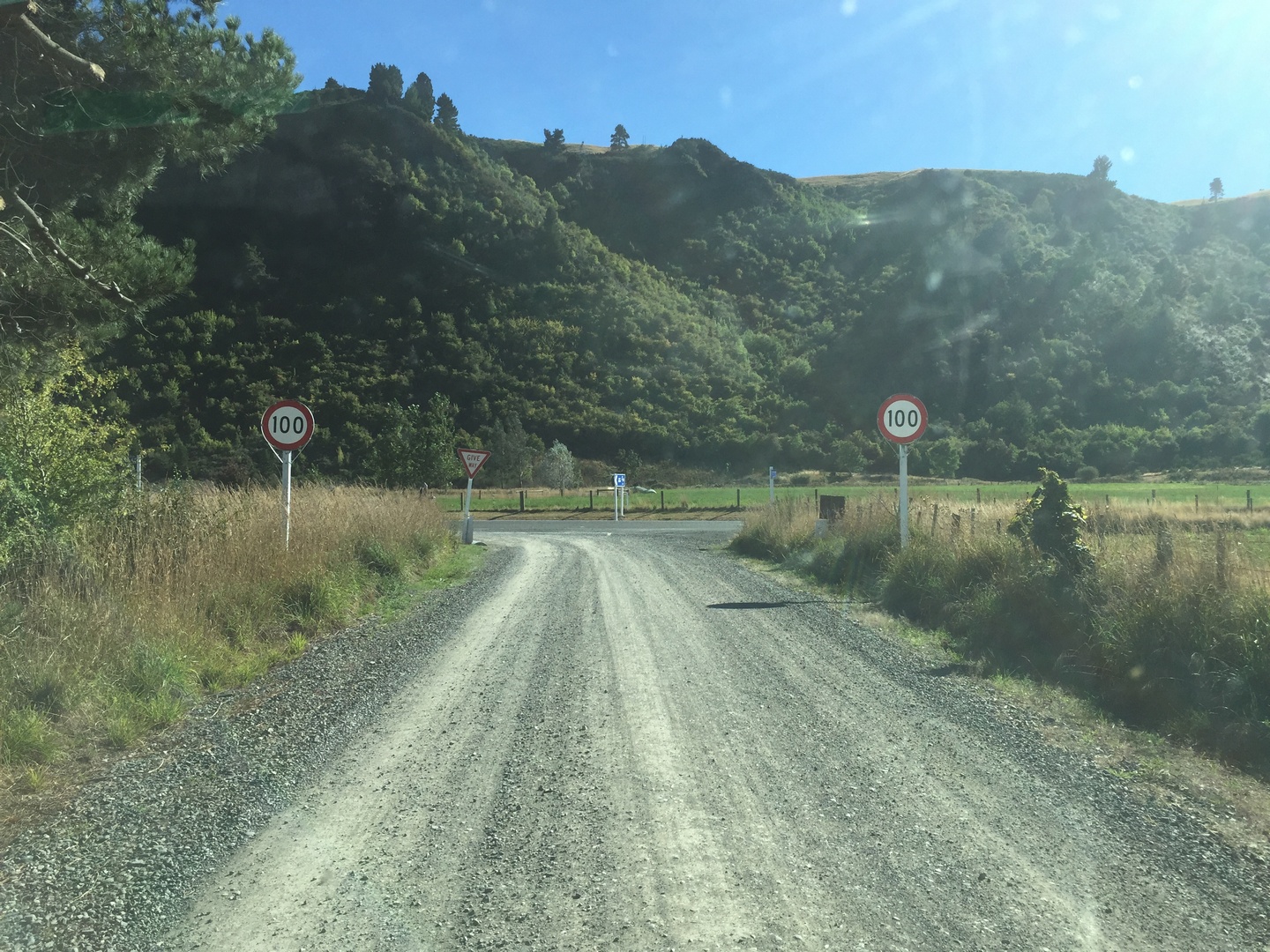
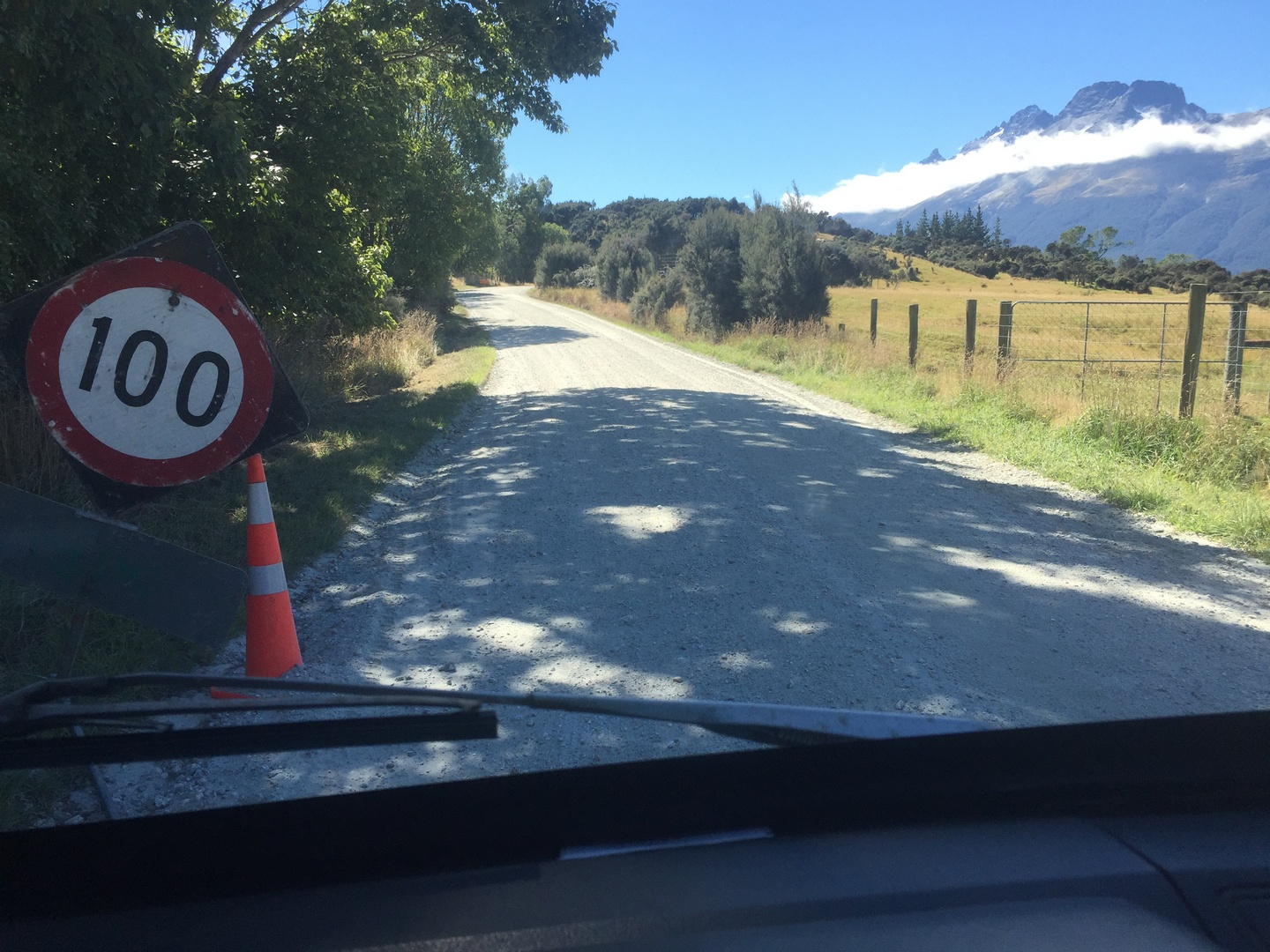
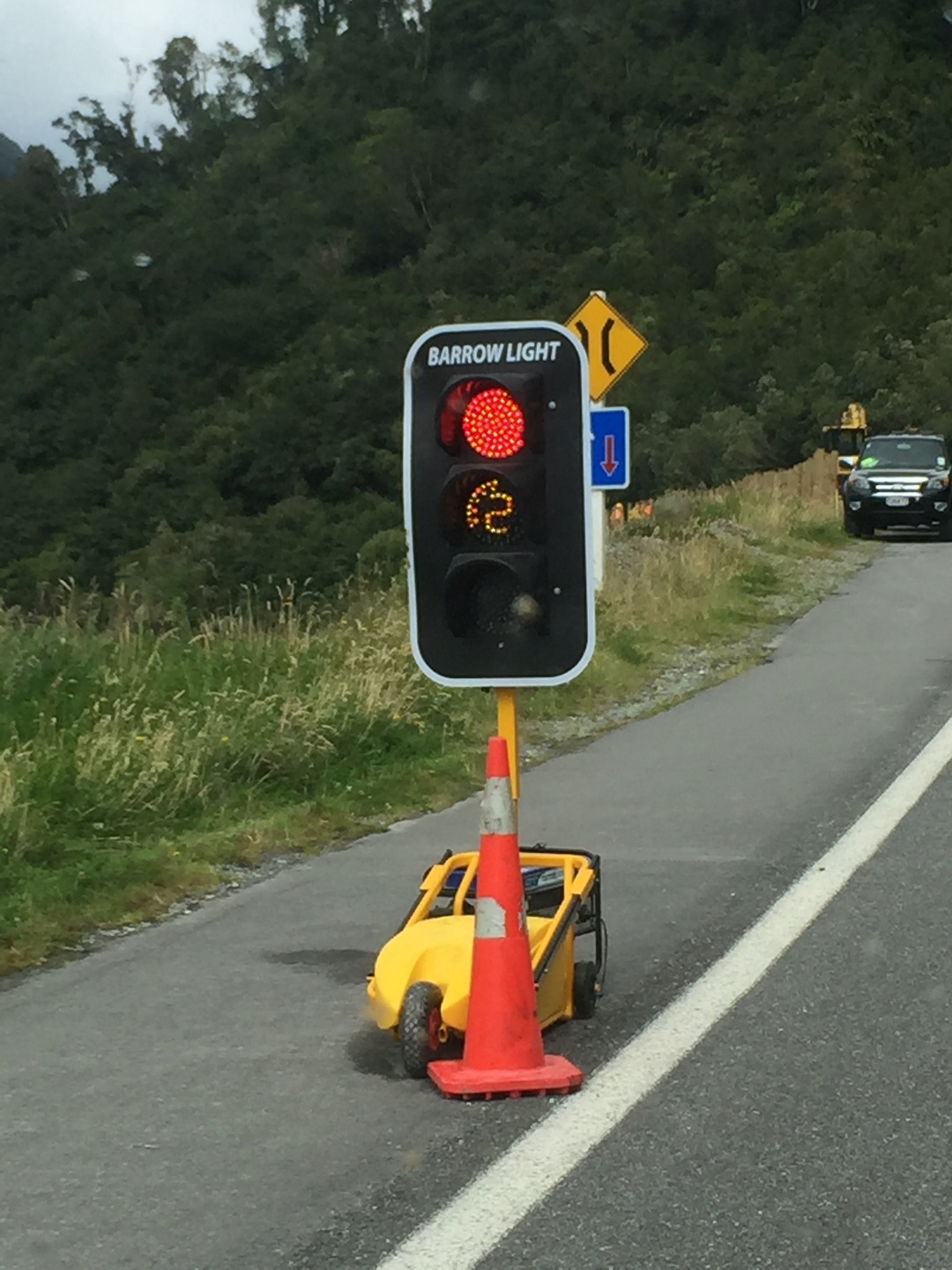
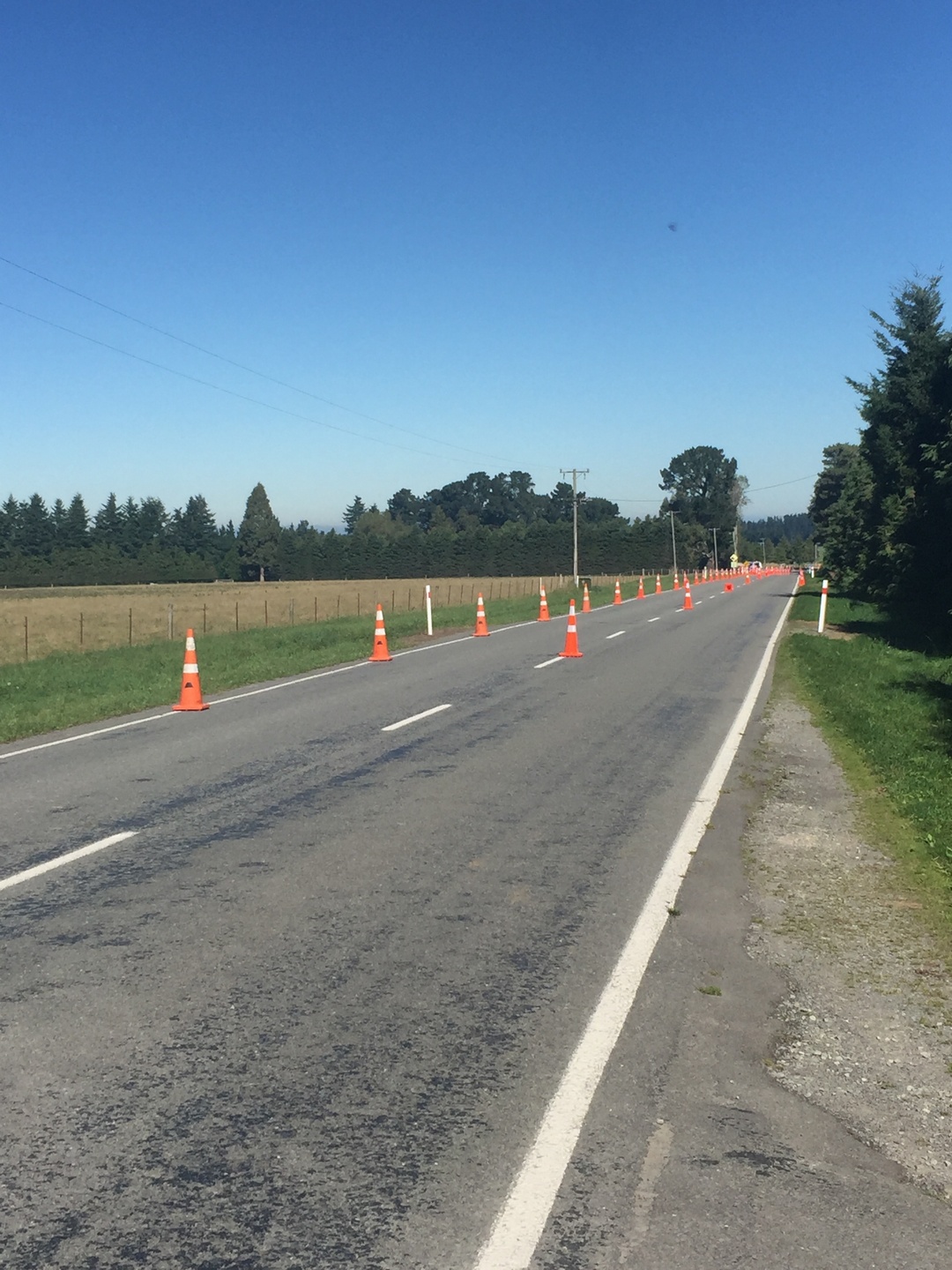
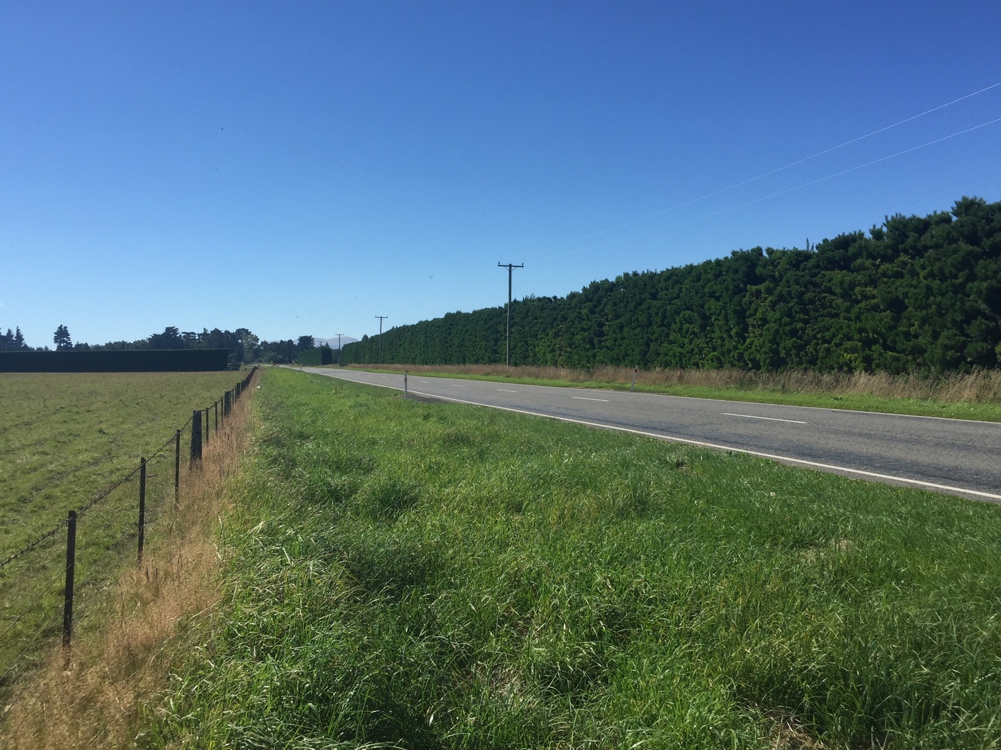
Over de wegen en verkeerssituatie:
Waarom er op Ilse haar blog postings zoveel mooie foto’s staan:

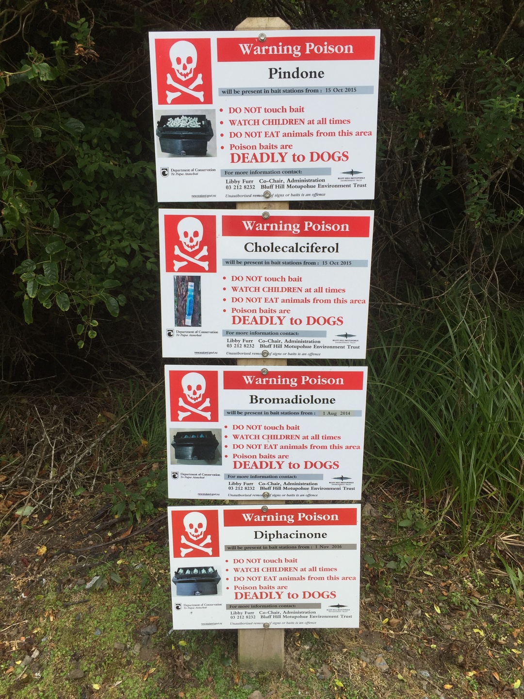
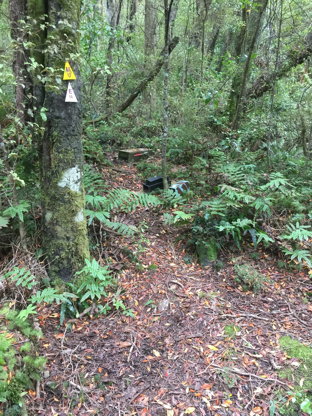
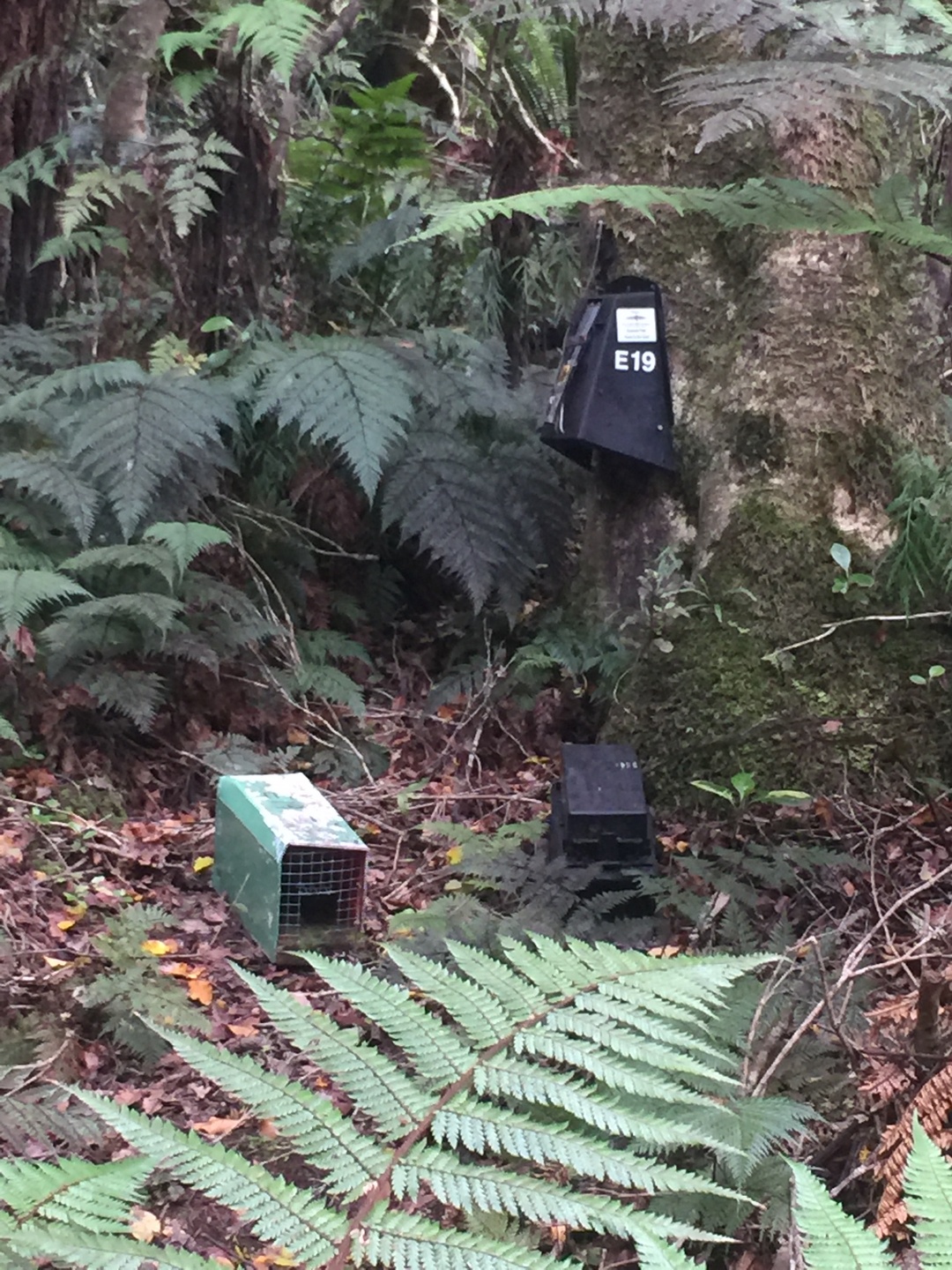
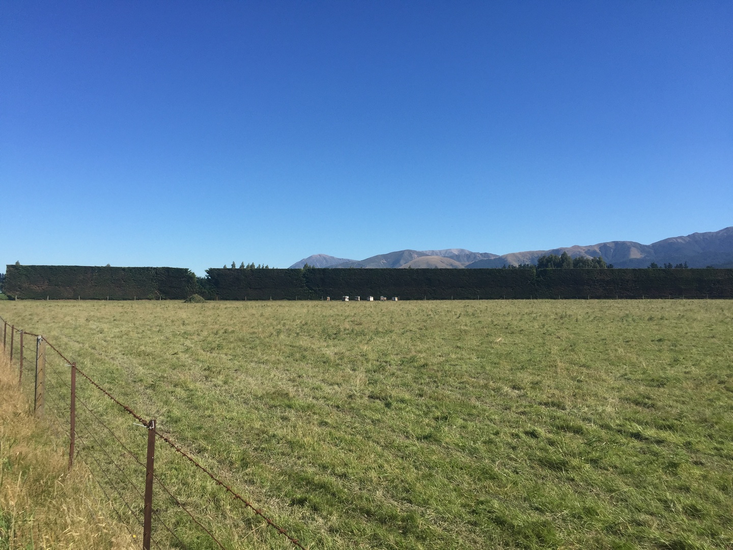
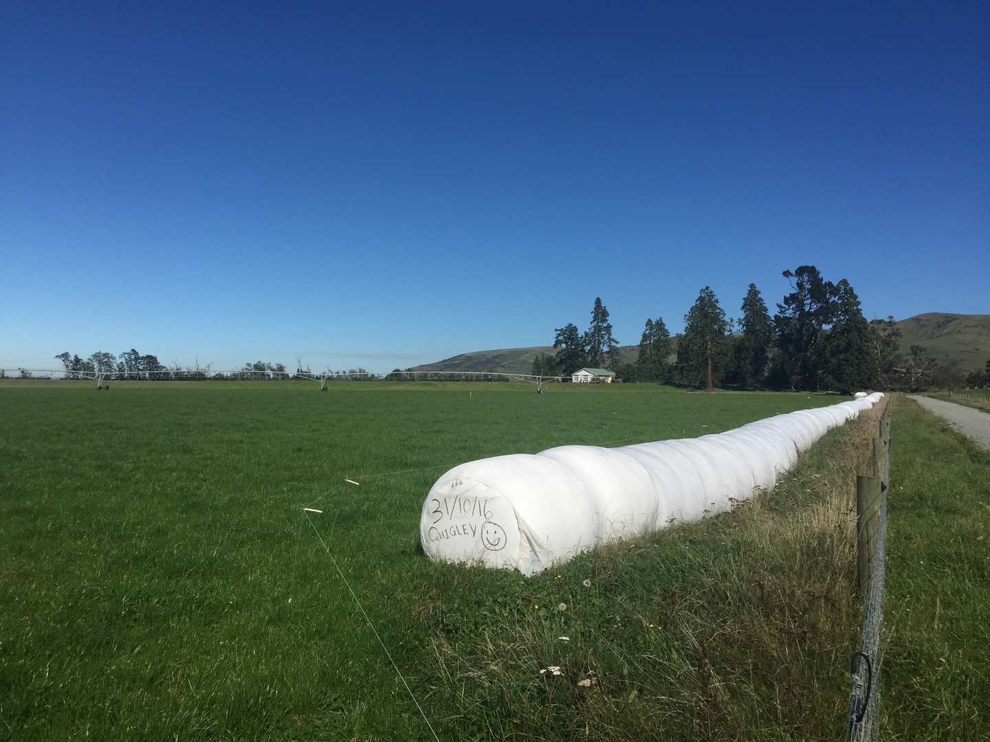
Over de menselijke invloed op de natuurgezichten:
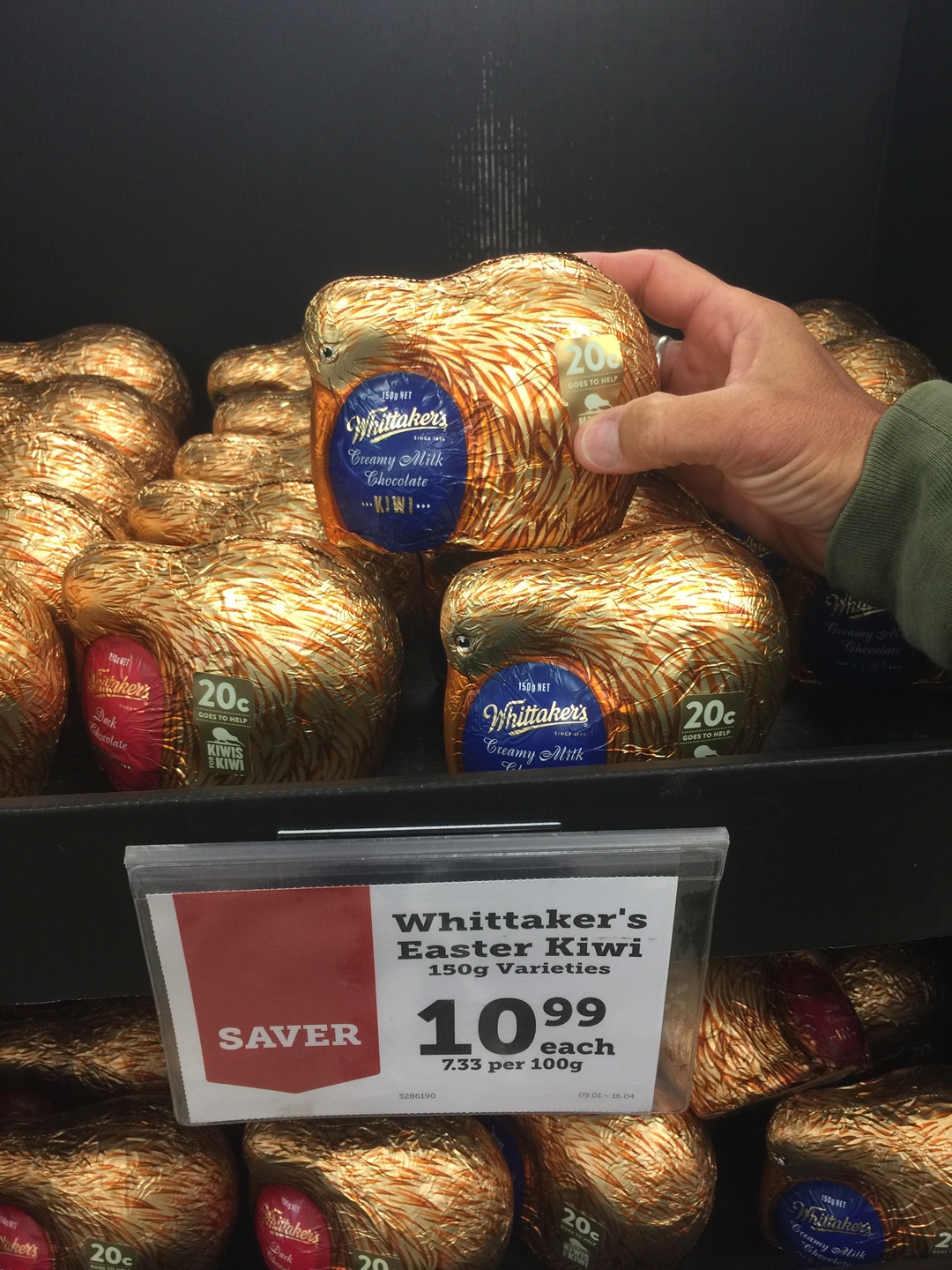
Pasen in Nieuw Zeeland.
Over vertrekken:
Over Christchurch of ChCh
Uitsmijter:
Here are some tips that I have found that will be useful for anyone traveling in New Zealand for longer than 2 weeks

April 15th, Auckland, Burnie is sold to a young french couple who are travelling for 2 months in NZ as part of their 1 year sabbatical. We hope they have as much fun as we did. We rented a little van for the remaining 6 days we are here to travel a bit on the north island.
After the glaciers (Franz Josef and Fox) we drove Burnie to Wanaka over the pass


Luckily we have made reservations at the Milford Sound Lodge since it was fully booked when we got there and it is the only campsite at Milford Sound.
In the next blog Milford Sound and our travels beyond.
Monday April 10th, we are back in Auckland ! What a wonderful journey (almost 7000KM) it has been through a beautiful country with lots of happy and relaxed people. I will try to give you some idea of this beauty although I can only say that many times reality is better than the pictures ! We are happy we could take our time and thus do a part of the many great walks as tramping is definitely the best way to see this country.


Te Wahipounamu was added to the list of World Heritage UNESCO sites in 1990. It covers 10% of NZ’s landmass. The glaciers (Franz Josef and Fox) form the connection between the coast and the highest peaks of the Southern Alps, MT.Cook (3724m).The area contains many of the natural features which contribute to New Zealand’s international reputation for superlative landscapes: its highest mountains, longest glaciers, tallest forests, wildest rivers and gorges, most rugged coastlines and deepest fiords and lakes.

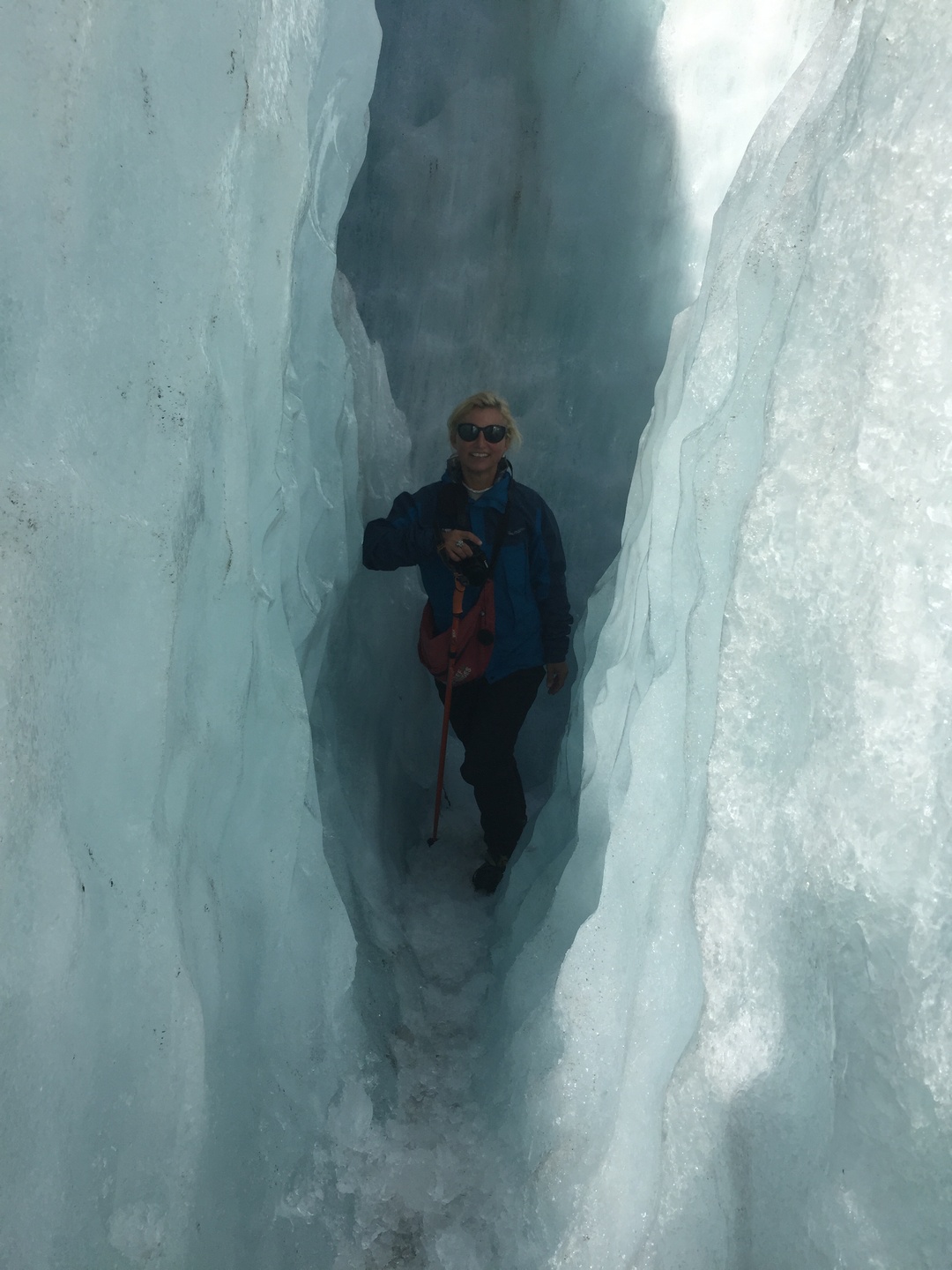
The Maori legend tells of the beautiful Hinehukatere who loved the mountains so much that she encouraged her lover Tawe to climb with her. He fell to his death and Hinehukatere was heart-broken.Her many, many tears flowed down the mountain and froze to form the glacier. Franz Josef glacier is known to Maori as “The Tears of Hinehukatere”. Since April 2012 all glacier walks require a helicopter flight past the unstable terminal face. This is exactly what we did !


The next day we drove to Fox glacier, only 24KM further. We did not go on to the glacier but made several small walks in the area.


We continued our journey to Haast and Jackson Bay all the while stopping for little walks and enjoying the landscape.


After a night of “free camping” in Haast, nice location but infested with sandflies 😦 we drove direction Wanaka with more gorgeous views.
Nu we van het noorden tot aan het zuiden van NZ gereisd hebben, geef ik nog enkele indrukken.


En tenslotte:
