This blog took a while to post but here are some nice memories of Fiji and its people. We have since sailed to New Caledonia. Hopefully we can post on this before the boat goes on the hard for the cyclone season.
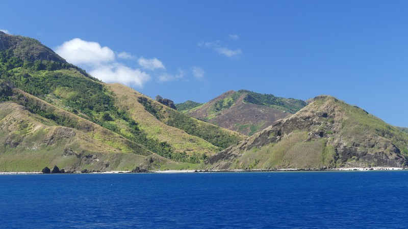
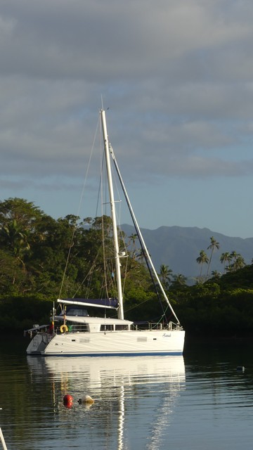
We left Savusavu on August 21 with clear skies and little wind. We had a week to sail around the Yasawa group of islands before we had a meeting with our insurance expert at Vuda Marina on Viti Levu.
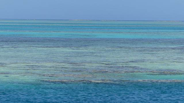
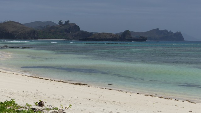
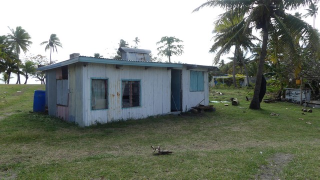
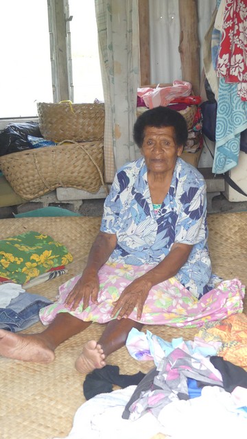
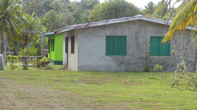
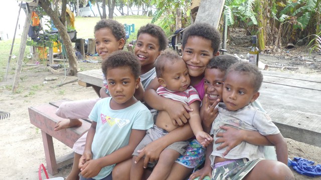
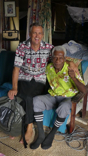
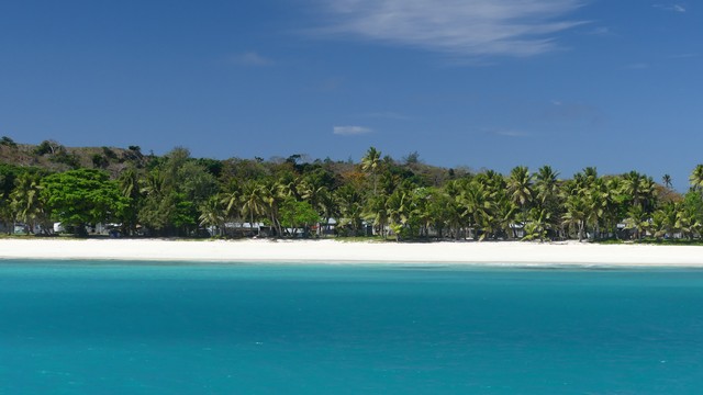
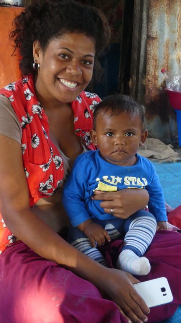
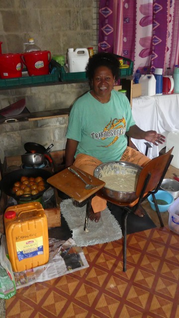
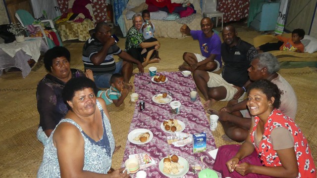
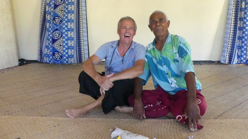
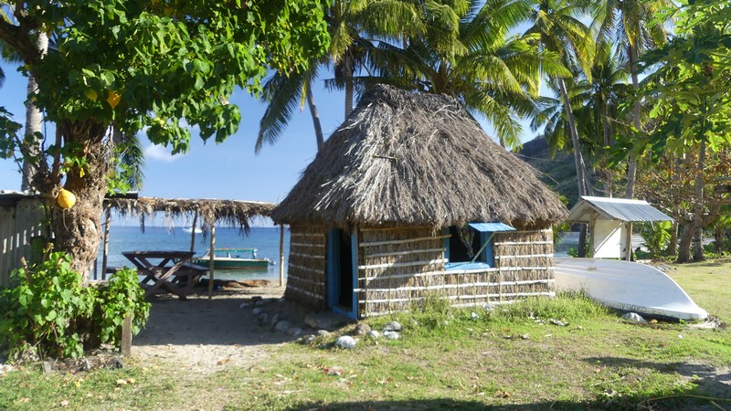
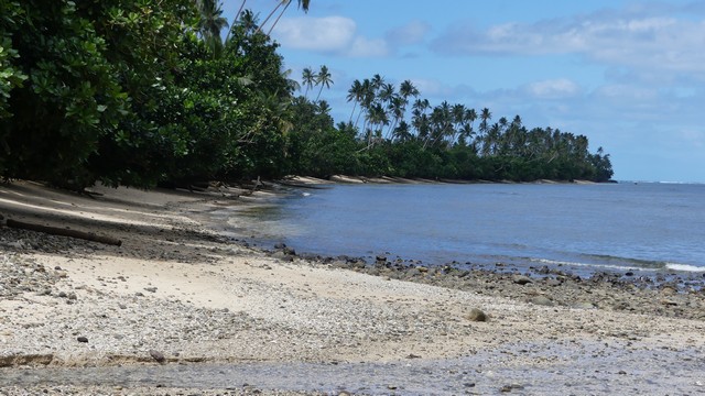
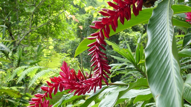
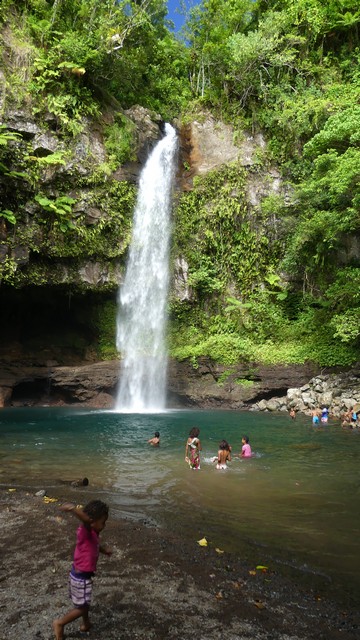
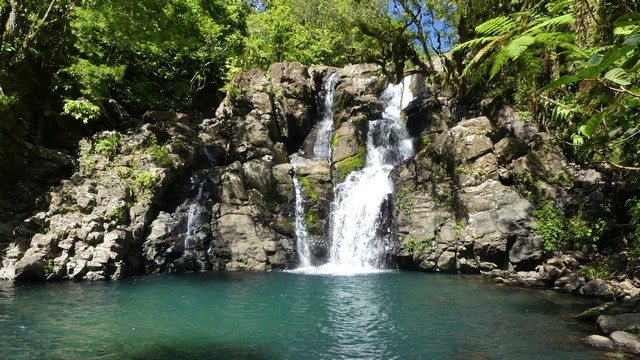
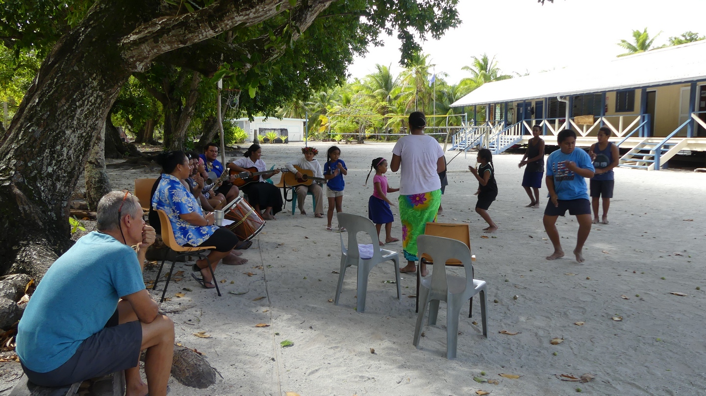
On our way to the Yasawas, all colours of blue.The beach at Yasawa-I-RaraTypical house at Yasawa-I-Rara villageIn the houses there is very rarely furniture. People sit , eat and sleep on mats.The village of Yasawa-I-RaraThe future of Fiji.Stefan in Bula shirt and sulu skirt with one of the elders of the village.The beach on a sunny day.Fiji mother and son, even here the smartphone is not far away…Preparing beignets the Fijan way.Family pictures at Yasawa-I-raraThe village chief and his wife. We were invited to have a wonderful dinner with them.Eating beignets and drinking tea sitting on the floor. The generosity and hospitality of the Fijans is truly amazing and heartwarming.
Before we left the village we were able to print out the pictures and this was the best present we could give them.
We left Yasawa-I-Rara to sail to the Blue Lagoon where we had 2 days of rain 😦 and decided to move on to Naviti Island where the snorkeling should be excellent.
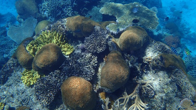
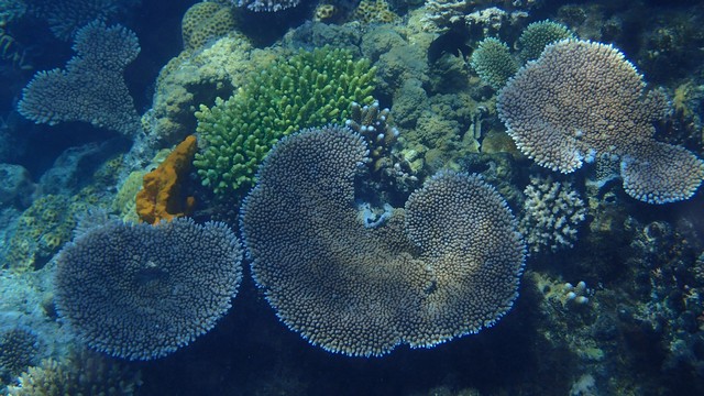
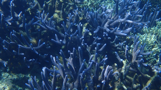
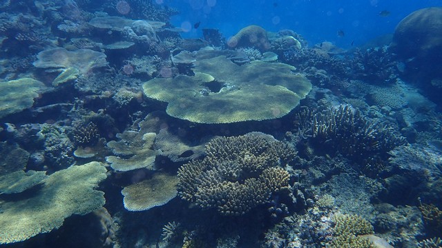
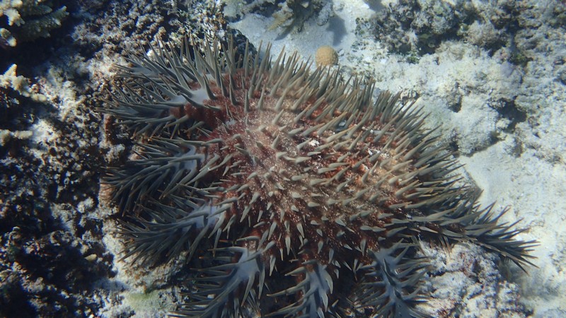
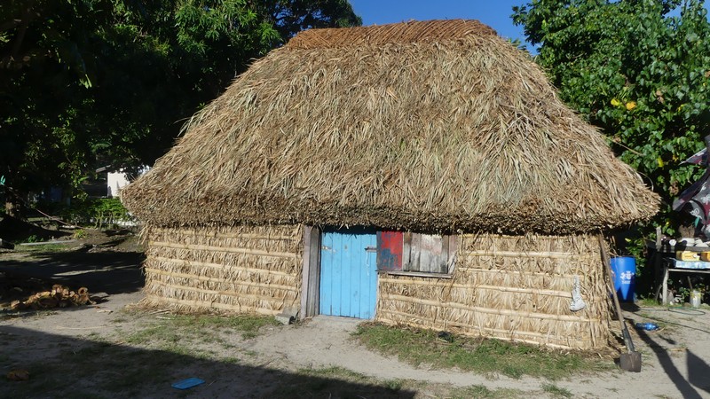
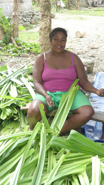
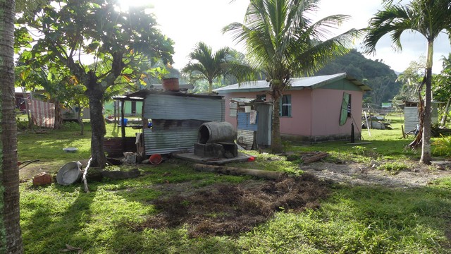
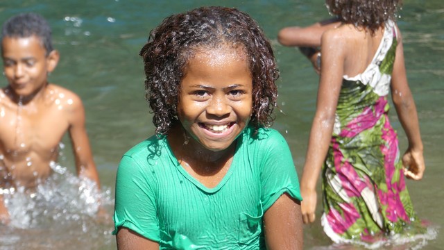
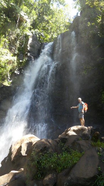
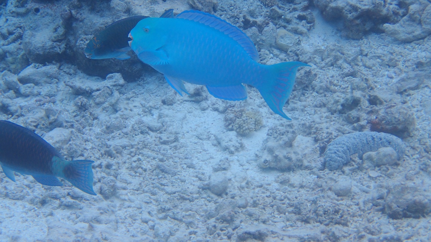
and the snorkeling was excellent…lots of beautiful coralin all coloursand shapes..A crown of thorns, this is a large sea star with 13-18 arms. The spines are venomous and can deliver a painful sting even when the animal has been dead 3 or 4 days. You do not want to touch this one.The next village we sailed to was Yalobi village on Waya IslandAnother warm welcome after the Sevu Sevu ceremony with the chief. Fijieans are very curious and in every village, children and adults ask how old you are :-).I will remember the Fijeans always with a smile on their faces.A small traditional “bure”, a house made from wood , bamboo and pandanus leaves. There are not many left in Fiji, new houses are built in corrugated steel boards. Goes faster and lasts longer but unfortunately is not as pretty.A typical “bure” would last about 3 – 5 years if a cyclone does not come by. The floor is covered by woven mats.School had been out for 2 weeks, tomorrow it was “back to school” again. This school took children ages 6 till 13. Most children stay at school for the week and go home by boat on friday afternoon to come back on sunday. The children learn Fiji and English in school.
Too bad we did not see the boys and girls in uniform as we had to leave early the next morning to be on time for our meeting with the insurance expert in Vuda Marina on Viti Levu Island in Fiji.
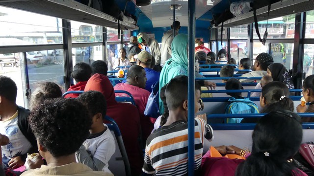
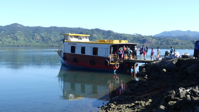
Because we were not allowed to move our boat till the insurance inspector came, we decided to go to Taveuni by bus and ferry. We got our tickets and made reservations at a small resort for 2 nights to return just in time for our meeting with the insurance inspector and the marina.
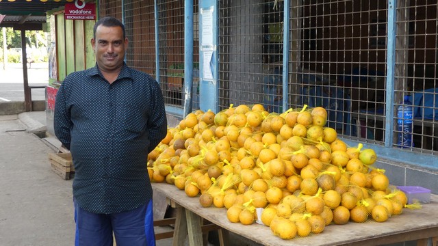
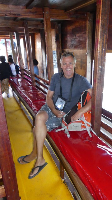
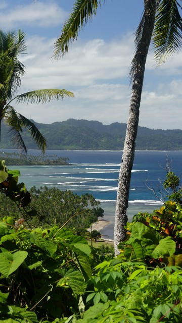
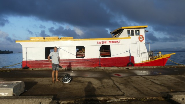
While we were waiting for the bus to arrive I got local oranges, 80Eurcents for a bag of 4. They do not look perfect but they are very juicy and the vendor sooo proud :-).The bus was full at 7am. One Fijan got up and insisted I take his seat for the 2hour ride….The Taveuni Princess 2…all new after cyclone Winston (catagory 5) destroyed her predecessor in February 2016. The boat was built by the captain’s 75 year old father at a cost of about 1Million Fiji Dollar (400.000EUR). It took 3months to build with 6 people.Stefan enjoying a seat in the Taveuni Princess 2.Arriving in Taveuni, the garden island of Fiji. We definitely picked a good weekend to go, no rain and lots of sunshine.
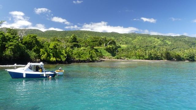
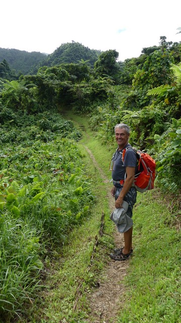
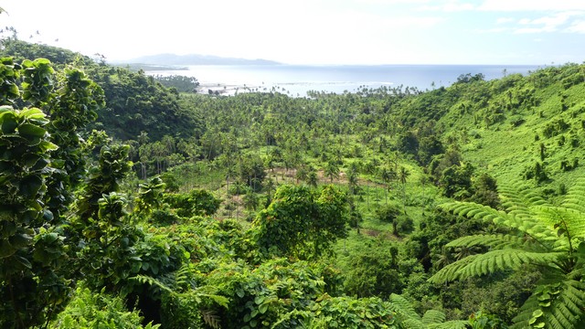
Because we only had 2 days on Taveuni island we decided, after some discussion, to limit ourselves to hiking the 2 top walks on the island:The Lavena Coastal Walk and Tavoro Falls Walk. Although there are many opportunities for beautiful snorkeling (rainbow reef) we unfortunately did not do this (captains orders). When we arrived on Taveuni we immediately put on our walking shoes, bought roti for lunch (indian wrap) and got a taxi to take us to Lavena to start the coastal walk.
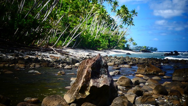
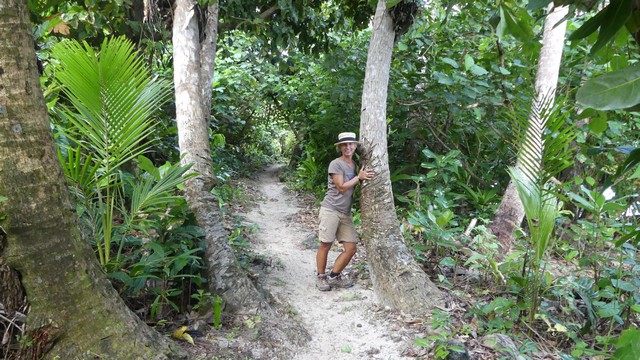
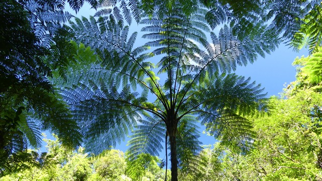
Lavena beach. The start of the Lavena Coastal Walk (5km one way).The walk starts along Lavena village. This woman is preparing the pandanus leaves to be dried so they can be used to weave baskets or mats.There used to be a swing bridge here but cyclone Winston (2016) took it with him…Apparently a lot of the spots here were also used for the movie “Blue Lagoon” with Brooke Shields.The vegetation and bird sounds were really beautiful, so peaceful, we did not see any other tourist. They recommended using a guide for this walk but we never had a problem finding the path.Taveuni is definitely a “garden island”. Part of the trail goes through the Bouma National Park.At the end of the walk one arrives at Wainibau Falls. The water was very refreshing and again no other tourists there….Returning along the coast, it was a gorgeous afternoon walk.Lavena village is a typical Fiji village with houses made from corrugated sheet metal and wood. The traditional “buré”, made from pandanus and bamboo is near impossible to still find.
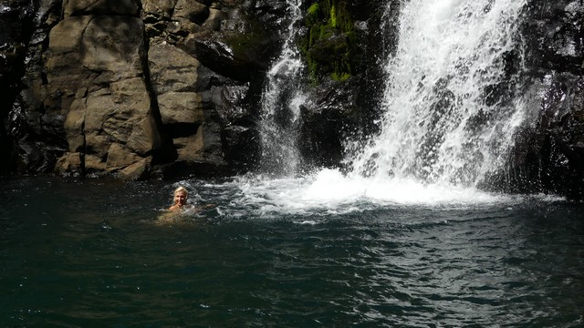
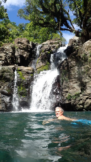
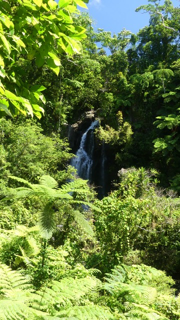
We left early on saturday to hike to the Tavoro Falls, which are a series of three waterfalls within Bouma National Heritage Park. A lot of people only make it to the middle falls because it is fairly steep to get to the 3rd one.
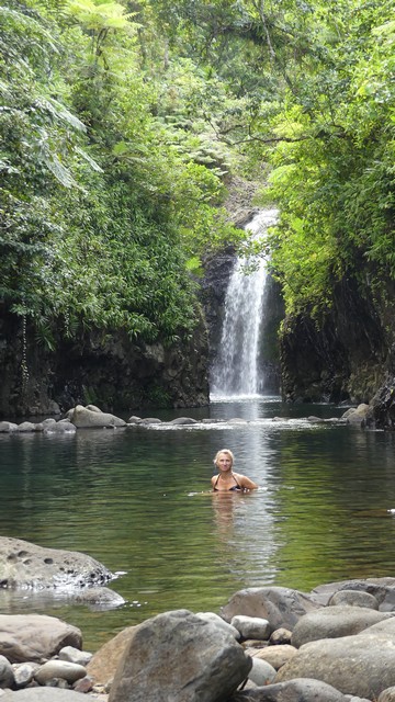
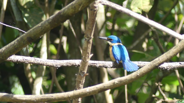
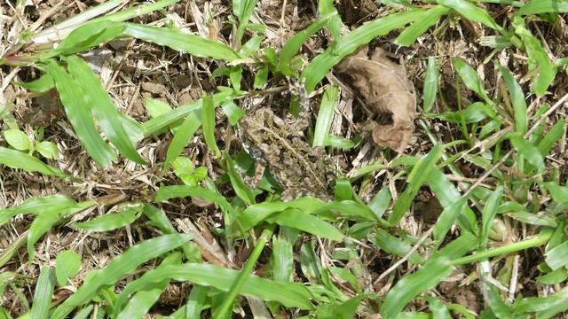
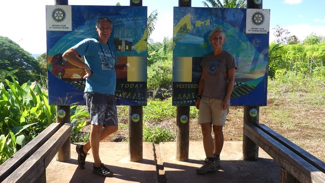
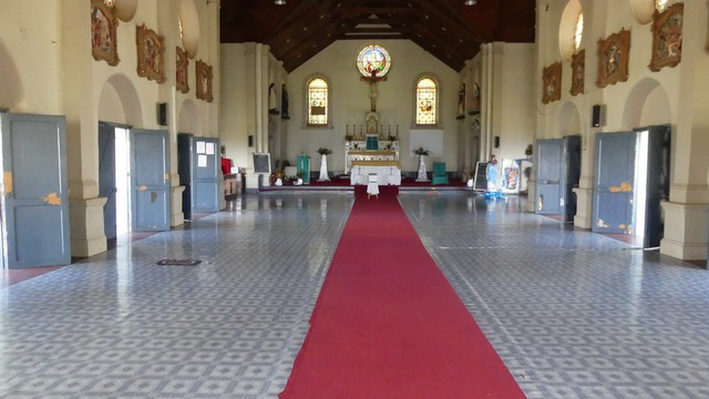
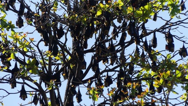
Just before we arrived at the entrance of the park I noticed the very blue Collared Kingfisher sitting in the sun to warm up.We had to borrow money from our taxi driver to pay the entrance fee of the park as we did not have enough cash…We paid our admission fee to a beautiful proud gatekeeper and were on our way.The first sight of Bouma National Park. The park protects rainforest and coastal forest and covers 80% of Taveuni.After 10min walking we reached the lower falls, The fall is 24m high and is an ideal spot for local children and families to play and spend their WE’s. There was even a facility to shower and change.Local children having a good time.We slowly climbed to the next fall and had a beautfull view of the ocean fronted with palm trees and Qamea island in the back.Can you spot the frog?Somewhere along the path we missed the turn for the middle waterfall and we arrived immediately at the top one…We were there all alone just at lunch time and had a wonderful time under blue skies in a perfect scenery with birds singing along.The water temperature was perfect.I even got Stefan into the water :-).We could not have picked a better day !On our way back we found the middle falls.The middle falls are hidden by the rainforest.View while returning to our starting point.Playing and adventure with a home made raft.In Ecuador we stood on the “equator”, latitude zero and in Taveuni we stood on the “international date line”, being the 180 degrees longitude north-south line. Stefan stands in today, Ilse in yesterday. My geography knowledge has never been better after visiting all these places :-).The Wairiki Catholic church in Taveuni was built in 1907 in honour of a French missionary who advised Taveuni warriors on how to defeat Tongan invaders. No chairs, people sit on the floor for mass on Sunday.A tree filled with fruit bats. Fruit bats rest in trees, not in caves. They are also called “flying foxes” and they are the only mammals that can fly (together with microbats). They eat fruits and nectar.Early sunday morning we left beautiful Taveuni with the Taveuni Princess 2. We were both happy we had a chance to visit this beautiful island.
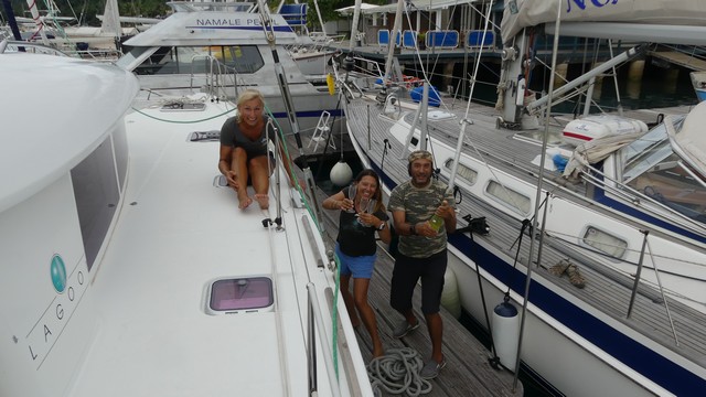
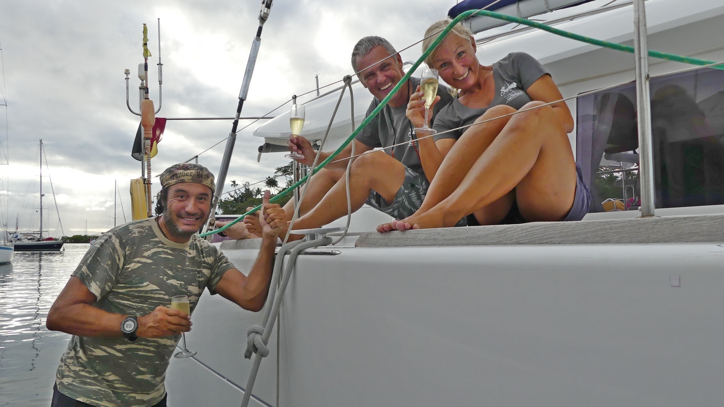
Monday morning (july 31st) the wind dies on us and we have to motor the last 12hours to SavuSavu because we want to get there before dark. We arrive at 16.30 under blue skies at the Q (quaranteen) dock from Copra Shed Marina and receive a warm welcome with “bubbles” from our friends from SY North. This was not in our “sailing plan” but a nice surprise. Three Fijiean ladies came aboard to clear Sanuk for customs, immigration and bio-security and after a lot of giggles and filling out documents we were free to go on land.
The British ruled Fiji from 1874 till 1970. In 1970 Fiji became a fully independent nation. Several coups took place in Fiji after their independence (1987,2000, 2005 and 2006) because of growing tensions between the Indo-Fijan and the native Fijans. It was only in 2014 that new democratic elections took place. The Indians originally came to Fiji under British rule to work on the sugarcane plantations. A lot of them stayed in Fiji because they did not have the money to return. The Indians make up about 38% of the population in Fiji.
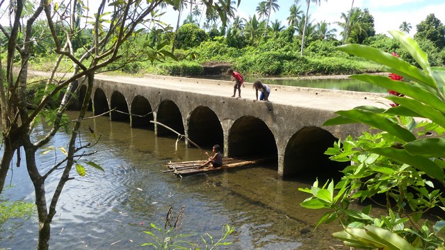
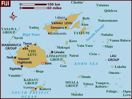
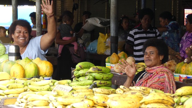
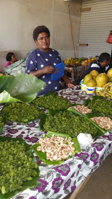
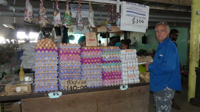
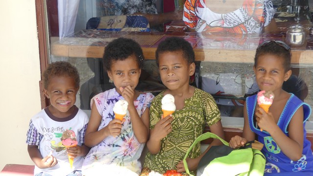
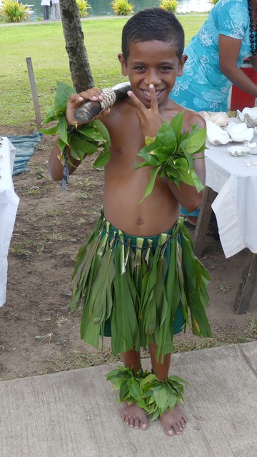
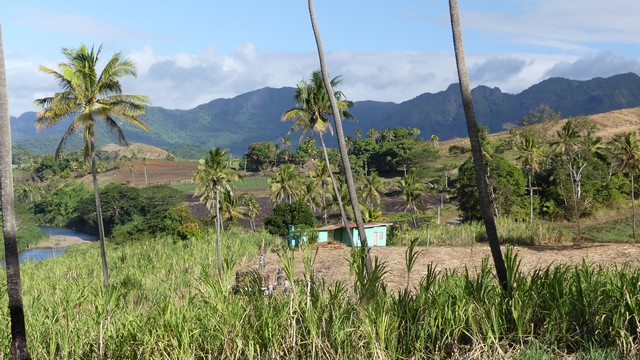
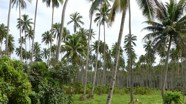
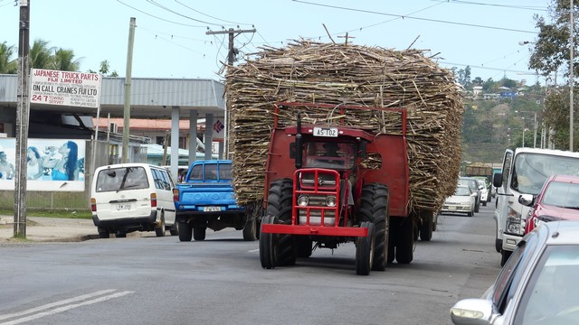
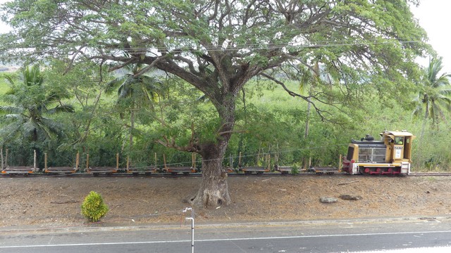
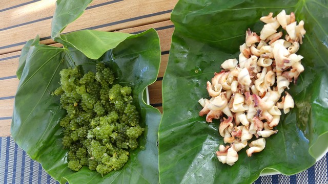
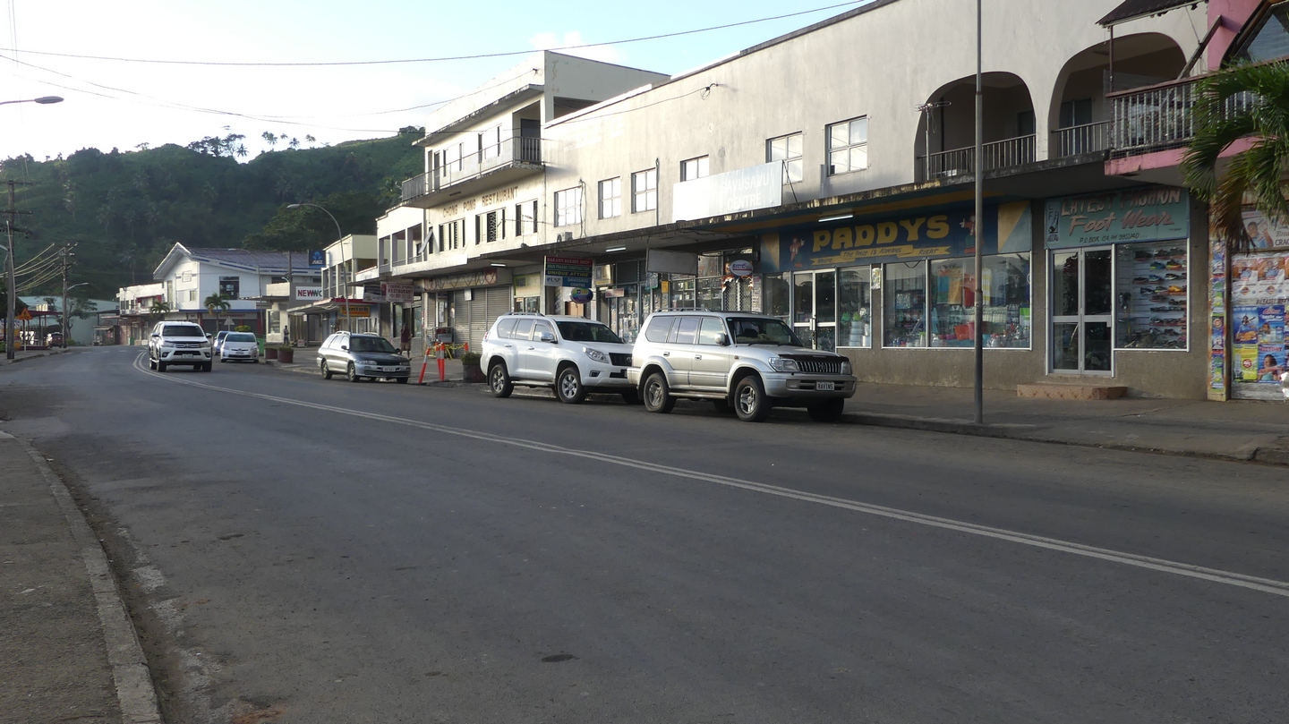
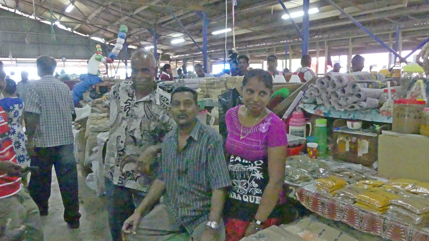
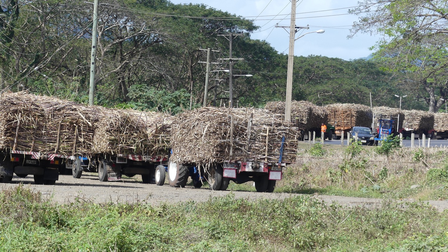
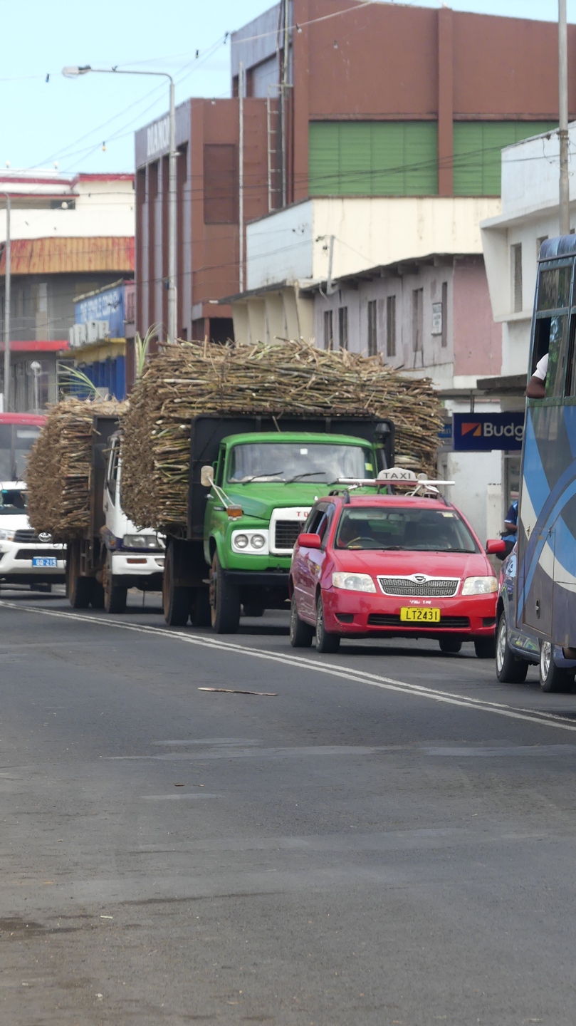
Savusavu is on the island of Vanua Levu. We will visit Labasa by car and go to Taveuni by ferry. From Savusavu we sailed to the Yasawa group of islands before arriving in Nadi on Viti Levu. Viti Levu and Vanua Levu account for 87% of the population.View from our anchorage in SavuSavu.The market on saturday with the typical Fiji smile and friendliness. Fijieans are melanesian and differ from the polynesians in Tahiti. In contrast to the long hair of the French Polynesian girls, the Fijieans have short curly hair.Fijian woman selling sea grapes and snails. We tasted both and it was very yummy.Eggs for sale at the market, no choice of free-range eggs 🙂 10 Fiji dollar (4EUR) for a tray of eggs (24). Above the egss is the cava root for sale. .Typical Fiji kids enjoying their saturday. On sunday all stores are closed and everybody respects the sabat.When a cruise ship arrives they dress up in traditional dress for the tourists. More and more traditions will disappear over the years.Sanuk at anchorage in Savusavu.The main street in Savusavu with all the businesses and restaurants. Most of these are owned by Indians who have clearly more commercial ambitions than the Fijians. This picture was taken on a sunday morning, no stores open or people on the street.The landscape on our way to Labasa.Lots of fields with huge coconut trees used for the copra (dried coconut).A truck loaded with sugarcane on its way to the sugarcane factory in Labasa.Many trucks waiting in front of the sugarcane factory waiting to be unloaded. Sometimes they have to wait 12-14hrs before they can unload. They receive on average 70Fiji dollars (28EUR) for a ton of sugarcane. It takes about 9 ton of sugarcane to get one ton of sugar. Most of the sugarcane plantations are run and worked by Indians.The train runs through the sugarcane plantations to pick up the sugar cane. The crushing season starts in june and lasts till about november. It takes about 15months before sugarcane can be harvested.Sea grapes on the left and snails on the right. They are best eaten together as an appetiser with a cold glass of white wine 🙂
As Stefan already mentioned in his blog we were unexpectedly stuck in Savusavu because another boat’s mooring broke and hit us in the front. No major damage but we had to involve the insurance company and this took 2 extra weeks. During that time we did go to the island of Taveuni (garden island) with the Taveuni Princess.
More on the Return of the Taveuni Princess in our next blog.
We zijn na een reis van 3,5 dagen goed en wel aangekomen in Savusavu op het tweede grootste eiland van Fiji, Vanua Levu. Tot nu toe telden de lengtegraden altijd op terwijl we west vaarden, maar onderweg hebben we de lengtegraad van 180 west doorkruist, waardoor we van 179° 59.999’W naar 179° 59.999’E vaarden. Vanaf nu tellen de graden terug af, naar 0°, zijnde Greenwich in England. Savusavu ligt bijvoorbeeld op 16° 54.882’S, 179 18.944’E, Gent ligt op 50° 59’N 3° 40’E.
We naderen Fiji, op de voorgrond zie je duidelijk de 180W lengtegraad, net onder het wateroppervlak
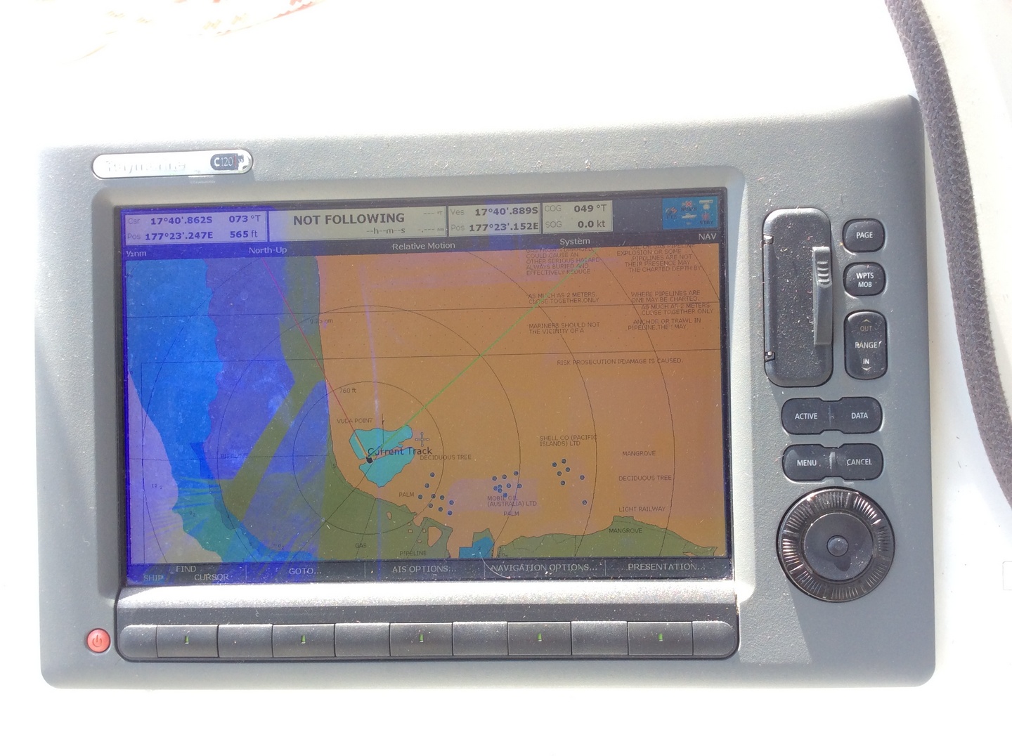
We hadden gehoord van een andere zeilboot dat hun navigatieprogramma tilt was geslagen bij het kruisen van 180°, en dat ze plotseling midden in het grootste eiland van Fiji, Viti Levu, aan het ‘varen’ waren. Ons nogthans bejaard Raymarine systeem (C120W van 2010) met kaarten van Navionics (V1.20, waarschijnlijk van rond 2014) was echter niet van slag te brengen. Wel heeft hij/zij(?) de onhebbelijke gewoonte om nu en dan eens zijn gps signaal te verliezen, waardoor we een minuut of twee niet meer weten waar we zijn op de wereld. Gelukkig houdt de autopiloot dan de laatste koers aan, zodat we niet plotseling van een ruime wind tot scherp aan de wind draaien. Of bij dagenlang continu gebruik zoals een oversteek durft het navigatieprogramma al eens te herstarten, meestal terug zonder veel erg en het houdt ons alert. Bij het schrijven valt me op dat we onze autopiloot, toch wel de belangrijkste derde man aan boord, nog geen naam gegeven hebben. Daarom vanaf nu, standvastige Stanny als piloot en Ray voor het navigatiesysteem.
Ray, voor een keer is hij juist als hij zegt dat we op het land varen. Hij zit er wel een paar honderd meter naast.De bediening van standvastige Stanny rechtsboven, naast Ray. Daaronder twee displays die een variabel aantal gegevens kunnen tonen: windsnelheid/richting, diepte, tijd, …
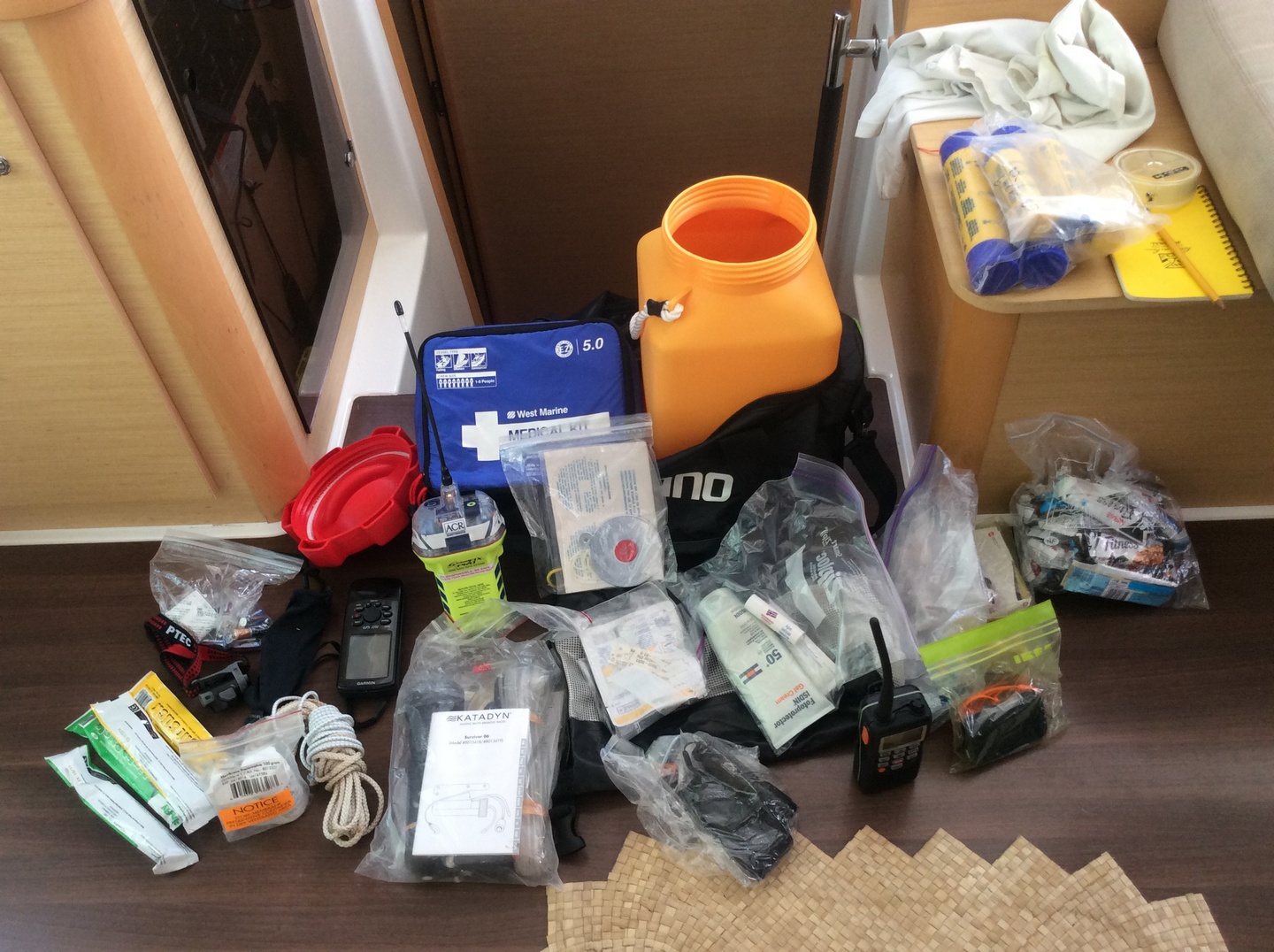
Nu moeten we zeggen dat we binnen ook een C120W hebben (Bisray), maar we die meestal niet gebruiken. In plaats daarvan draaien we een programma op de pc, OpenCPN, dat ik eigenlijk beter vind. We kunnen er immers satellietfoto’s van Google Earth mee opladen, en die geografisch laten overeenkomen met de getekende kaarten. Dus kunnen we op moeilijke plaatsen, zoals bij een pas of een rif, heen en weer flippen tussen de satteliet foto en de kaart. De pc heeft een gps-puck, zodat we twee onafhankelijke systemen van navigatie hebben. Ook hebben we een ipad met een bluetooth GPS en daarop een Garmin kaartprogramma. We zorgen voor redundantie, door ook nog twee Iphones met gps te hebben, en een Garmin gps handtoestel dat in de ‘grab bag’ zit. Dus zolang het gps systeem niet uitvalt zullen we weten waar we ons op aarde bevinden! (oh, ik vergat de sextant) Terzijde, de grab bag is de sportzak die we meenemen in het reddingsvlot en altijd klaar staat. Daarin zit ondermeer een manuele watermaker, vuurpijlen, ehbo kist, energie repen, batterijen, vhf, mes, zaklamp, spiegeltje, zonnecreme, visgerief.
Onze zwarte grab bag in de achtergrond met ervoor/erop de inhoud.
Enfin, na al het bovenstaande kwamen we dus aan de maandagavond in Savusavu, Fiji. We meerden aan het Quarantaine-dock van de Copra Shed Marina aan met onze gele vlag in de mast. Dit wijst erop dat je nieuw in een land bent en nog niet langs de douane en immigratie bent gepasseerd. We werden verwelkomd door onze vrienden van North, die ons op een fles bubbels trakteerden.
We mogen nog niet van boord, maar we zijn toch al aan het feesten!
Alhoewel er schrikverhalen de ronde doen over de biocontroles in Fiji viel dit allemaal verschrikkelijk mee. We kregen 4 vrouwelijke officials op de boot, wat wel wat moeite kostte want het dek van Sanuk ligt zowat een meter boven het water oppervlak. Dus moesten de ladies via een rubberen stootkussen met gaten dat als laddertje dienst doet naar boven, al dat Melanesisch gewicht!
Na veel gegiechel, geduw en getrek – dit hadden ze nog nooit moeten doen – waren ze aan boord. Het bleken goedlachse dames, en er was geen enkel probleem met Sanuk, noch met zijn bemanning en dus kregen we na het invullen van een twintigtal documenten (en 160€) de toelating om de gele vlag te strijken en de Fiji vlag te hijsen. Welcome to Fiji!
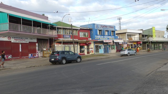
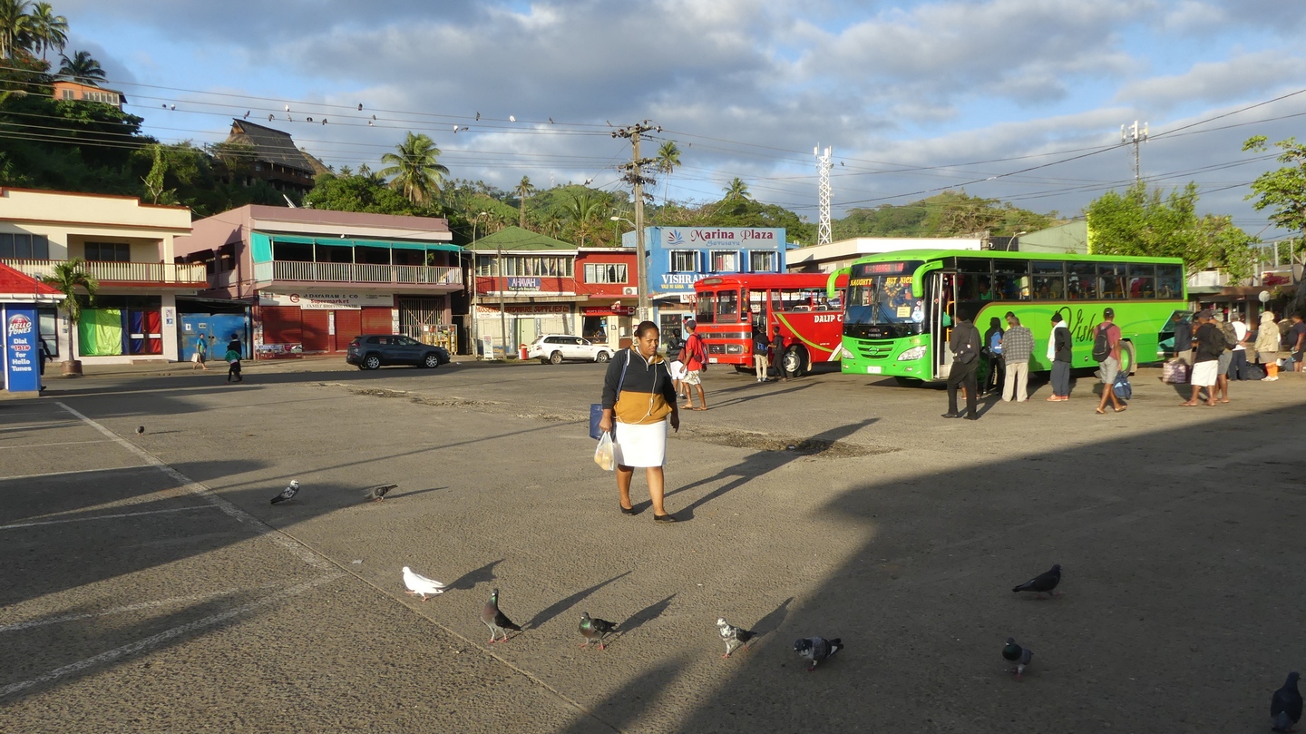
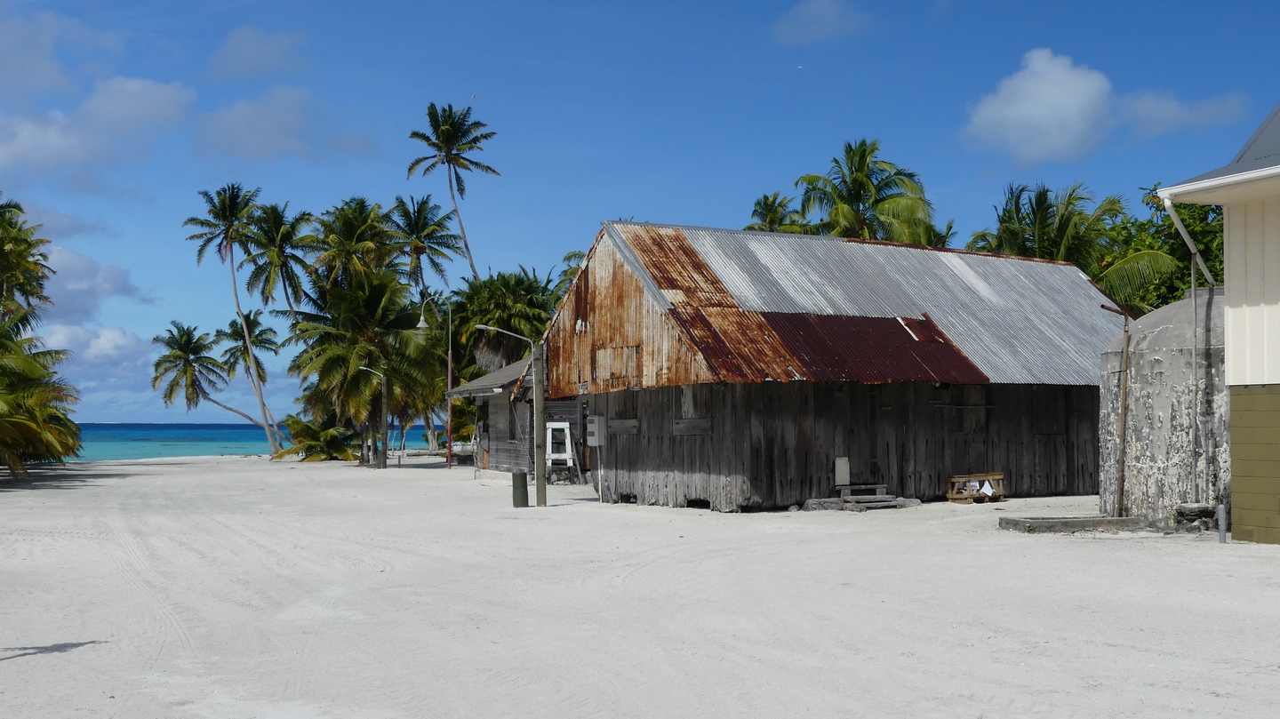
Savusavu is een 1-straat stadje. Vanaf het marinagebouw, een oude copra opslag plaats, kom je het busstation tegen, de markt en dan het ene winkeltje na het andere. Er is de ‘download’ winkel voor muziek en films, twee bakkerijen, drie banken met ATM, autoverhuur, tankstation, apotheker, souvenierwinkel, slager, kledingszaken, … Op het eerste gezicht verkopen de kruideniers allemaal hetzelfde, maar toch zijn er kleine verschillen die je pas na een paar bezoeken opvallen. Zoals je merkt was Savusavu voor ons was een grootstad!
het busstationSavusavu op een zondag: hier wordt de heer zijn dag nog gerespecteerdhet ene winkeltje naast het andere
In de marina liggen een twintigtal zeilschepen, waaronder sommigen al een hele tijd. Het is immers verleidelijk om te blijven hangen in een plaats waar voor het eerst sinds Tahiti terug de meeste courante dingen te vinden zijn, aan schappelijke prijzen. Internet is hier zeer goedkoop (50Gb/20€) en meestal snel, dus we besteden de eerste dagen met het whatsappen naar het thuisfront en het lezen van wat er ondertussen bijgekomen is op het web… De mensen op straat zijn ook anders: naast de Melanesiers lopen er minstens evenveel Indiers rond, naar hier gekomen onder Engels bewind om mee te helpen aan de copra en suikerriet oogst. En dus zijn er ook veel Indische restaurants waar je goedkoop curry kan eten. Het leven en vooral het eten is hier een pak goedkoper dan de voorbije maanden, dus gaan we geregeld op ‘restaurant’. Voor 6 € krijgen we een curry van eend met rijst, naan-broodje, chutney en een sausje. Het vlees is altijd wel ongeveer de helft beentjes, dus je moet voorzichtig eten.
We hebben een auto voor een dag gehuurd en zijn naar de andere grootstad van het eiland getrokken: Lambasa (geschreven Labasa). Het is een twee uur durende rit over asfaltweg, die zich over de bergen slingert om aan de noordkant bij de zee uit te komen. Het is nog een stuk groter dan Savusavu, nog een stuk Indischer, nog een stuk grauwer. Er is terug een grote winkelstraat die eindigt aan het busstation en de markt.
overdekte markt in Lambasa
Er is eigenlijk niets te zien, behalve de vele tractoren die langsrijden, geladen met suikerriet. We hebben hen gevolgd tot aan de fabriek even buiten de stad en zagen de vele, vele vele vrachtwagens en tractoren staan wachten tot ze hun lading mochten lossen. Ik vroeg aan de fabriekspoort of we de installatie mochten bezoeken, en hoewel dat na wat overleg initieel mocht hebben ze dat ingetrokken toen ze zagen dat we sandalen droegen. De veiligheidsvoorschriften vereisen gesloten schoenen. De manager was oprecht teleurgesteld dat hij ons geen rondleiding in zijn fabriek kon geven, en vertelde over de moeilijkheden van Fiji’s suikerindustrie. Een subsidiering van de EEG met een vaste suikerprijs verloopt in drie maanden, en de wereldprijs van de suiker was in de loop van het veeljaren contract gezakt tot een derde van wat ze vandaag nog krijgen. Harde tijden in het verschiet, en er was zelfs sprake om de fabriek te sluiten, maar voor de vele boeren is het suikerriet hun enige inkomen. Dus gaan ze herstructuren, moderniseren en stroomlijnen. Hopelijk worden de wachttijden voor de vrachtwagens dan een stuk minder, want nu varieren ze van 10 uur tot 2 dagen!
Aanschuiven om hun lading in de suikerfabriek te mogen afgevenDe hoofdstraat in Lambasa
Ondertussen in Savusavu was er echter een incident dat onze reisplannen danig in de war stuurde!
We waren op 6 augustus in de namiddag vertrokken vanuit de marina naar het einde van de baai, zo een 8 km verder. Dit was het vertrekpunt om de volgende morgen een kleine zeiltocht te maken naar een nabij gelegen eiland, Taveuni. Maar we hadden ons huiswerk slecht gedaan: toen we de rust van de baai ruilden voor de open zee zagen we dat de wind en de golven het geen pretje zouden maken om de 25Nm af te leggen. Na een uurtje worstelen tegen de wind en de golven gaven we het op en besloten om terug te keren naar Savusavu. Dus zo kwam het dat we terug aan dezelfde mooring lagen die we de dag voordien hadden verlaten.
Terwijl Ilse en ik rustig in het salon aan het internetten waren, lag Sanuk zoals gewoonlijk met haar kont te draaien aan het meertouw. Catamarans liggen immers niet stil zoals een zeiljacht, en draaien nerveus altijd heen en weer. Niets speciaals, en ook de wind was in de beschutting van de marina niets om zich zorgen over te maken, een door de weekse 15 knopen.
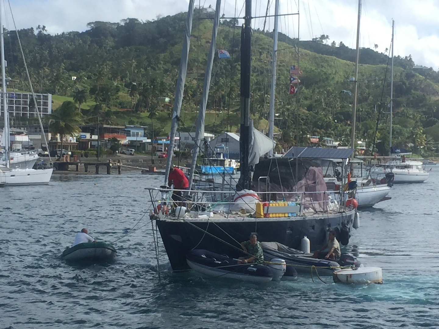
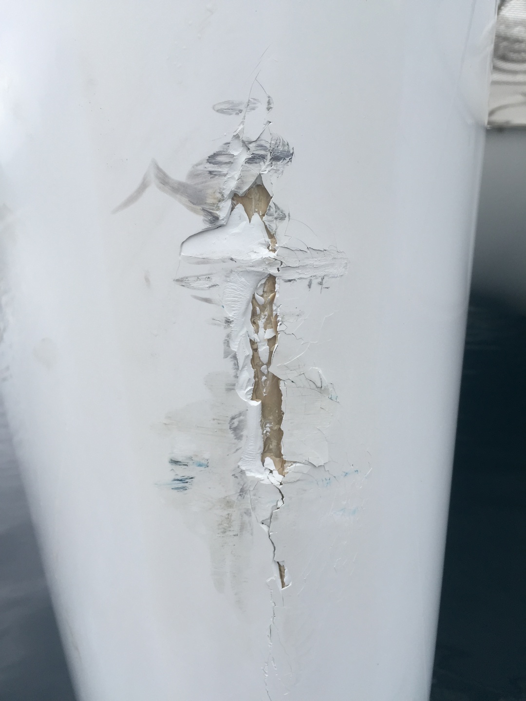
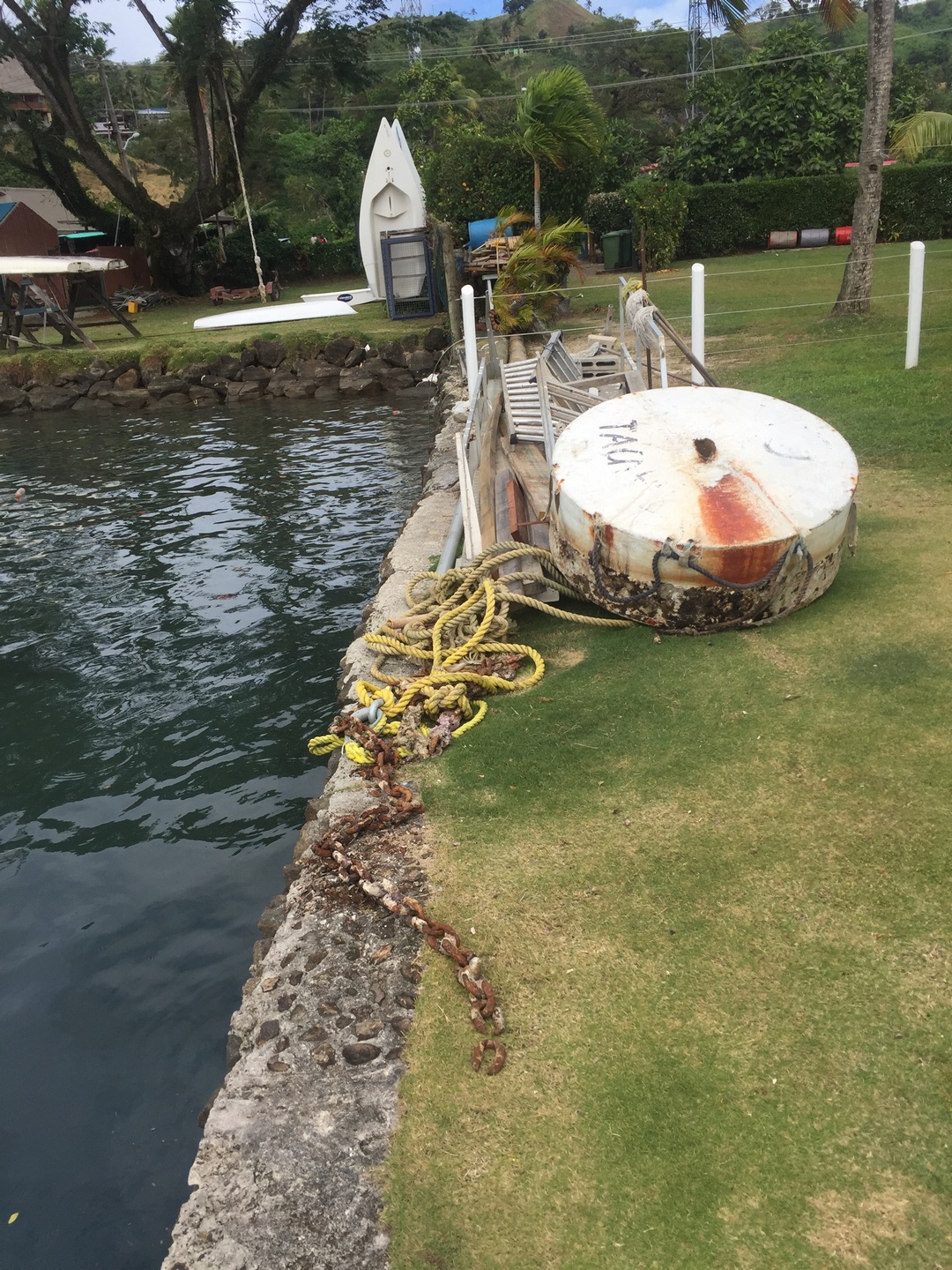
Maar toch was dat genoeg om onze buur zijn meerketting te laten breken. Niet zijn touwen van de boot naar de boei, maar de verankering van de boei naar de grond. De 15 meter lange boot kwam zijdelings tegen onze Sanuk zijn twee boegen gedreven. Het duurde even voor Ilse en ik doorhadden waarom Sanuk plots een harde schok te verwerken kreeg. Maar dan schoten we in aktie: Ilse nam een stootkussen en hield dit op de plaatsen waar ze het meeste schade kon vermijden. Ik greep naar de misthoorn van gecompresseerde lucht en trok de aandacht van andere boten afgemeerd in de marina. Het was allemaal voorbij in 5 minuten, en de schade was beperkt. Met een 4-tal bootjes konden we de losgeslagen boot, Moon Dancer, terug aan een mooring leggen, en de schade nagaan. Bij hem viel het zeer goed mee, bij ons was er schade aan beide boegen zo een meter boven de waterlijn, en wat aan de stuurboord kant waar hij langs gegleden was.
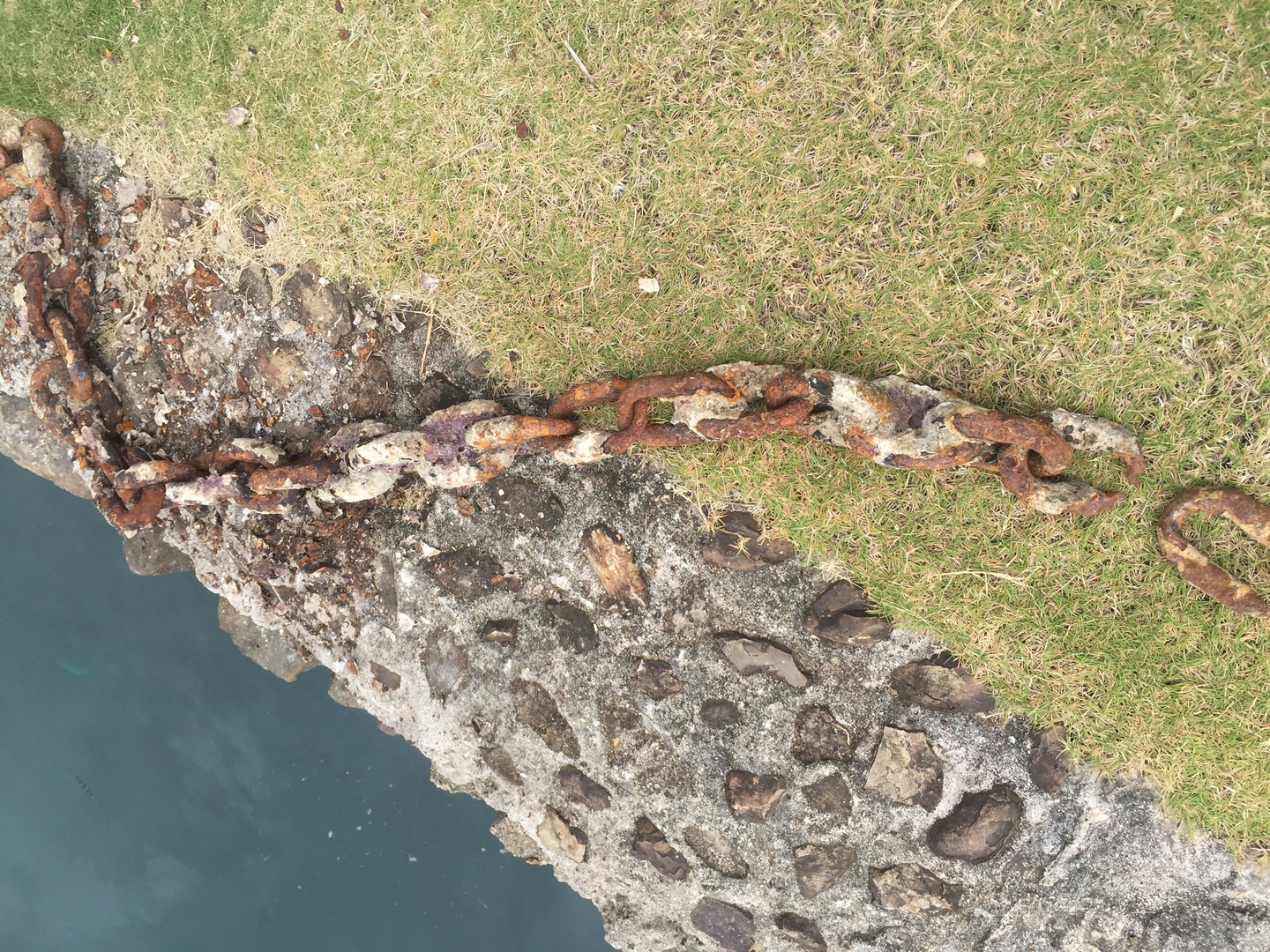
Moon Dancer, die onze Sanuk molesteerde, wordt met een paar dinghy’s terug aan een mooring gelegd. De ronde tonboei hangt met zijn meertouwen nog vast aan de boot, maar niet aan de bodem…Auwww, Sanuk heeft zijn boegen geschaafd. Wie zijn neus schendt, schendt zijn boot!De meerboei …… en zijn ketting, of wat daarvoor moest doorgaan.
Dus niets erg, maar de Copra Shed Marina, eigenaar van beide boeien, verwierp alle verantwoordelijkheid. Ook de eigenaar van Moon Dancer wilde niets met de zaak te maken hebben, hij had een derden verzekering met hoge vrijstelling en vond dat hem geen schuld trof. Daar kon ik inkomen, want het was duidelijk dat de ketting die onder water de indrukwekkende meerton op zijn plaats moest houden, totaal verroest en versleten was. Omdat het na een aantal dagen duidelijk werd dat niemand onze schade zou vergoeden, heb ik onze verzekering – Generali – aangesproken via onze makelaar in Marseille. Nou die lieten er geen gras over groeien! Ze stuurden een inspecteur vanuit Tahiti ter plaatse om het volgende weekend alle partijen te interviewen en een raming van de herstelkosten op te maken. Of we tot zolang zeker ter plaatse konden blijven. En zo kwam het dan dat we drie weken in Savusavu gebleven zijn, een week langer dan verwacht. De positieve kant van de zaak is dat ik eens mijn franse verzekeringstaal heb kunnen oefenen met de polis te lezen, en dat we eens te weten komen wat onze maatschappij waard is.
Ilse en ik besloten om de bus en de overzet te nemen naar het eilandje Taveuni, dat we in onze eerste poging gemist hadden. De ‘return of the Taveuni princess’ firma, richt een georganiseerde reis in: eerst een luxebus van Savusavu via de snelweg naar de haven van de baai van Nassau, dan een ferry naar de haven van Somosomo op Taveuni. Dat alles voor de prijs van 32€ voor 2 personen, heen en terug. Ok, ok, de luxebus was een gewone bus met open ramen als ventilatie, de snelweg was een asfaltweg en veranderde halverwege in grave, en de ferry was een omgebouwd vissersbootje waar een extra dek was opgezet. Maar het was leuk zo tussen de Fijians te kunnen reizen, en het viel allemaal reuze mee. We kwamen aan in Taveuni de vrijdagmiddag om 11 uur, en hadden tot zondagmorgen 7 uur om het eiland te zien. Maar dat bleek voldoende, want met de hulp van een gecharterde taxi hebben we de hoogtepunten van het eiland gezien: een mooie strandwandeling vertrekkende van Lavena die eindigde in een waterval, de drie watervallen wandeling in het reservaat van Bouma waar we de hoogste waterval voor uren helemaal alleen voor ons hadden, en verder nog de oudste kerk van Fiji (1892) en het 180 lengtegraden infopunt. Een mooie herinnering aan een mooi eiland!
Terug in Savusavu leerden we dat het vliegtuig van Tahiti naar Auckland van onze expert was geannuleerd, waardoor we een nieuwe afspraak hebben, ditmaal in de door ons gekozen locatie van Vuda Marina, waar ze de boot kunnen uit het water halen, en waar hij een drietal weken kan blijven liggen.
Afspraak op 28 augustus in Vuda Marina, op het grootste eiland van Fiji: Viti Levu. Volgende blog zal gaan over onze reis van Savusavu naar Viti Levu, via de Yasawa eilanden.
Every year , from June to October, the humpback whales migrate from Antarctica to the warmer waters of the Pacific to have their calves and to mate. Tonga is one of the few places in the world where it is possible to swim or snorkel with whales. We did not want to miss this opportunity. Although the end of July is still early in the season, we really hoped to have this unique experience. We checked the weather and saw that monday July 24th would be a good day, not a lot of wind, calm seas and sun. We decided to go with Vava’u whale watch at Mounu resort together with our fellow cruisers from SY North (Milike and Nejat). We made reservations for dinner on sunday evening at the resort as I had read that the food was excellent there. And it was!
Mounu resort, really an idyllic place to relax and enjoy the water.
Ready to enjoy a great evening, underneath the cheekbones of a whale.Having great fun with Melike from SY North.Celebrating Amber’s (co-owner of Mounu resort) birthday with a fantastic meal. From left to right: Nejat (SY North), Melike(SY North), Kirsten (co-owner Mounu resort), Amber (birthday girl), Evelyne (great chef), Ilse and Stefan. Julia took the picture.We had carpaccio of tuna, a red snapper with rice and a great sauce and for dessert there was a soursop pudding. Everything was very yummy.From left to right : Evelyne, Melike, Stefan, Amber, Julia, Kirsten and Ilse..dancing was next.
It was hard to get up the next morning at 6.30AM, but the anticipation of swimming with whales made it easier. No whale watch company will guarantee that you will swim with whales as it really depends if they can find a whale that will let you come close. There are many companies “fighting” for a whale. We were lucky to be out there very early and till about 10am did not see another whale watching boat. After about 45min motoring we encountered a mother whale with a calf. Yeah!! Before we could jump in the water Kirsten and Amber had to evaluate if this whale was going to stick around and let us swim with her and her calf. 45 minutes it was clear this would not be the case. This early in the season mothers are hesitant and nervous because their calfs are still little. For this reason it is better to do this end of August and early september when the calfs are already bigger and the mothers are more confident. A baby whale weighs about 1ton when it is born and is between 3 and 5m long. It drinks approximately 500 liters of mothermilk per day ! The milk consists of 60% fat so they can grow quickly ready to swim to Antartica in October.
Was this the most we would see of the mother?
Here are videos taken by Mileke and Stefan. We found a whale pod with 1 female and 5 males. They gradually got used to us, and the swimming experience was fantastic, judge for yourselves:
We left Niue on friday July 14th (Bastille day) late in the afternoon to the tunes of great French music. We crossed the international date line and lost the 15th completely in a flash and arrived early monday morning the 17th in Neiafu, the Vavau group of Tonga.
We only cruised the Vava’u group of Tonga (60 islands) as we did not have time enough to go more south.
After a visit from the health inspector, customs and immigration officials at the dock and paying our duties we were cleared in and free to take a mooring in Neiafu harbour.
Neiafu harbour left, Nieafu town in the middle, mooring field on the right. Picture taken from Mt.Talau (130M)
The kingdom of Tonga is the oldest and last remaining Polynesian monarchy and the only Pacific nation never brought under foreign rule. It is the first country west of the International Dateline and they call themselves “the place where time begins”. They are a very Christian nation.
Utula’aina Point, with the Tongan Flag, a cross symbolizing Christianity (97% of the people are Christian), white colour is purity and the red colour symbolizes the sacrifice of the Blood of Christ.Typical schooluniform of girsl and boys is conservative, no knees are shown. The boys wear a wrap around skirt (tupenu) and a woven mat (ta’ovala) of pandanus leaf around the waist.Pandanus leaves drying in the sun before it is flattened to weave mats, hats, baskets etc.Tongans carrying pandanus to be washed and soften in the sea before it is dried.Weaving of a pandanus mat. Usually women will get together in a weaving house to make mats or other handicrafts.We went to a Tongan feast in the village of Matamaka and visited the school. There were 2 classrooms. One for ages 5 to 8 and one for 9 to 12 years old. This picture was taken in the class of the older group.Happy Tongan school kids.Typical Tongan dance, totally different from the Polynesian hip dancing we saw in French Polynesia. In Tonga the arm and hand gestures were important. During the dancing money gifts are collected in the basket on the floor. In some places Tongan dollar bills will be stuck in the belt of the dancers. The skirt is made from tapa.
The next day we motorsailed to the Coral garden anchorage and snorkeled…
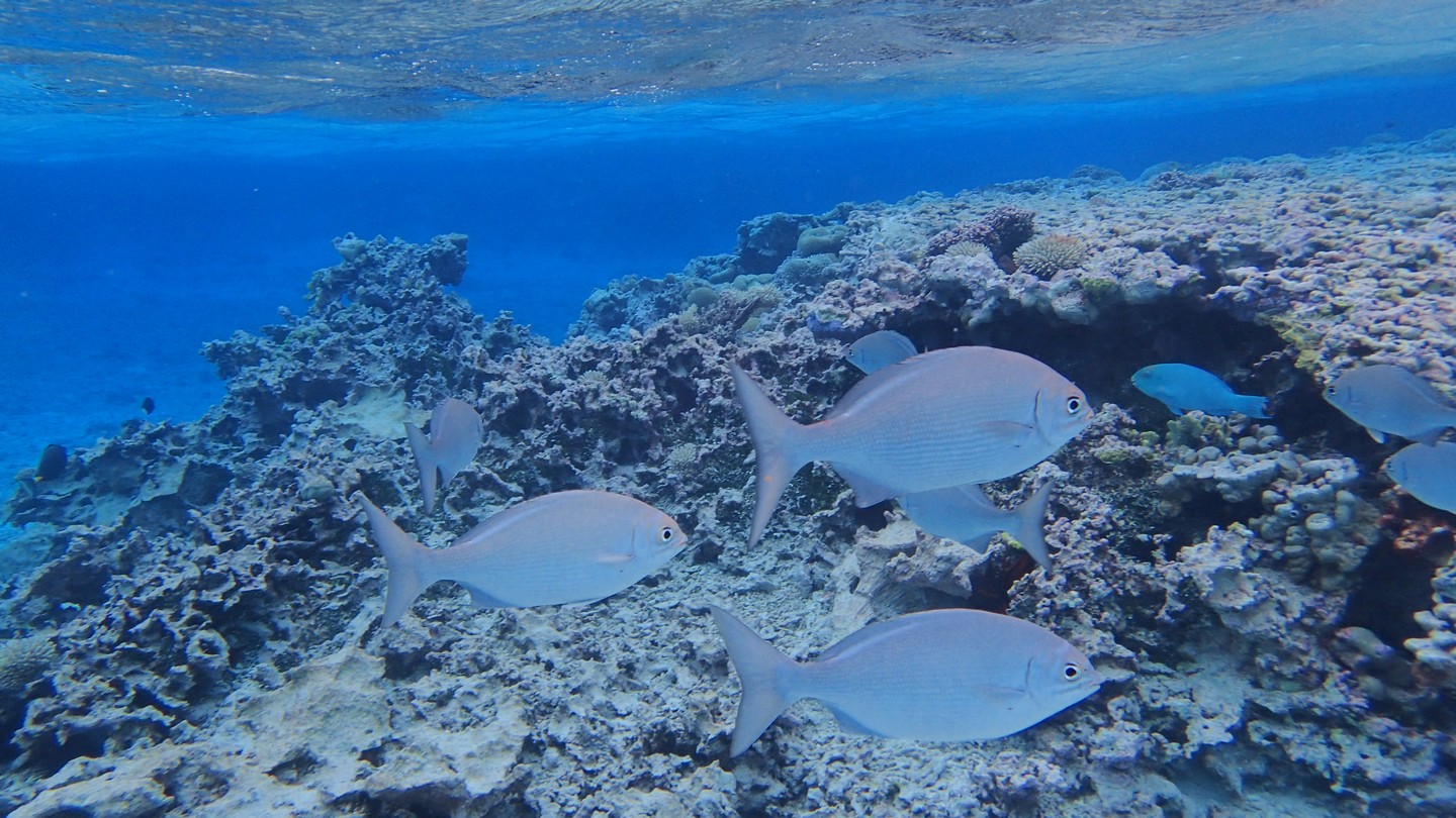
The Linckia laevigata. There were many of these blue seastars.Soft coral. It comes in very many different colours and shapes.Anemonefish trying to hide.Soft coral.It was almost like being in an underwater flowershop…Acropora sp hard coralFeather stars, they are animals! They like to be in a spot where there is a lot of current since they feed on passing plankton.A “heart shaped” coral, I think the Acropora hyacinthus, but I am not sure.A beautiful spider shell hiding between the coral. We did not take it with us since it was occupied.Sanuk and Flipper in another paradise like anchorage.
Coral with, I think, polyps on it. They look like eyes …Swallow cave. We went inside with Flipper but found only a lot of graffiti.
Stay tuned for our next blog post where we talk about our incredible whale encounter !
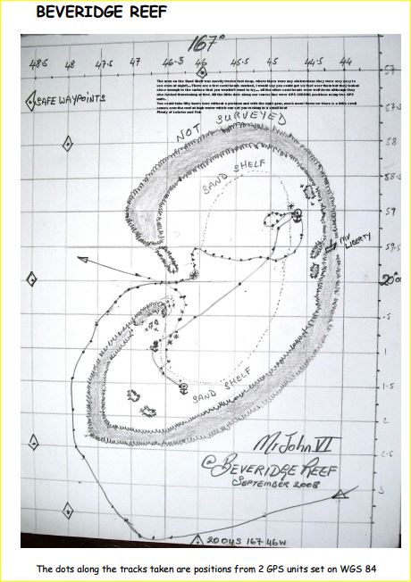
Tussen Palmerston en Niue ligt Beveridge Reef: ongeveer een cirkel van 2 zeemijl (3,6 km) doormeter, vanbinnen 7 meter diep koraal met daarrond een brede zandbank van 2 a 3 meter diepte en daarna het rif met zijn brekende golven… Vanop volle zee zie je enkel het opspattend witte schuim van brekende golven die vanuit het niets opduiken, uitgezonderd aan de westkant een 200 meter strook waar de golven niet breken: de pas.
Onze GPS gaf aan dat we tegen 17:00 uur aan het zuiden van het rif zouden komen, en de zon ging onder om 18:20. Onze Navionics kaarten gaven het rif enkel aan als een ondiepe vlek zonder detail, hetzelfde voor OpenCPN (we hadden geen satellietfoto van het rif), maar we hadden wel een nauwkeurig verslag met tekening en gps coordinaten van ene zeker MrJohn VI.
Vanwege een wijde boog kwamen we aan de pas ongeveer bij zonsondergang, en hoewel er een driekwart maan stond was de zichtbaarheid slecht. In retrospectief hadden we moeten omkeren en doorvaren naar Niue – en nadien hebben we er ook een nieuwe regel van gemaakt: geen navigatie op nieuw terrein in de buurt van land na zonsondergang – en we vaarden dus enkel op gps een ons onbekend rif in. Ilse deed me beloven dat als er iets misging ik niet zou zeggen: het spijt me, ik kon er niets aan doen. Er stond weinig stroming, een 15 knopen wind met kleine deining, maar het bleef wel blind varen. Met drie knopen over de grond volgden we de koers van MrJohn, en eens binnen hebben we zo snel mogelijk het anker uitgegooid en gewacht op de zon van de volgende dag (zo ergens midden in de atol). Maar de weergoden waren niet met ons: zelden meegemaakt maar 360 graden rondom ons waren er grijze lage wolken waaruit af en toe een bui viel.
Toch was het water zo ontzettend helder dat we ons konden verleggen naar de zandbank aan de rand. We passeerden heel veel koraalkolommen en hoewel ze er benauwend hoog uitzagen in het heldere water bleven ze allemaal 2 tot 3 meter onder het oppervlak. Sanuk heeft 1m20 diepgang.
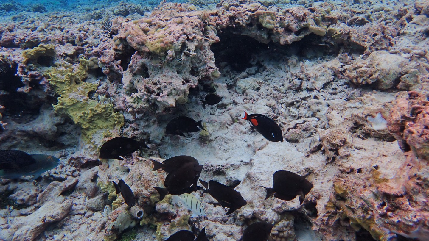
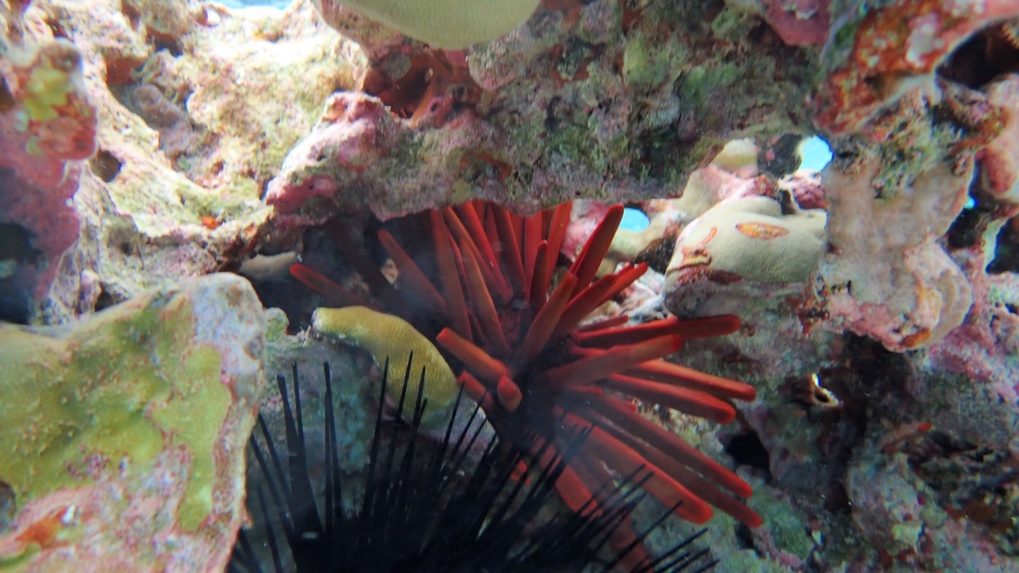
Op onze eenzame parkeerplek in de oceaan hebben we tijdens onze twee dagen ter plaatse toch eens een straaltje zon gehad zodat we spectaculaire foto’s hebben kunnen maken van deze heel speciale plek. Met Flipper zijn we naar de rif gevaren op zo een 300 meter, en hebben we massa’s vissen en mooi koraal gezien. Ondanks het slechte weer was het een van de beste snorkelingvaringen.
Maar het blijft toch wel een dubbele bedoening: heen en weer tussen Sanuk en het rif mag de motor van flipper niet uitvallen, want dan drijft de wind je weg, en met roeien kom je niet terug aan de boot. En er is ook geen andere boot in de wijde omgeving, enkel zee. Daarom dat Ilse toch wel opgelucht was toen we terug door de pas vaarden, op weg naar onze volgende bestemming op 150 zeemijl: Niue, een van de kleinste landjes van de wereld.
heel veel vis bij het rifOok deze nog niet eerder geziene soort rode zeeegelEen blauwe papegaaivisDeze bleekschijters (latijnse naam) zagen mij wel zitten
Palmerston bereikten we na exact 3 dagen varen. De tweede dag hadden we een kanjer van een MahiMahi mannetje aan de lijn, maar helaas wou hij wel even tot aan het trapje komen, maar niet verder. Hij schoot van de haak vooraleer ik de tijd had om de gaffe erin te slaan. Mijn strategie voor de volgende keer is bijgesteld: als een vis aan de trap is, schiet ik hem met mijn speerpistool door de kop, dan kan hij niet meer weg vanwege de weerhaak en is hij waarschijnlijk ook naar het vishiernamaals (in de visvolksmond den frigo). Ilse was er niet goed van, zo een schoon manneke, zeker 80 cm en 12 kilo, en toch liever naar de haaien dan bij haar!
Een dorado of mahi mahi of dolphin fish. Dichter dan dat is hij niet bij Sanuk gekomen
Enfin, we kwamen aan om 10 uur en we radiooten kanaal 16 : “This is sailing vessel Sanuk Sanuk Sanuk for Palmerston Yacht Club, Palmerston Yacht Club. Do you copy?”
We waren op zoek naar Bill, de eigenaar van de Palmerston Yacht Club want we hadden een vracht mee voor hem van zijn vrouw die we op Aitutaki waren tegen gekomen: 16 dozen met gerief, vooral bananen, papayas en watermeloen (denken we). Maar het was ene Bob die antwoordde dat hij ons ging opvangen en naar een meerboei begeleiden. Hij kwam een half uurtje later af met zijn bootje door de lagoon en de kleine pas naar ons, net buiten het koraalrif. Hij toonde ons aan welke boei we konden afmeren en ging daarna de douane halen.Ik gaf hem nog de boodschap mee dat we veel gerief hadden voor ‘deputy mayor Bill’. Nog een klein halfuurtje later kwam Bill zelf naar ons gevaren, met de Health Inspector, de Douane en de burgemeester. Omdat we reeds ingeklaard waren in de Cooks eilanden was het papierwerk snel geklaard en vertrok het gezelschap terug, samen met Bill en al de dozen. Eerst had hij ons nog meegegeven dat hij ons om terug 13:00 kwam halen voor de lunch.
Blij terug op vaste grond te staan
Op Palmerston word je de gast van een gastgezin. Bij ons was dit dus Bill, de eigenaar van de Yacht Club Palmerston.
De yachtclub van Palmerston, naast het huis van de familie Bill Marsters
Hij had een stevige lunch voor ons klaarstaan: rijst, lamskoteletten, saus, tarotwortel en als toetje ijscreme van mango. Hij vertelde honderduit en om 2 uur kwamen de kinderen van de school toe: twee jongens, 10 (?) en 14 Ngariki, en een meisje van 16 Juliana. Zij aten ook, en namen ons achteraf mee op een bezoek van het eiland.
klas volksdansen voor alle leerlingen van de schoolIlse bij de muren van het originele huis van Bill Marsters, gemaakt uit aangespoeld wrakhoutDe hoofdstraat van Palmerston met het originele huis van stamvader Marsters
Er wonen 58 mensen, onderverdeeld in drie families. We waren snel rond op het eiland want het is ongeveer twee op een kilometer groot. Het is zeer verzorgd, met wegen in wit zand afgeboord met cocos boomstammen. Er staan zelfs lantaarnpalen met led lampen (ongetwijfeld het resultaat van een actie van een of andere NGO).
Een straat in Palmerston. Het had net stevig geregend, een welkome opvulling van de mensen hun regenwater voorraad.
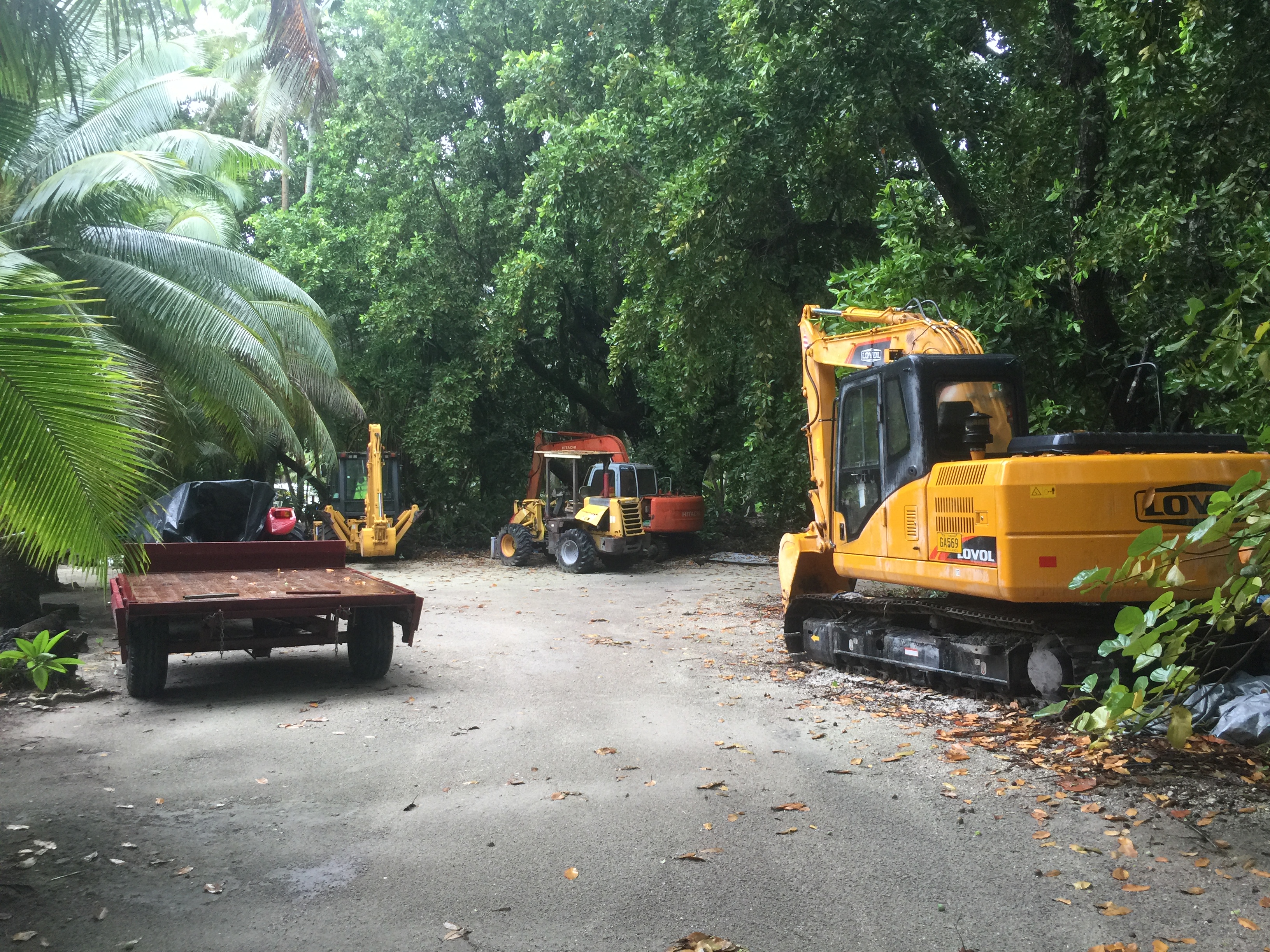
Er zijn geen autos op het eiland, wel een quad en nogal wat brommertjes. Het laatste heeft meer met status dan met noodzaak te maken want je bent echt in geen tel te voet op je bestemming. Ook de afdeling van openbare werken heeft een indrukwekkend machinepark staan, van een bulldozer tot een graafkraan. Zag er allemaal nogal nieuw uit.
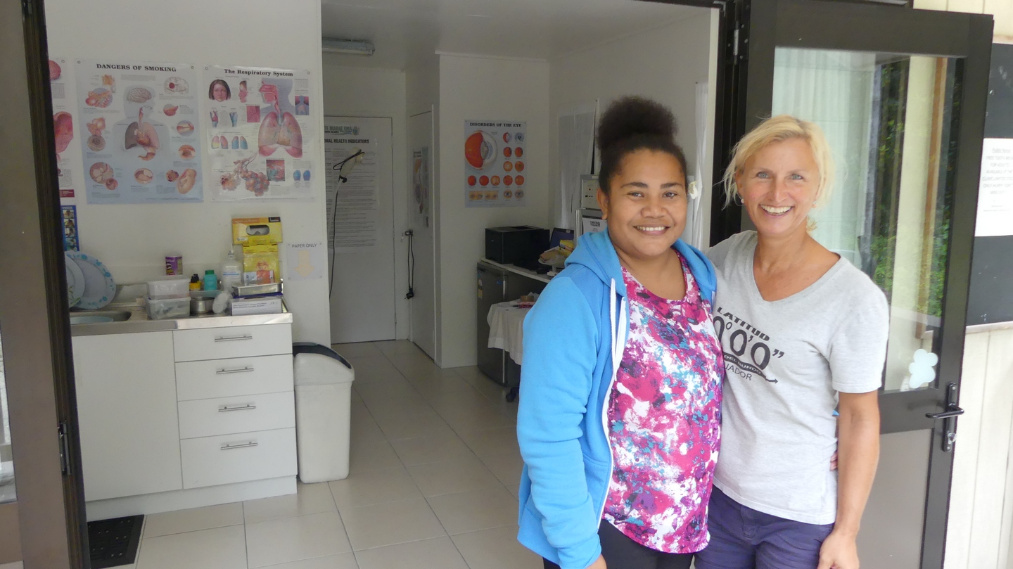
Een super sympatieke verpleegster ‘Mother’ voor haar wel uitgerust ‘hospitaal’
Dat brengt me meteen op een delicaat onderwerp, namelijk ontwikkelingssteun. Palmerston, en de Cook eilanden bij uitbreiding weten handig op de internationale hulpverlening in te spelen. Als er een project is dat in aanmerking komt voor steun, dan komt het erop aan om een voorstel in te dienen bij de juiste kanalen, en de kans is groot dat er een geldschieter gevonden wordt. Daar hebben we mooie voorbeelden van gezien, zoals de electriciteitscentrale met zonnepanelen park, de school, het hospitaaltje, de dienst openbare werken. Maar ook de bijna onvermijdelijke buitensporigheden zoals 4 leraren voor 15 leerlingen op school, de zeer royale voorraad gezondheidsmiddelen die gratis verdeeld worden, de gratis voedsel of kleren giften van de Cook administratie of vanuit Nieuw Zeeland, het feit dat niemand belastingen betaalt maar wel op een maandelijks pensioen van 400EUR kan rekenen… Zo zijn er nog wel meer voorbeelden maar dit doet niets af van de charme van de mensen die er wonen.
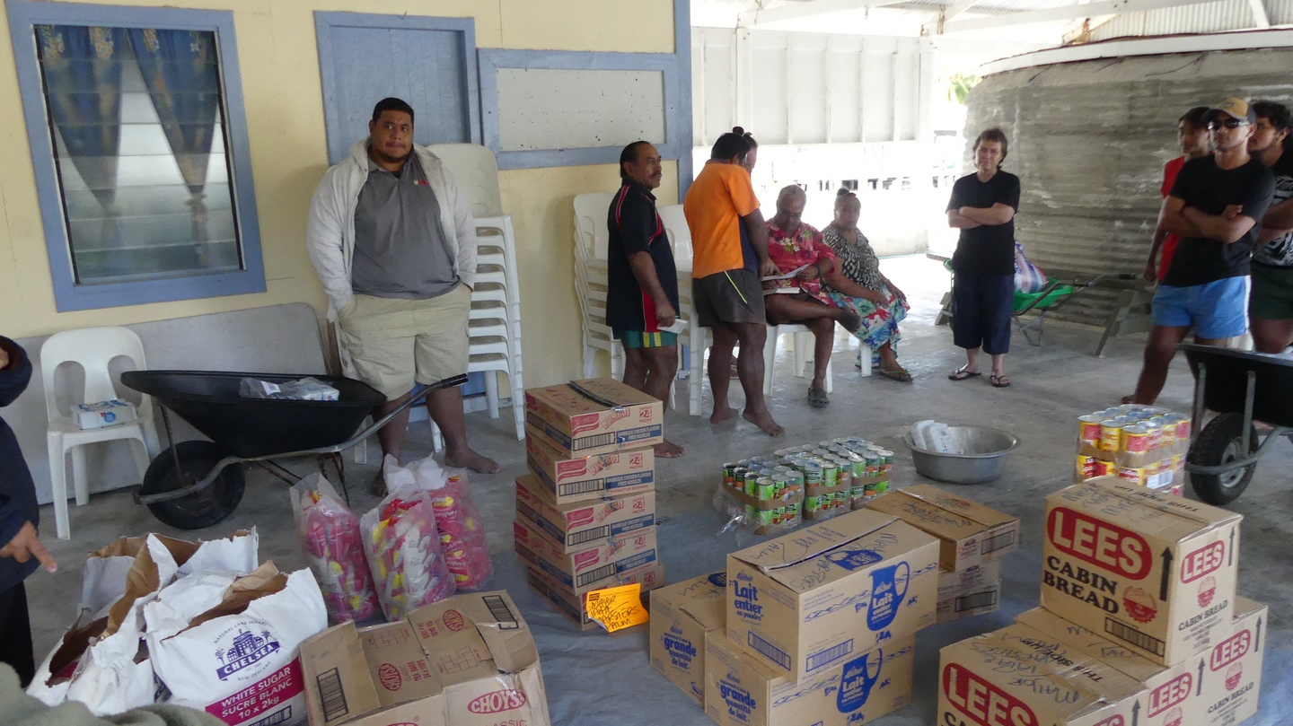
We woonden een vergadering bij waar een schenking van een parlementslid (nadat hij verkozen was) werd verdeeld onder de inwoners.
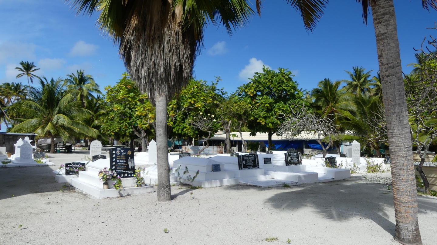
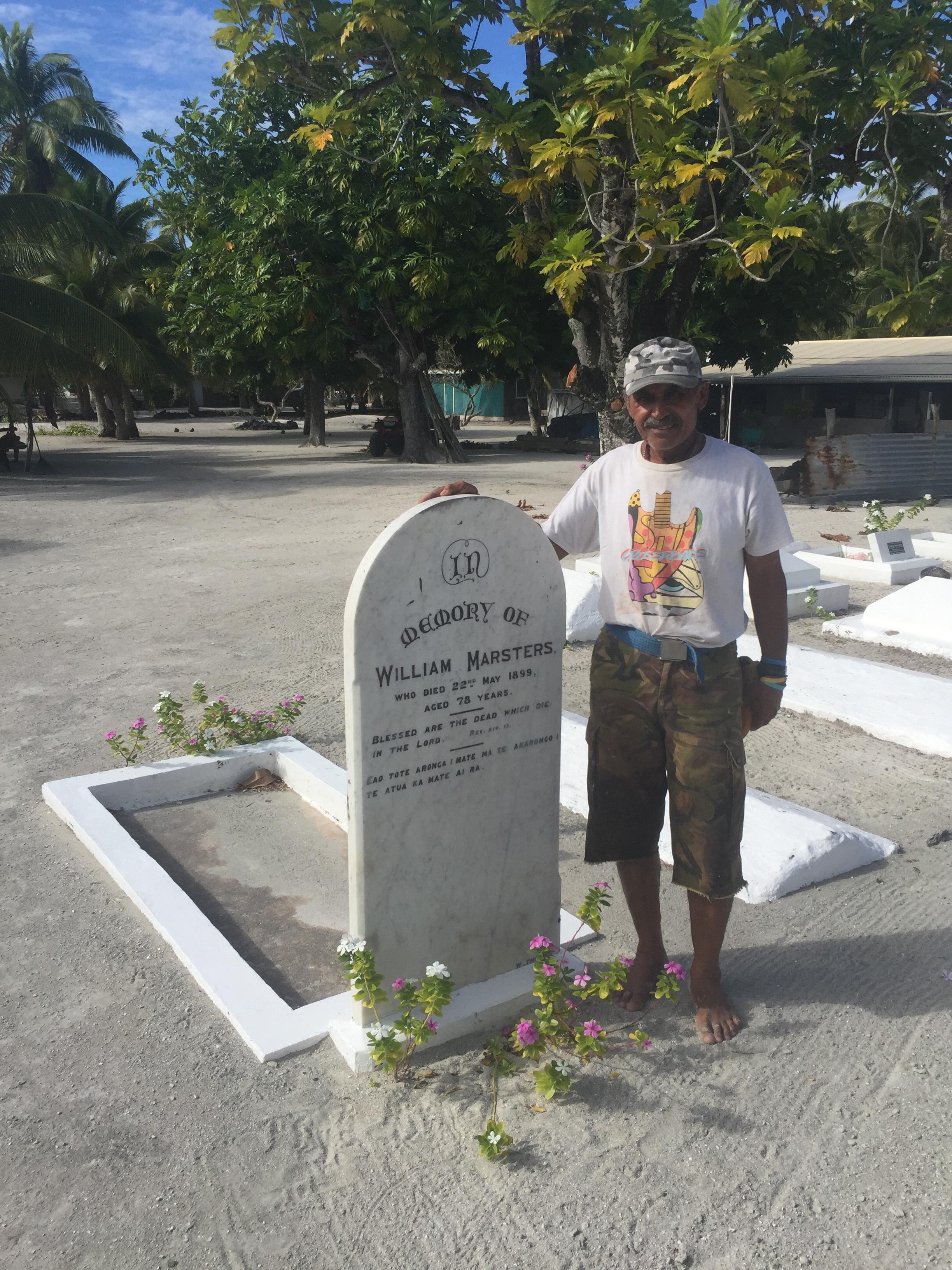
Zo werden we bijzonder hartelijk overal ontvangen waar we langs wandelden. We woonden een oefensessie bij van volksdansen door de leerlingen van de school (van 4 tot 18 jaar) , een les graveer vaardigheden, een vis-sessie op het rif, het bouwen van een nieuwe hut, we bezochten de begraafplaats van de allereerste Marsters (1894), en zijn eerste huis dat er nog steeds staat, ondanks verschillende orkanen die reeds over Palmerston zijn gepasseerd.
De graven van overal op het eiland zijn samengebracht naar een nieuw kerkhof achter de kerk.Bill bij het graf van de stamvader MarstersBill en zoon samen aan het vissen op het rif voor twee uur. Ik mocht niet mee het water in, want te gevaarlijk voor de hongerige haaien. Buit was twee grote papegaaivissenn (die we later meekregen voor op de boot)
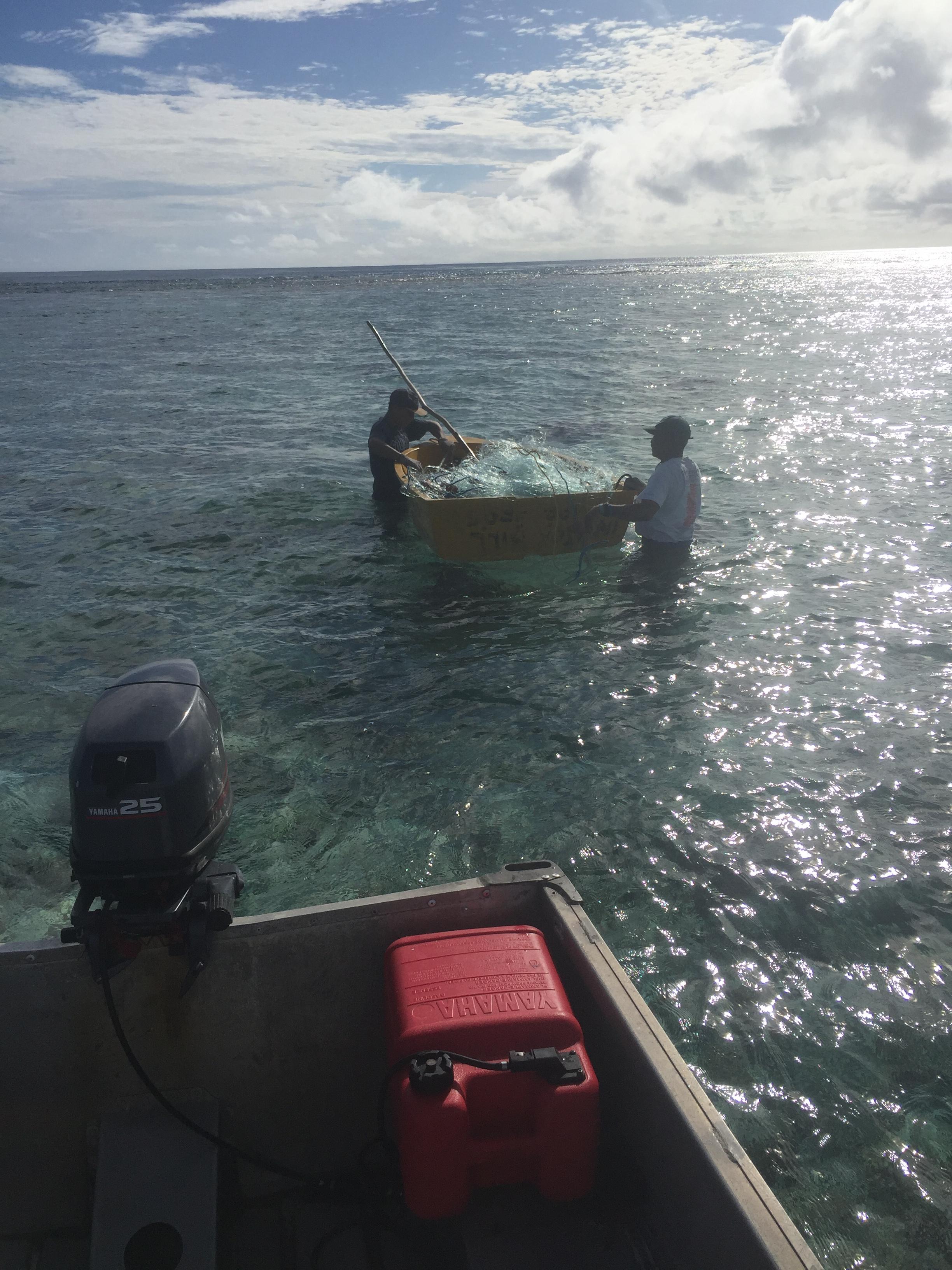
Ik heb Bob ook geholpen door twee nieuwe moorings voor hem te leggen. In drie duiksessies (mijn fles en twee die Bill gevuld had liggen) ben ik erin geslaagd om op 16 meter diepte een ketting om en door een koraalblok te leggen, met een schakel vast te leggen en vervolgens de schakel met ijzerdraad te blokkeren. Aan de ketting vertrekt dan een drie centimeter dik touw naar boeitjes aan de oppervlakte, om een zeilschip toe te laten de mooring op te pikken.
Klinkt gemakkelijk, maar het was mijn eerste keer als mooring legger, en het uitzoeken van een geschikte blok koraal is moeilijker dan het er vanop de oppervlakte uitziet. Maar ik heb vertrouwen in mijn werk, en Sanuk heeft twee dagen aan de nieuwe mooring gelegen, bij een gematigde westenwind die ons met het achterschip het koraal liet zien. Ik zou immers niet graag moeten lezen op het internet dat er een schip aan een mooring is losgebroken en op het rif is versplinterd!
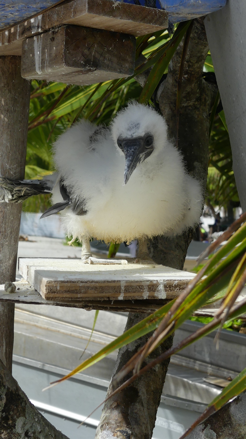
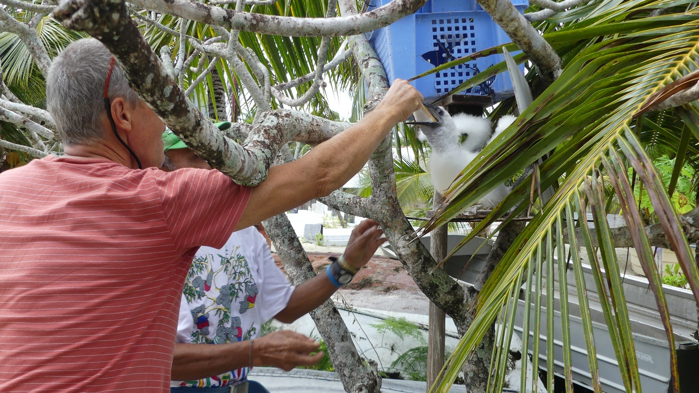
Boven mijn hoofd hangt onze herinnering aan SanukEen boobie wordt grootgebracht als huisdiertwee keer per dag krijgt hij een bevroren visje
Na vier dagen zijn we dan opnieuw vertrokken naar onze volgende bestemming: Niue.
Als bewijs van de vrijgevigheid van de Marsters kregen we visfilets mee van twee grote papegaaivissen, een stuk tuna, twee pakken diepgevroren spek, een versgebakken taart van Bill zijn dochter, 24 eieren, twee amuletten gemaakt door Bill zijn zonen en 2 sarongs gemaakt door zijn vrouw.Van ons kant waren we blij dat we hen ook kunnen helpen met wat steun aan de school en een lading nieuwe muziek, documentaires en films.
Ook al was ons bezoek kort, het is een stop die we niet snel zullen vergeten!
We arrived in Niue thursday, july 6th early in the afternoon. From a distance at sea, it looks like a dark and foreboding place. Unlike other coral islands, Nieu rises up from the sea as a black massive rock, hence it’s nickname ‘Polynesian rock’.
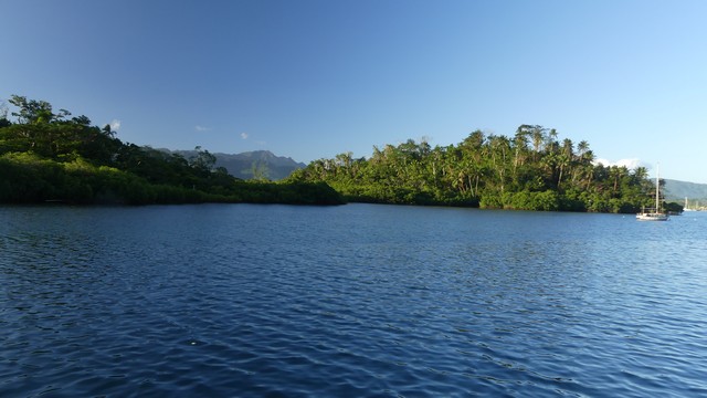
the rockLooking from ashore, Sanuk lies alone in the large bay, which is unprotected from westerly winds.
We took a mooring and radioed the Niue Yacht Club for customs and immigration. Stefan was picked up about an hour later at the dock and another hour later we were checked in.
We immediately went ashore although this involves some work. You cannot just leave your dinghy at the dock because of the waves pounding against the unprotected harbor wall. This could cause damage if you would leave it there for some time. So Niue has engineered a system where the dinghy is hoisted out of the water by a crane to which you can attach to your boat. The 8 days we were in Niue this worked great although on some days it took some acrobatics to get in and out of the boat because of the large waves.
We were immediately charmed by the island. We had dinner at an Indian restaurant, good food for a small price. The Indian had wanted to immigrate into New Zealand but ended up in Niue and liked it so much that they decided to stay.
The captain attaching Flipper’s single point harnass to the crane at Niue dock.Flipper hoisted out of the water with the electric motor.and safely deposited on the dinghy cart at the dock. You try to make sure that you did not forget anything on the boat because it takes a while “parking” the dinghy.
It took Captain Cook in 1774 three tries to get on land in Niue. He was not welcomed by the natives who all had painted faces and red teeth and he therefore called it “Savage island” which stuck for centuries until it reverted to Niue. He was able though to plant the flag and claim “Savage Island” for the Queen.
Niue (which means “behold the coconut”) is made up of limestone with cliffs rising up 30m from the sea. It is the largest raised coral island in the world. Niue was once ruled by kings but it became part of New Zealand in 1901. NZ is responsible for foreign affairs, defense and the necessary economic and administrative assistance. Just when we arrived the departure tax had gone up from 34NZD per person to 80NZD. This fee has to be paid by every person leaving Niue. Niueans are not happy with this increase imposed by NZ and fear that it will impact tourism. The future will tell.
Niue suffered a devastating blow in January 2004 by Cyclone Heta. Winds of up to 300km per hour damaged 90% of the buildings. The hospital was completely blown away… The population before Heta was about 2500 but declined to as low as 1100 and is now, 13 years later, 1900 souls. Niue tries hard to get its expatriates back, mostly from NZ and Australia.
Lots of abandoned houses after Cyclone Heta hit Niue hard in 2004.well maintained roads
Niuean is the official language but most people also speak english, their second language. Besides fishing and agriculture, tourism is one of the main economic pillars of Niue. Niue is famous for its limestone caves and many chasms, crystal clear seawater (up to 50m visibility) and diving. We tried to do all ….
One of the first caves we visited was spectacular Avaiki Cave. This was the private bathing cave for the ancestor kings and site of the first canoe landing.Looking down in the crystal clear water. The beautiful colours were really incredible.People are not burried in a cemetary but along the road in a nice spot or in the gardens.During the WE we walked around the island visiting the different chasms leading up to the sea.We rented a car and visited most of the tourist attractions of Niue in 2 full days. A highlight was the walk in the Togo chasm ib the east side with its black coral pinnacles .A canyon leads to a small beach area with golden sand and coconut trees.The typical coastline in Niue with the limestone cliffs.the ladder that leads into the canyon near Togo Chasm
Anapala Chasm, 155 steps to a fresh water pool which was used by the local people to get their waterPalaha cave: looking from within the cave to the ever restless sea.The Limu pools were great for a swim and snorkeling.An Arceye hawkfish in the clear waters of the Limu pools.Corals in the Limu pools. It is so great to just hang in the water and look at these underwater aquariums.Beautiful colours in the limestone cave near the Talava arches.A rock in the limestone cave, such beautiful colors…The Talava arches.Having fun with our fellow cruisers, Nijad and Milike from “North” (Turkish boat) in the anchorage of Alofi.A whale in the anchorage at about 30M from the boat. We are a little early in the season to see a lot of the humpback whales who migrate from the cold waters of Antarctica to Niue and Tonga to have their babies and mate. The top of the season is during August and September when you see a lot of baby whales.We hope to see more whales in the Kingdom of Tonga, our next stop…
After one full week in Niue the winds changed and made the anchorage very rolly. Time to leave for Tonga. We dropped our mooring Friday July 14 after checking out and paying our departure tax. We really enjoyed the friendly people of Niue and its beautiful caves and chasms.
Before leaving Aitutaki we decided to participate in a lagoon cruise and yes the sun was out so we could admire the different shades of blue of the lagoon and it’s motus. We visited Akaiami motu, once a refueling stop on the famous Coral Route in the 1950’s-60’s for waterplanes on their route from New Zealand to Tahiti. We had a barbecue lunch on One Foot Island, awarded one of the leading beaches in Australasia region. We did some snorkeling but were disappointed after being spoiled in the Tuamotus. The lagoon cruise is definitely a must if you want to see all aspects of Aitutaki.
We booked one evening at a resort for a typical Cook dance performance.I was amazed by the way they handled the fire.Our daily visitor in Aitutaki, the reef heron.The lagoon of Aitutaki on a sunny day.cruising the Aitutaki lagoon on a beautiful day with all the shades of blue…View of “one foot island” where we had a lunch barbecue.I do not think it can get more paradise-like.The snorkeling was not so great compared to what we have seen in the Tuamotus but I did manage to take a picture of the White barred triggerfish. You see them a lot in French Polynesia but they are very fast…We could walk from the sand spit to One Foot island.Last beautiful sunset in Aitutaki, time to leave for Palmerston.
June 25, Sunday , we checked the weather and the wind was good so it was time to leave for Palmerston. Bill’s wife (whom we met in the visitor centre) asked if we could take “something” for her family to Palmerston which we gladly accepted. This “something” turned out to be 16 cartons with bananas and papayas and 4 more bags with watermelons, a suitcase, and a bag of candy … a good thing we have a catamaran and lots of hull space! Two days and 236NM later we arrived at lunch time in Palmerston and took one of the moorings guided by Bob Marsters.
The streets in Palmerston with a view of the original house of William Marsters (next to the church), still standing after several cyclonesView of the beach of Palmerston. Every morning somebody will sweep and makes sure the fallen leaves and dirt is collected.
The history of Palmerston is unique. In 1862 William Marsters from Lancashire settled here with his 3 wives and 26 children. He divided the island and motus into sections for each of the 3 families with strict rules of intermarriage. Today 58 people are living on the island all connected somehow to William Marsters, except for some people employed by the Cooks Government (nurse and teachers). The island has no airport and the supply ship only comes when it is profitable to come by, so once every 2-3 months. Since 2015 they have 24hr electricity supplied by a solar power station sponsored by the Cooks government. Before that they only had a generator who supplied 6hrs electricity in the morning and 6hrs in the evening. There is internet and one TV channel since 2014, so life is changing….
The welcome was incredible. We were invited into Bill’s house for lunch and after saying a blessing we had rice, fish, lamb, corn and tarrot root. For dessert there was ice cream. Not only the first day but every day we were invited for lunch prepared by Bill because his wife was in Aitutaki with one of their daughters, Caroline. The other children, Juliana (16), Ngariki (14) and the youngest son (10) ate after returning from school around 2-3PM. Ngariki gave us a tour of the island, showed us the school (15 children between 6-18 years old), the infirmary with an enthousiastic nurse from Fiji, the wreck from the Riri and the old cemetary. There are no paved roads on Palmerston but the sand roads are raked clean on a daily basis. No cars but at Bill’s house they had 2 motorcycles and we did see one quad…times are changing. There are no stores on Palmerston and thus everything has to be ordered from Rarotonga to come with the supply ship. Every house has serveral huge freezers to make sure they have enough food till the next ship arrives. Most of the families live from fishing. They sell their fish (mostly parrotfish) to hotels and cooperations in Rarotonga for about 15NZD a kilo. But they remarked that there is less and less fish to be caught…is this temporary or a trend? They are aware of the climate change and see more and more coral bleaching because of the warm water. The population of Palmerston is aging. A family with 9 children had just left the island a couple weeks before. Although Palmerston is for some a paradise I can fully understand that for others (especially youngsters) this is too limited and they move to NZ, Australia or Rarotonga in search of a “better” life. A lot of them do come back for visits or to grow old.
The little but well supplied “infirmary’ of Palmerston.We are so happy we met with the teachers Josh (US) and Melissa (South Africa). Their contract ends in December in Palmerston. I hope they stay in contact and let us know where their next assignment will be.The grave of the founder of Palmerston, William Marsters.Picture of the primary school, from age 6 to 10.Juliana, on her 16th birthday, playing the guitar at dance practice.The happy girls from Palmerston.Dance practice at the school.Bill Marsters (left), next Juliana (16), Stefan and Bill’s son Ngariki (14).A last picture before leaving with Bill and his family. His wife and one daughter were in Aitutaki.
The unconditional generosity and “do good” attitude of the Marsters (In Flemish we say “doe wel en zie niet om”) is so remarkable that this short stop of 4 days will be fondly remembered.