Travelling the East Coast of the South Island, on our way back to Auckland.

April 17th, Papeete, Tahiti, it feels good to be back in 28degrees temperatures and closer to the boat! Our shopping possibilities were limited because all stores were closed because of Easter monday, except the Carrefour supermarket and a chinese supermarket where we could find the foodsupplies to take to Apataki tomorrow on the Cobia 3 !

Flashback to March 26th,2017: We did not stay very long in Dunedin since time was running out and we still wanted to see more of the East Coast.

We made a quick stop to see the Moeraki Boulders and met a Belgian working at the cafetaria there. The Moeraki boulders are large, spherical boulders on Koekohe beach. They are made out of mud, silt and clay cemented by calcite.
The large boulders, 2m in diameter,are estimated to have taken 4 to 5 million years to grow !

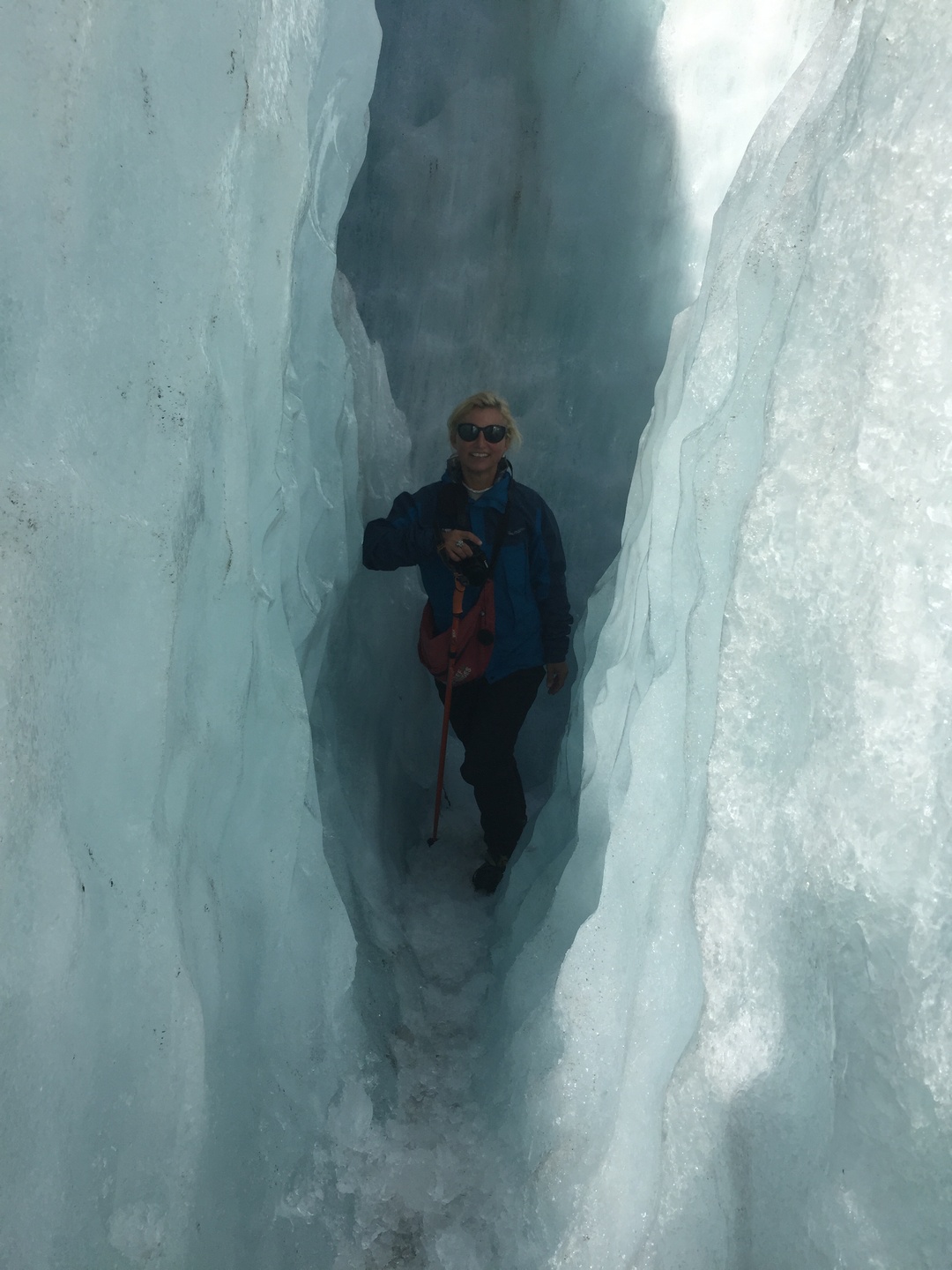
We continue driving to Mount Cook village in the rain and low clouds 😦 and spent a day at the Sir Edmund Hillary Alpine Center watching a 3D movie on Mount Cook,  a documentary on the local mountain rescue team and the digital dome planetarium.

A bronze statue of Sir Edmund Hillary looking at Mount Cook! The day we arrived it was sooo cloudy and rainy that you could not see any mountains in Mount Cook national park! Sir Edmund Hillary is a famous and admired New Zealander not only because of his achievement, his ascent of the Mt.Everest in 1953 but also because of his humanitarian work in the villages of Nepal.

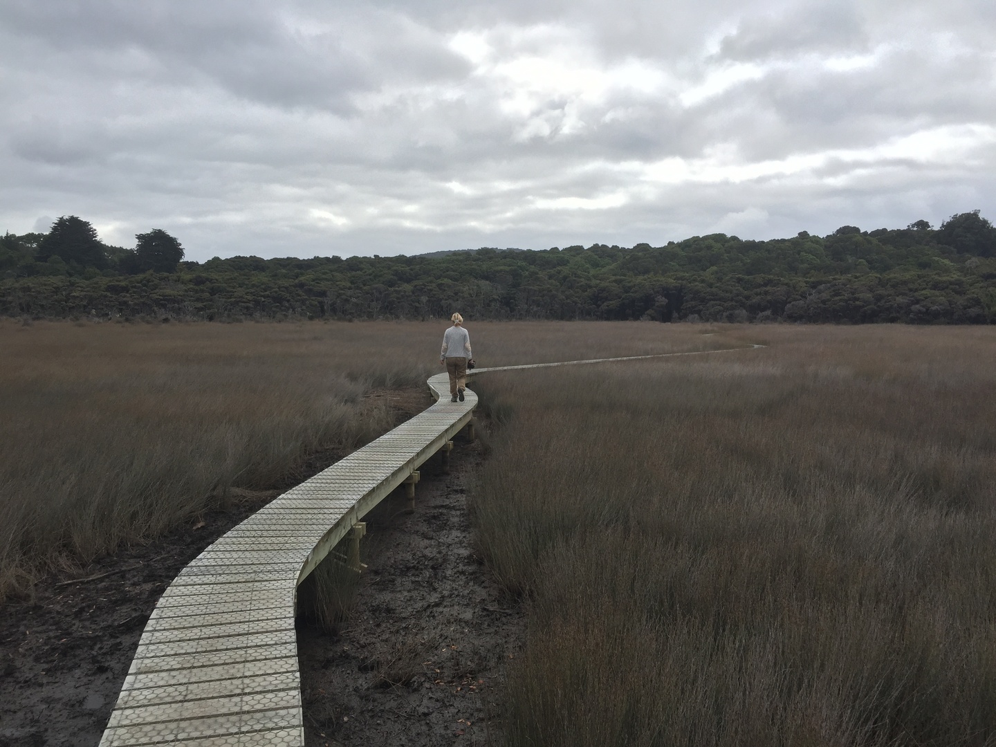
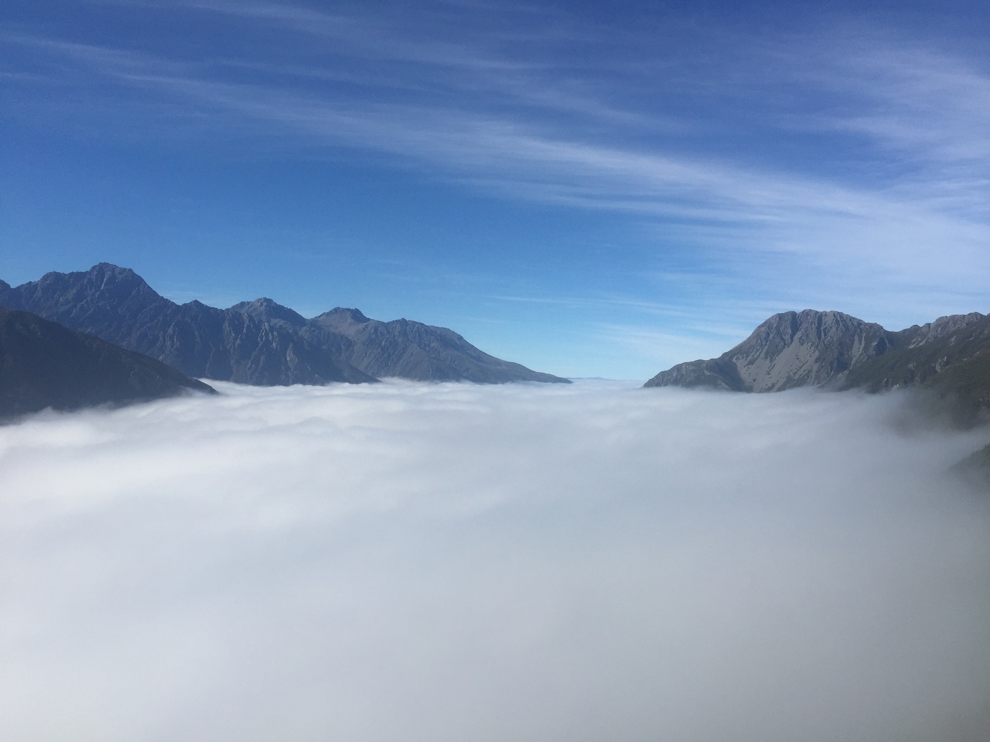
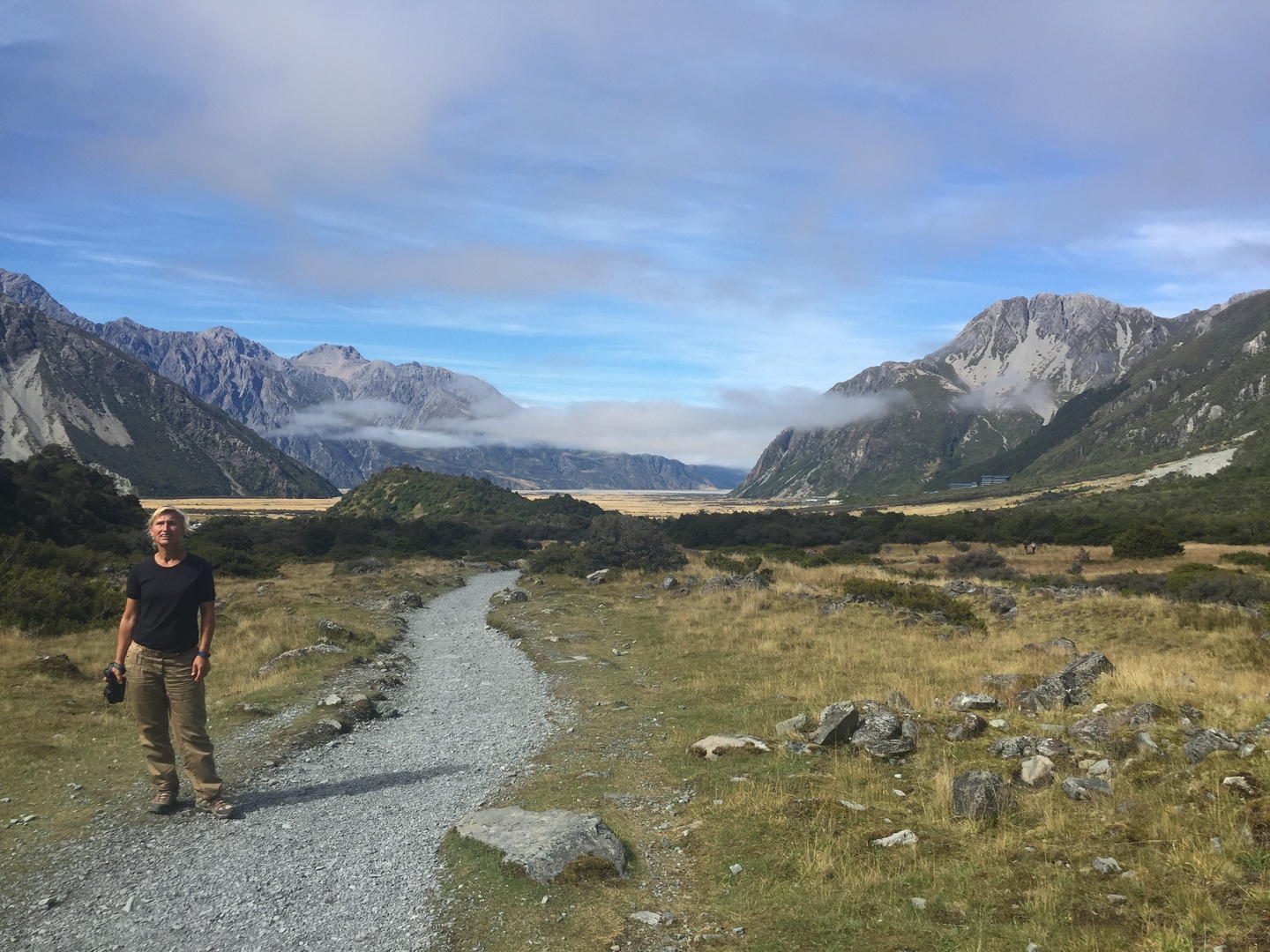
The next morning it was not raining but there were still a lot of low hanging clouds over our campsite. We were not sure what walk to do and decide to go to the outlook and take a decision on the way. Rainjackets, pants and backpack with some water we go on our way. When we come to a marker with the several walks we decide to take “Sealy Tarns”, only 5.2KM(one way), 3-4HR return walk, we think that is not too bad… Later we read the description of the walk,”The Sealy Tarns Track begins gently until you reach the foot of the Mueller Range. The track zigzags steeply up to Sealy Tarns.” The track consists mainly of 2200steps which have to be climbed! This was definitely one of the most challenging walks we did and we were not prepared! But the reward was incredible…

After 45min of walking, climbing and huffing and puffing we get this view! Above the clouds…it is really magical.You can see Mt.Cook all the way in the back.
Taking a rest and enjoying the view.
The Maoiri name for Mt.Cook is Aoraki, meaning “cloud piercer”, could not find a better one.
Reaching the Sealy Tarns. A tarn is small mountain lake or pond.
While we were eating our granola bar, we did not bring anything else, we watched the clouds disappear and a beautifull view unfold. Mt.Cook is showing all its beauty.
The glacial lakes at the bottom with the last clouds evaporating by the sun.

The return walk was not easy as well since it was so steep our legs were shaky. But we enjoyed the scenery so much that we did not care and arrived all happy under blue skies at the campsite. We drank and ate something. Felt stupid not to have prepared this walk better, we had no suncscreen nor a hat with us …we should know better, in the mountains the weather can change rapidly! This walk was definitely one of the highlights of our trip to NZ! We continued our route out of Mt.Cook National Park (also UNESCO world heritage) and went to Tasman glacier view and Tasman Lake…

Tasman glacier with Tasman Lake.You can take a boat ride in Tasman Lake and see the icebergs in the water up close.
In the early 1970’s there were several small meltwater ponds on the Tasman glacier but by 1990 these had merged into Tasman Lake. Tasman Lake has quickened the retreat of Tasman glacier.

The scenery along the drive from Mt.Cook village to Lake Pukaki and Lake Tekapo is really incredible.

Lake Pukaki (glacial lake)and Mt.Cook in the back.
Church of the Good Shepherd and lake Tekapo in the back. It was the first church built in the McKenzie region in 1935.

In the visitor centre of Omarama they told us to go see the Clay Cliffs and the pictures convinced us to go. This is definitely a hidden gem in NZ! We did not have the blue skies which would have made it even more beautifull but they were incredible. We had to drive 12km on unsealed road and pay 5NZD a the gate because they are on private property, but it was worth it!

The cliffs were formed 2 million years ago.
We were there all alone which made it even more special.

We leave the cliffs just in time to stop by a salmon farm and buy smoked salmon for aperitive and fresh salmon filet for the barbecue!

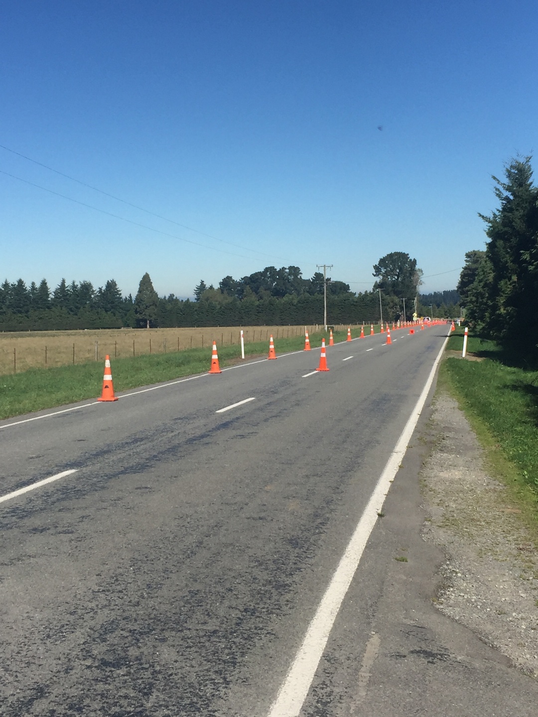
The next day we start out with rainy weather but as we continue our drive the clouds give way to sun and by the time we arrive at Rakaia Gorge it was perferct! We see a perfect camping spot but decide to do the Rakaia Gorge walkway first since the weather was so nice.

It is a 10,2km walk (return) along the top of the Rakaia Gorge and the views are spectacular.
The Rakaia river making its way through the gorge.

We lost our good camping spot but were happy we did the walk under blue skies as the next day it was drizling again…

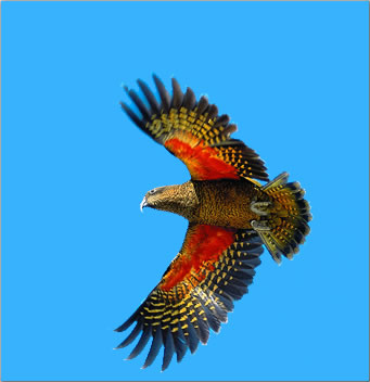
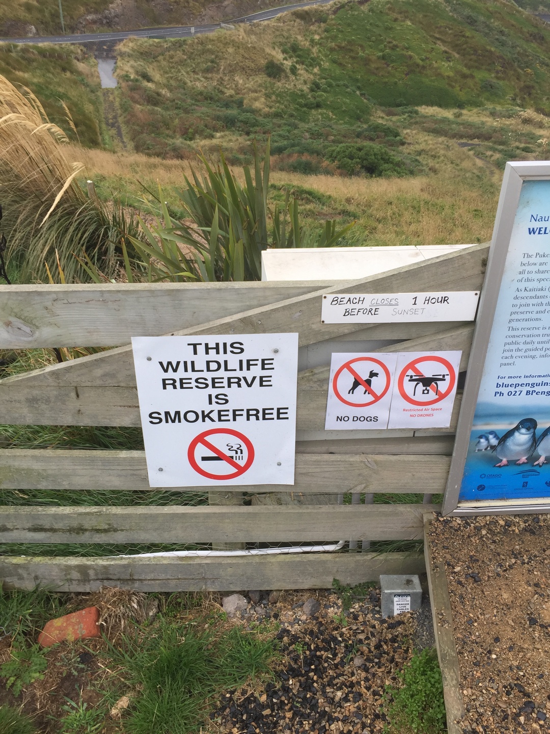
Because we did not see any penguins nor an albatross in the Otago Peninsula (Dunedin) we decided to drive along the coast to Oamaru because the Rough Guide said this is a unique place to see the Yellow Eyed Penguin and the blue penguin since there is a colony within walking distance from the town centre!

Would they really cross the street…
The yellow-eyed penguin or hoiho (Maori) is native to NZ.They are endangered and considered one of the world rarest penguin species.Their estimated population is only 4000.
You can only spot them early in the morning when they leave their burrow to go fishing (not a good time for us 🙂 ) or in the late afternoon, in this case 5.30PM when they return from a day fishing. NZ is very protective of the penguin and you cannot go on the beach or near at certain hours of the day so they do not get frightened and return back to sea.

We then decided to go see the blue penguin but we were informed that they only show up around 7PM, almost dark…We were at the rendez-vous a little after 7PM together with a lot of other penguin enthousiastics. We waited and waited, Stefan got a blanket, it was cold and windy, started to drizzle but we persevered and around 8PM a whole bunch came tumbling with a wave on the beach 🙂 Really funny how they then walk up the hill to their burrows. Unfortunately because it was already dark and you can not use a flash and they are far away I did not get any good enough picture…The blue penguin (Korora) is the smallest of the penguins. Cold and wet we returned back to Burnie, happy we did at least see the penguins!!

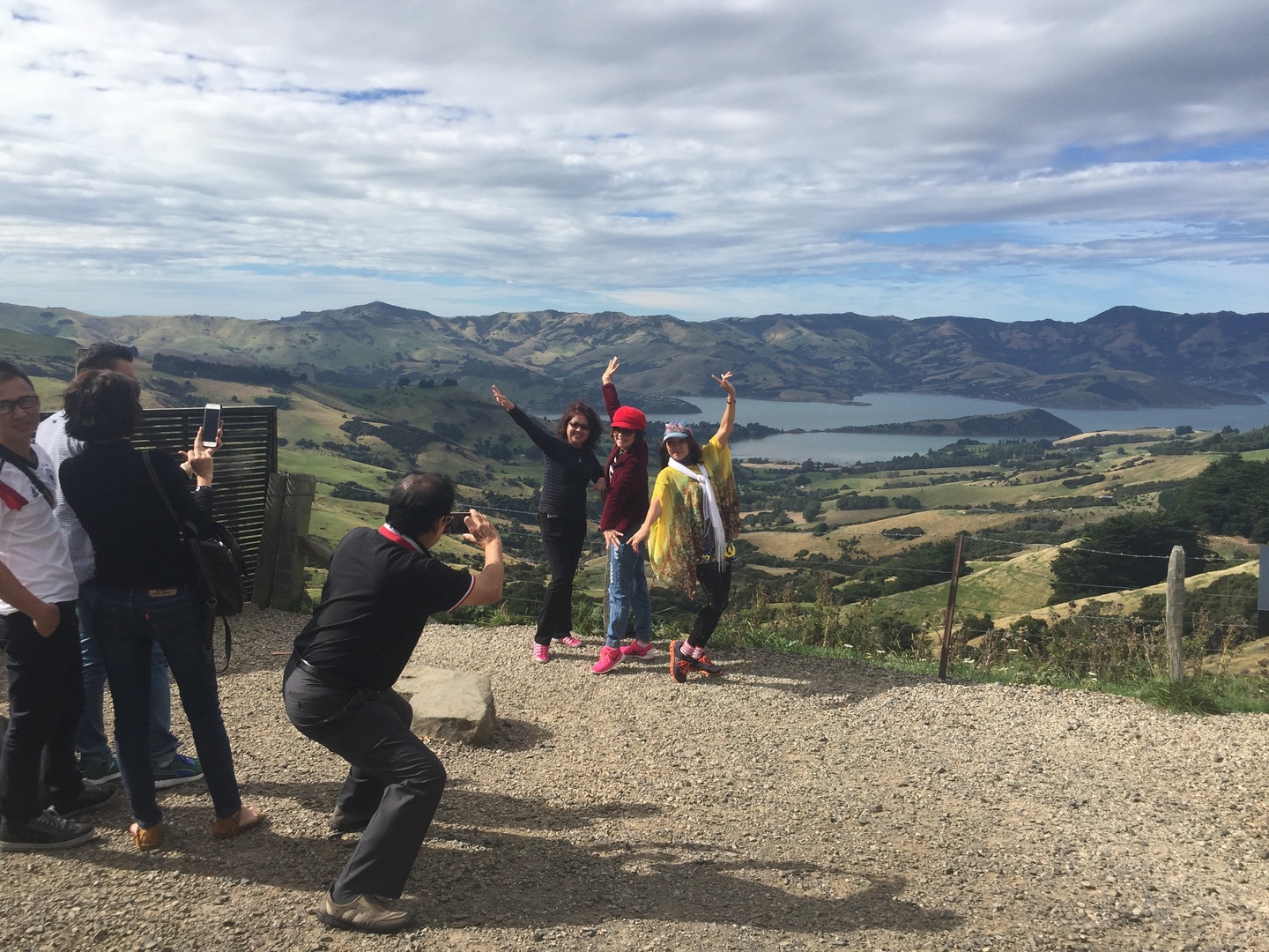
Our drive to Chrischurch was with continuous beautiful scenery and very variabel weather. Summer was over, leaves were turning to yellow and orangy colours and a lot already falling. We camp at Lyttleton harbour and the next day we decide to drive to Akaroa along a scenic route, Summit Road which traces the 600m high Akaroa crater rim. We stopped many times to take pictures and walked 30min to a viewpoint, all just in time to see the clouds roll in.

Akaroa is a little town with french roots. The first settlers came from France and a lot of the street names are still in french. It is a popular KIWI holiday destination.

The Akaroa Lighthouse Preservation Society moved the lighthouse from the Akaroa heads close to the town centre in 1980. It was built in 1879 and one of the few wooden lighthouses remaining.We made it back to the town centre before the downpour.

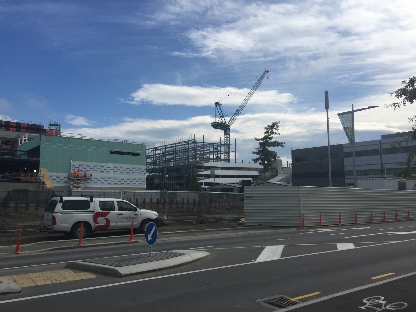
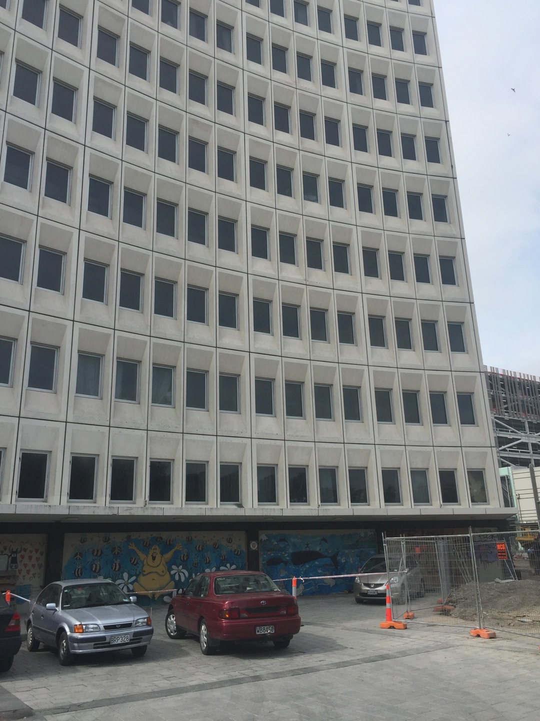
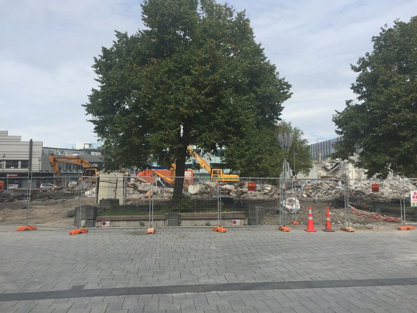
Arriving in Christchurch was a surprise. We could not believe the destruction still visible from the earthquake that hit the city in February 2011! 6 years later and still so many buildings waiting to be torn down, rubble and cranes everywhere. Stefan felt sad seeing the city like this while I could sense a dynamism in the newly created parts of the city. We did not stay very long because it was already April 3rd and we had to be in Auckland by April 8th to show Burnie to a potential buyer.

Earthquakes occur very frequently in NZ because it is situated in the collision zone of two plates, the Indo-Australian and the Pacific tectonic plates. About 14000 earthquakes occur in and around the country each year and about 150 to 200 are big enough to be felt. We did not feel once the earth rumble.

The 2011 Christchurch earthquake registered 6.3 on the Richter scale and was centered 10KM of the centre of Christchurch. 70% of the CBD (Central Business District) buildings have to come down.
The Christchurch cathedral was severely damaged and the Anglican church decided to demolish the building and build a new one but this led to many protests and legal action from various groups. This litigation is still going on and so the church still stands…the tower was destructed in 2012.
The Canterbury Earthquake natiional memorial was unveiled on February 22, 2017, just before we visited. 6 years after the destruction…185 people of more than 20 countries died.
The new Christchurch, which is being marketed as “greener, more compact, more accessible and safer”, will cost in the region of NZ$40bn – almost 20% of New Zealand’s annual GDP.
The Chalice still stands! It was built in 2000 and survived the 2011 earthquake.It is designed by New Zealand artist Neil Dawson, and is made up of forty-two leaf patterns featuring different native plants.
The Paua House was a tourist attraction in the southern New Zealand town of Bluff, but now on display at the Canterbury Museum in Christchurch. The house was owned by elderly couple Fred and Myrtle Flutey, who built up a massive collection of ornaments made from the iridescent shells of the paua. They continued to do this for 40years and welcomed visitors from all over the world. When they died their grandson gave their collection on loan to the Canterbury Museum who made a replica of the house. NZ kitsch at the extreme but such a nice story!

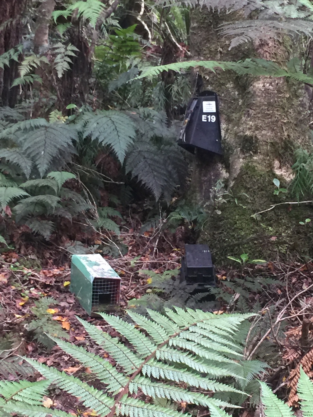
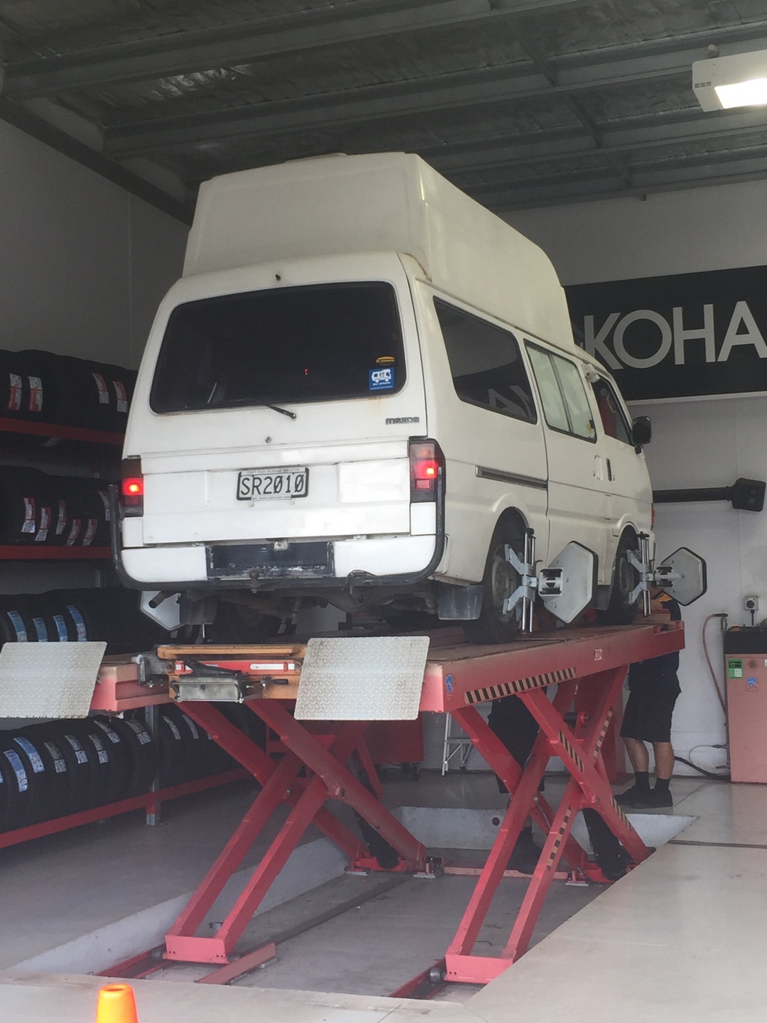
We hurried back to Auckland passing by Wellington in the pouring rain from the storm Debbie and managed to sell Burnie to a french couple travelling for 2months in NZ. We rented a little camper and drove north of Auckland to Whangarei. Visited Aislado (NZ) in Marsdens Cove Marina, An and Ivan on Vaguebond in Town Basin at Whangarei. Drove to Russel ,where we had an excellent meal at the Duke of Marlborough, and stopped in Waipoua Kaori Forest to see the largest living Kaori tree from NZ. Cyclone Cook passed by…but we arrived safely and saturated with lots of nature scenery in our heads at our friend’s house late April 14! So nice to finally have the luxury of staying in a nice house, sleeping in a bedroom, toilet and bathroom next door 🙂 !

Together with Sylvia, Vaughn and Zara at a Thai restaurant on our last night of our trip in NZ.

Thank you so much Sylvia, Vaughn and Zara for your hospitality, help and friendship!  We hope someday to welcome you all in Ghent !!! 🙂

Riding Dreams

April 16th, we are in the Holiday Inn near Auckland airport since we have to be there at 7 AM the next morning for our flight to Papeete ! We have 5 bags and 2 check-in pieces ! Hopefully it will go smoothly 🙂

Flashback to March 19th 2017: The next day was just perfect blue skies and we could admire Milford Sound (Piopiotahi) in all its beauty.We could not have planned any better.

Milford Sound is part of Fiordland National Park, the largest national park from NZ. Actually Milford Sound is a glacialy formed fiord and not a sound. It is 16km long and mostly less than 1km wide. The most prominent mountain is Mitre Peak (1692m) named for its resemblance to a bishop’s mitre.
We took a 2hr boat trip into the sound and although we were somewhat disappointed (we are spoiled) it was still beautiful.
Stirling Falls thundering down.
A sealer John Grono discovered Milford Sound in 1823 and named it after his home port in South Wales, Milford Haven.
Standing at the Homer Tunnel taking pictures of the road below. Really an impressive sight!
And finally we meet the Kea bird on our way back from Milford Sound ! It is the only alpine parrot and endemic to NZ. It is olive green on the outside but when he opens his wings…
I unfortunately could not take this picture but this is what the Kea looks like in flight. He is hiding all his colours under his wings.
They are not tame birds but they are very playful and inquisitive and love the interaction with tourists. Stefan finally found a good playmate 🙂
Along our way back we stopped to walk the last section of the Routeburn track. The Divide to Key Summit.
Gentiana Frigida, I thought they were always blue but apparently in NZ the white variation is common.
On our way to the southern tip of the South Island we made a stop at the historic Clifden suspension bridge, one of the longest in the South Island. It was built in 1899 but no longer in use.
The coast is wild and beautiful. Even with the clouds and rainy weather we enjoyed getting out and watching the waves.
Stirling Point at Bluff, almost the most southern tip of NZ. The anchor chain sculpture disappears in the sea to symbolically connect with a near identical sculpture in Lee Bay on Stewart Island. The sculpture is from Russell Beck.
We made 2 short walks at Bluff and finally I managed to take a nice picture from the TomTit! This bird is also endemic to the islands of NZ.
The Tui bird singing away, you hear them everywhere but they are not easy to spot. They are easy to recognise by the 2 white feathers in the front.
Windswept trees so typical for the Catlins Coast.
Curio Bay at the Catlins. The Catlins Coast is one of the least populated areas in NZ.
Not a lot of people but a lot of sheep. Although more farmers are now switching from sheep to cows because dairy is more profitable. In 1982 there were still 20 sheep to one NZ’er now it is only 6 sheep. We talked to one farmer who had 30.000 sheep and 1500 cows!
Stefan at the bottom of the McLean Falls.
The McLean Falls, 22m high. It was great to just sit back and admire…
A little further down the road were the Purakaunui Falls…
Right near the falls was this NZ woodpigeon or Kereru. Happy to have his picture taken. He chose a good spot right in the sunlight.
Stefan found his treehouse 🙂
Nugget point with its lighthouse from 1870 still working.
Nugget point at the Catlins.
Happy it was not raining and we could enjoy the scenery without rainjackets or umbrellas.

While we were in Dunedin we did the self guided street art tour and it was really a lot of fun with great artworks ! Maybe a good idea to have a similar project in Ghent!

Riding Dreams from Pixel Pancho (Italy)
Tuatara from ROA (Belgium).
Love is in the air from Natalia Rak (Poland)
This work is from Phlegm (UK) but I do not remember the title.
Even the electric distribution box was painted…

Next blog on our way to Christchurch and back to Auckland.

Nog wat videookes van NZ

In Oamaru, someone has triggered the steampunk locomotive animation


ChristChurch

I just love what this artist does: Phil Price

Wat kan er nu zo grappig zijn aan dahlia’s?


Update zondag 16 april: we zijn goed en wel in Tahiti geraakt met onze 7 valiezen.

Enkel Air New Zealand deed moeilijk bij check-in omdat we geen vertrek ticket uit tahiti hadden, maar een supervisor kwam dan met de verlossende mededeling: just check them in. Ook was onze handbaggage 12 en 13,5 kg ipv 7kg, maar dat zagen ze door de vingers!

Het is wel raar dat we twee keer paaszondag meemaken: een keer in Auckland, en dan vijf uur later doen we het nog een keer over omdat we over de dateline gevlogen hebben. 22 uur terug in de tijd.

Dinsdag gaan we met de Cobia III varen naar Apataki.

Bye Bye New Zealand: afsluitende mijmeringen

Over de natuur en de natuurparken:

Typisch NZ: geen kosten worden gespaard om een natuurgebied tot zijn recht te laten komen voor de toerist. En allemaal gratis: geen enkel natuurpark is betalend!
Je kan maar beter geen (allochtoon) ongedierte zijn in NZ. De jacht is open op opossums, wezels, ratten, wespen. Ook als hond moet je op je tellen letten…
Overal langs de wandelpaden kom je de driehoekjes tegen die de vallen locaties aangeven.


Over de wegen en verkeerssituatie:

Voor je op de hoofdweg komt geven ze de snelheid van deze laatste aan. Dit is een onverharde weg of ‘metal road’, en zo zijn er nogal wat in de dunbevolkte streken.
Ietwat optimistisch? Er gebeuren nogal wat ongevallen op de onverharde wegen vanwege het verlies van controle over het stuur.


Een leuk idee: zo heb je een gedacht van hoe lang je nog moet wachten tot het licht groen wordt. Overigens is dit de uitzondering, meestal is het een persoon met een tweezijdig bordje STOP/GO. Vanwege de herstellingen aan de wegen na de aardbeving van November hebben we er zo wel veel gezien.
Nieuw Zeeland, land van de miljoenen verkeerskegels…
Roken wordt hier wel zeer beperkt!

Waarom er op Ilse haar blog postings zoveel mooie foto’s staan:

geduld van de fotograaf voor het juiste shot
Op een gletsjer wandelen was toch wel een heel speciale ervaring
Zo moet de vallei er in de ijstijd hebben uitgezien…
.. en hetzelfde zicht maar dan zonder ijs/wolken


Ik geloof niet dat ik een aziaat een foto heb zien maken waarop ze zelf niet stonden afgebeeld. We hebben zelfs iemand gezien die een heuse garderobe meehad en van kleren wisselde tussen de shots!

Over de menselijke invloed op de natuurgezichten:

Ze kijken niet op een kilometer haag meer of minder in het zuidelijke eiland. En allemaal geschoren. Ik zweette alleen al bij de gedachte aan het scheren van mijn klimophaag.
Nog een haagje. Vooral bedoeld om de wind te breken, niet zozeer tegen de inkijk…
Naast de individuele verpakking van strobalen was ook deze worst varieteit heel populair. We hebben alle kleuren van verpakkingsplastiek gezien: roze, lichtblauw, wit, felgroen, maar geeneen in kaki kleuren. Een gat in de markt?


Pasen in Nieuw Zeeland.

De klokken van Rome geraken niet zover dus moet de kiwi het doen.


Over vertrekken:

Afscheid van Burnie, we sturen hem de baan op met twee nieuwe banden en een uitlijning. Hopelijk hebben de nieuwe eigenaars er evenveel genot van als wij.


Over Christchurch of ChCh

Na de aardbeving van 2011 wordt er nog steeds duchtig gebouwd…
…. maar het is verassend te zien dat er nog zoveel gebouwen moeten afgebroken worden.
Overal zie je bulldozers en kranen die puin weghalen. Ongeveer 70% van de binnenstad is ofwel parking of wacht op sloop. Toch verrijst er ook veel nieuwbouw.


Uitsmijter:

Morgen op het vliegtuig naar Tahiti, terug naar Sanuk. De valiezen zijn gepakt…

“C’est un bijou”

April 15th, Auckland, Burnie is sold to a young french couple who are travelling for 2 months in NZ as part of their 1 year sabbatical. We hope they have as much fun as we did. We rented a little van for the remaining 6 days we are here to travel a bit on the north island.

After the glaciers (Franz Josef and Fox) we drove Burnie to Wanaka over the pass

The start of our Rob Roy Valley walk, not so good weather but at least no rain. Mount Aspiring National Park is also part of the UNESCO heritage.
Rob Roy Glacier with lots of clouds.
We reached the lookout point after a 2,5 hour climb.
More blue from glacial water.
The NZ scaup or black teal. They are endemic to NZ. The maori name is papango
On our way to Glenorchy we met some young french people and they were also impressed by the nature, “c’est un bijou”, she said. We could not agree more.
The scenic road to Glenorchy next to Lake Wakatipu.
Relaxing and playing with the drone at a DOC campsite before walking part of the Routeburn track (one of the Great Walks) the day after.
Diamond lake, a 30min walk from the campsite.
NZ falcon is endemic to NZ, can fly at speeds over 100km/h and catch a prey larger than itself. They are protected. This one was hiding in the trees next to our campsite.
The NZ robin, Stefan’s favourite bird.
Another suspension bridge to start out the Routeburn track over the Routeburn river. The track is 32KM long and there are 4 huts along the way. You can do the whole track in 2-4 days. We walked till the second hut, Routeburn Falls Hut, and then returned. It was a 6 hour beautiful walk but we were both happy when we reached the parking lot with Burnie.
The whole track overlaps two national parks : Mount Aspiring National Park and Fiordland.
View of the Routeburn river and the mountains Mt.Somnus (2293m)and Mt.Momus (2148m). I could not stop looking at this unbelievable scenery. Nature can really make me feel so happy!
After all that walking it was time for a relaxing day near Lake Te Anau, the largest glacial lake of the South Island and on our way to Fiordland. A picknick with apple cider, crackers and smoked NZ salmon, fresh homemade guacamole and corn chips. Life is wonderful!
It s a 2hr drive from Te Anau to Milford Sound along a scenic route. Eglinton Valley is the first stop.
The clouds were setting in slowly….
Hollyford valley. In the distance the road we had to conquer with Burnie :-).

Luckily we have made reservations at the Milford Sound Lodge since it was fully booked when we got there and it is the only campsite at Milford Sound.

In the next blog Milford Sound and our travels beyond.


21 maart 2017 Nog enkele Nieuw Zeelandse indrukken

Nu we van het noorden tot aan het zuiden van NZ gereisd hebben, geef ik nog enkele indrukken.

  • Er wordt hier gul met gif omgegaan. In elk park vind je talloze vallen en vergif dozen om de allochtone dieren naar het eeuwige land te sturen. De ratten, de oppusums en de wezels zullen maar beter niet aan het snoep zitten dat hier overal in het woud ligt, en zoals vroeger de eieren of de jongeren van de autochtone beestjes eten. En de campagne heeft success: sinds de invoering ervan in 1957 is het aantal bedreigde diersoorten aan een flinke opmars bezig. Vooral de niet vliegende vogelsoorten zoals de Takahe, de Kiwi, de Kaka herpakken zich. Tegen 2050 zou Nieuw Zeeland zelfs door een ambitieus overheids programma volledig verlost moeten zijn van elk niet inheems-ongedierte. Je kan maar beter een Nieuw Zeelandse zandvlieg zijn dan een buitenlandse wesp.


Overal langs wandelwegen zie je vallen staan voor ratten of opossums
Voor elk wat wils
  • Ik versta niets van de marketing van de benzinestations hier: bijna in elk station kan je 6 cents / liter korting krijgen. Ofwel met je (gratis) kaart van het grootwarenhuis Countdown bij 2 grote merken, ofwel met een coupon voor andere merken die je krijgt bij het winkelen in de andere grootwarenhuizen. Je moet wel minimum 40 liter tanken om de korting te krijgen, en ze ronden af per 10 liter: 59 liter geeft je 50 x 6 c korting, dus 3 NZD (2 euro). Maar je kan ook je korting opsparen, dan krijg je 12 of 18 cents als je telkens  minimum 40 liter tankt. Of als je voor 200NZD koopt krijg je 10 cents korting.  Ook de stationsbedienden kunnen het niet echt goed uitleggen… Enfin, ik snap niet waarom er geen enkel tankstation is dat gewoon 6 cents korting geeft, zonder dat een kaart of coupon nodig is. Terloops gezegd: we tankten voor 1,03NZD/liter diesel in Auckland, maar hier in Invercargill is het goedkoopste tankstation 1,33 NZD/liter. Ik denk dat er nog wat speling op zit …

  • We hebben met Burnie al ongeveer 100 km gedaan op metal roads, dat zijn niet verharde wegen. In de verlaten gebieden loont het  niet om overal asfalt te leggen, en dan schakelt de weg over op zand. Op onze laatste trip moesten we 30 km over wasbord weg, waar het wegdek als een golfplaten dak is, maar met golfjes van zo een 5 cm diep. Na wat geexperimenteer blijkt dat je er best over rijdt ofwel aan 30km/uur, ofwel aan 60km/uur (als er geen grote putten zijn!). Het maakt niet veel verschil: onze Burnie rammelt dan aan alle kanten, en zelfs de sleutelbos valt dan uit het stuurcontact! Maar dat houdt onzen Burnie niet tegen, hij heeft dat niet vandoen eens hij gestart is. Ik vraag me zelf af of we wel een sleutel nodig hebben, deze is zodanig verweerd dat ik denk dat een schroevendraaier hem ook wel zou starten. Niet dat ik dat ga proberen hoor. Hier leggen ze uit hoe zo een wasbord weg onstaat.
Op weg naar een wandeling (Rob Roy walk) via een metal road, kwamen we 9 forden tegen…
…Een ford is een kruising van een beekje met de weg, zonder brug. Naargelang de recente neerslag kan dit zeer gemakkelijk zijn (zoals hier), ofwel voor een onoverbrugbaar obstakel zorgen. Terugkeren is dan de enige uitweg.
Zeer bizar: zeer weinig kippen hier al gezien. Deze twee bij onze slaapplaats aan de suspension bridge van Clifden vormden de uitzondering.
Is dit de voor of achterkant van een auto?
‘s nachts kan het al koud zijn. Soms slaap ik zelfs met mijn kousen aan, en ‘s morgens schiet ik dan vlug in mijn sletsen om naar de douches te gaan. De sandalen zijn voor het betere stapwerk.
Zie je hem?
Invercargill Southland museum and Art Gallery wc’s: hopelijk is het bezoek aan de WC’s voor een kleine boodschap


En tenslotte:


Travelling along the West coast of the South Island in NZ

March 21st, we are in the library of Invercargill. We just went to Stirling Point (Bluff), the most southern point on the island. I had Bluff oysters and they were indeed delicious! It is a NZ delicacy, harvested from March to August in the Foveaux Strait here in Bluff. We are lucky to be here at the right time. Tomorrow we will drive to the Catlins and hopefully see some penguins. It is cold here, 12 degrees Celsius but it is not raining.

Travelling on the South island is like driving from one national park to another. From the 4.7million people living in NZ, 76% live on the North Island. On average there is less than 15 people per square kilometer in NZ (contrast this with Belgium where there are 892 people per square kilometer). Their conservations efforts are really incredible. A lot of indigenous species were lost both by Maoris and European settlers hunting and farming, but they managed to change their behaviour after realising the disastrous effect on flora and fauna. The NZ Department of Conservation manages about 30% of the NZ land as parks. There are 14 national parks in NZ and 31 marine reserves. Besides these there are many regional protected areas.

Cape Foulwind, named by Captain James Cook in 1770 when his ship Endeavour was blown offshore from this point.
The Cape Foulwind Walkway leads to Tauranga Bay,where there is a fur seal colony.
Fur seal or Kekeno. They were at the brink of extinction in the 1800’s when Europeans hunted them for the meat and their pelts. In 1978 they were fully protected by the Marine Mammals Protection Act, and they have continued to grow in numbers ever since.
Pancake rock in Punakaiki.

Pancake rock is a very popular tourist destination, so we could not resist.
The pancake-layering of the limestone is created by immense pressure on alternating hard and soft layers of marine creatures and plant sediments.
Hokatika Gorge. The turquoise colour of the water is caused  by the combination of rock “flour”(fine powder of rock), glacial and river water.
Dorothy Falls in Hokitika.
Lake Kaniere in the evening.
Lake Kaniere early morning.
The Kaniere Water Race Walkway, following a channel that used to supply water to the gold mining operations. In 1864, Hokitika was the centre of the West Coast gold rush. We hiked the 20KM (10KM one way) walkway.

The next day we travelled to Franz Joseph Glacier where we did a Heli-hike on the glacier. More on that in the next blog.

Tramping away on the South Island of NZ.

March 13th, we are in Queenstown and it is cloudy. We are planning to do part of the Routeburn Track tomorrow. This is one of the 8 Great Walks in NZ, is 32KM long and takes about 3-4 days. We will only do one day and see if we can make it to the first hut and then return, because these walks are not a loop.

In the meantime some pictures of our walks in Abel Tasman National Park, the smallest but very pretty National park of NZ. Abel Tasman (a Dutchman) set foot here in 1642. The park was opened in 1942. We walked two parts of the Abel Tasman Coast Track, which is 60KM long and also one of the Great Walks of NZ.

The park is known for its golden beaches …
and its beautiful rocky formations, but unfortunately also for the many sandflies.
Too bad I did not bring my bathing suit to go for a swim!
Golden Bay.
The coastal track includes some tidal river crossings that can only be done at low tide. As we were a bit too early to cross, we relaxed and ate our lunch while watching the adventurous trying to find a shallow path across.
View of a river estuary from Gibbs Hill.

From Abel Tasman we continued north to Cape Farewell. It is the most notherly point on the South Island and named by Captain James Cook in 1770 because this was the last land seen by his crew as they departed to their homeland.

We made a beautifull walk of 3 hours along the beach with lots of driftwood, wetlands and dunes.

Oystercatchers.
… dreamcatchers …
On our way to Wharariki Beach near Farewell Spit.
sand everywhere…
Much of the scenery made me think of the Hobbit movie.
Wharariki Beach.
On our way back to Nelson we had the famous green-lipped mussels with garlic bread at the Mussel Inn. Yummy but I still prefer our little black ones.

From Nelson we went to St.Arnaud and stayed two nights at the Nelson Lakes.

Rotoiti Lake
The longest swing bridge of NZ, 110m, over the Buller River.
A beautiful DOC (Department of Conservation) campsite but we could only sit outside when covered with DEET. The only pest on the west coast of the South islands are the sandflies, which bite ferociously.

As much as I love the nature and being surrounded by it, the sandflies make it sometimes very difficult to endure being outside. James Cook was one of the first europeans to record his encounter with the sandfly as follows: “The most mischievous animal here is the small black sandfly, which are exceedingly numerous, wherever they light they cause a swelling and such intolerable itching that it is not possible to refrain from scratching and at last ends in ulcers like the small pox”.  It is only the females that bite and suck blood which helps them to produce eggs. The males are vegetarian. After some time you become used to it…a little..:-)

The fantail or by its Maori name Piwakawaka. They are not shy and constantly fly around trying to catch insects disturbed by hikers.
The New Zealand robin or toutouwai is only found in New Zealand.

In the next blog I will report about our trip from Westport to Franz Josef Glacier.

On our way to the South Island of NZ.

We are today March 11th, sitting in Burnie in a carpark in Wanaka town with free wi-fi. The weather is cloudy and thus time to do an update of our travels on the South Island of NZ.

We took the ferry in Wellinton on February 22nd and drove from Picton to Nelson, then up to Cape Farewell with a stop in Abel Tasman National Park. Then back to Nelson, St.Arnaud with a visit to the Nelson Lakes. From there on to the Westport, Punakaki, Hokitika, Franz Josef, Fox Glacier to Jackson Bay. Back to Haast over the pass to Wanaka. The coming weeks we will travel to Queenstown, Milford Sound down to Invercargill and make our way back up along the East Coast.

As promised some more pictures from our visit to Napier.

Lots of 1900’s cars in Napier during the Art Deco WE.
Andy took us along for a guided tour from Napier. Thank you Andy and Sue for letting us stay 3 days in your beautiful house!
The whole town was in Great Gatsby style !
…in the rain but..
also some sunshine
Pouring rain on our first swingbridge in Waiohine Gorge.
A KaKa bird eating away on a toast he managed to steal from the plates of a cafe guest in Pukaha Mount Bruce National Wildlife Centre.
Stefan reading the manual of my camera…
Takahe, a flightless bird, looks a lot like its cousin the Pukeko.
We are in Kiwi Country ! We saw the Kiwi bird at the Pukaha centre where they protect the Kiwi by taking the eggs and incubating them. This is called Operation Nest Egg where eggs and chicks are protected from predators. The Kiwi is also a flightless bird, with hair-like feathers, strong legs and no tail. Kiwis are mostly nocturnal so very difficult to spot during the day.There are 5 species and all are threatened with extinction.
The parliament buildings in Wellington, with the Beehive that houses the Cabinet and the offices of its ministers. We were able to get a free guided tour of the buidlings.
View over Wellington from Mount Victoria.
We also visited Weta Cave where the movies Lord Of the Ring, Avatar, Great Adventures of TinTin are digitally mastered. It was a learning experience to see how much craftsmanship there is involved in these creations.
The Interislander ferry waiting for us to come aboard at 8AM
It was a beautfiul day crossing the Cook Strait.
Views on the Queen Charlotte drive to Nelson.
Views over Pelorus Sound.
On our way to Abel Tasman National Park.

On our way to Abel Tasman we stopped to admire Rawhiti Cave.
Rawhiti Cave, also known as Manson Cave, is 40m wide and 20m tall. The ceiling is densely covered in stalactites which become increasingly finer deeper down into the cave.

More pictures in the next blog from beautiful Abel Tasman and the West Coast.

22 februari Initiële Beschouwingen over Nieuw Zeeland

Een goede drie weken na mijn eerste kennismaking met NZ ben ik klaar om een eerste terugblik op het land, zijn inwoners en zijn gewoonten.

De mensen zijn heel vriendelijk en behulpzaam, maar ik moet opmerken dat ik dit reeds voor vele landen die we bezochten heb gezegd. Ligt het aan het warm klimaat, of merk ik dit gewoon meer op dan in België? Ik denk toch dat het aan de mensen ligt, ze verwelkomen je gelijk waar met een groet en een vraag hoe het gaat en of ze kunnen helpen. En “no worries” sluit meestal elke conversatie af. Toch mooi he, zonder zorgen de wereld in worden gestuurd?

De natuur is mooi en heel verschillend van wat we gewoon zijn in Europa: de bossen zijn veelal tropisch regenwoud, wat voor een soort voorhistorische plantengroei zorgt met metershoge varens en enorme woudreuzen (kauri). Toch is de houtindustrie alomtegenwoordig: de helft van de vrachtwagens op de landelijke wegen vervoeren gevelde boomstammen en overal zie je gerooide dennenbossen die terug aangeplant zijn met jonge boompjes. Er schiet nog zowat 20% over van de bossen die het eiland heel lang terug (pre 1800) volledig bedekten en door de ingeweken Europeanen werden geveld om plaats te maken voor weiland en akkers. Toch is dit nog een heel groen land, met veel regionale en nationale parken.

Er wordt heel veel geld in toerisme gestoken hier. De parken hebben allemaal zeer goed bewegwijzerde paden, die regelmatig onderhouden worden. Om de eeuwenoude kauri reuzebomen te beschermen tegen een oprukkende schimmel, staan aan het begin en het einde, en veelal ook midden in het bos een stand om je schoenen te ontdoen van modder, en in te spuiten met een ontsmettend middel. Op de drukke paden staan zelf vrijwilligers die deze ontsmettingsposten bemannen en je helpen om te ontsmetten. Dit project moet heel veel geld kosten, maar dient om het land en zijn fauna te bewaren voor volgende generaties. Ook vind je heel veel openbare toiletten langs de wegen, in de steden of langs de wandelpaden in het midden van het bos.

Je kan op twee manieren kamperen: in privé of officiële kampeerplaatsen die variërend zijn uitgerust met toiletten, douches, keuken, wasplaats en wifi. Of je kan overal wild kamperen tenzij het expliciet verboden is. Dan moet je echter over een “self contained” campervan beschikken: je moet kunnen 3 dagen op een plaats blijven zonder iets nodig te hebben of iets achter te laten in de natuur. Dit vereist aldus voor twee personen: een toilet/porta potti, 24 l vers water, opvang voor al het vuil water, een wasbak met stromend water en een vuilbak met deksel.

Hierover wil ik wel een beetje uitweiden: onze Burnie was niet self contained, maar hij leek er dichtbij. We hadden genoeg vers water, een wasbak en een porta potti. We kochten in het begin een vuilbak dus was het enkel nog het grijs water dat moest opgevangen worden in plaats van het door een gat in de vloer op de ondergrond te laten lopen. Ik las de informatie op de website van de NZ camper association, en het leek allemaal redelijk simpel. Dus ben ik naar de Miter10 getrokken om het nodige materiaal te kopen: afvoer flexibel van 25 mm doormeter en 3 meter lang, een afsluitkraan, een plastieken container van 25 liter, een ventialtiebuis van 15 mm. De afvoer moet met een N boog gebeuren om een reukstop te vormen, en indien de wateropvang kleiner is dan de vers water hoeveelheid moet er een monitoring zijn. Dit heb ik gemaakt door de verluchting van de grijswater tank omhoog te laten lopen tot deze boven het wasbakje, zodat dit niet meer wegloopt als de opvang container vol is. Ook moet de porta potti op elk moment bruikbaar zijn (op dit moment nog geen wet, maar binnenkort wel) en genoeg elleboogruimte hebben voor het gebruik. Onze Burnie heeft genoeg plaats, maar de vele minivans (vb Renault Espace) die nu nog gecertifiëerd zijn, zullen in de toekomst niet meer ge(her)certifieerd kunnen worden want als het bed is opgemaakt is er geen plaats meer voor de porta-potti.  De bijkomende verkoopstroef van een self contained van, en het voordeel om overal te kunnen kamperen zorgden ervoor dat ik in Wellington een inspectie aanvroeg bij een inspecteur. De initiële inspectie moet gedaan worden  door twee inspecteurs die hiervoor geen geld ontvangen, en het betalen van 55 NZD voor de kampeerassociatie. Helaas plattekaas, het is njet geworden: de zeer vriendelijke heren waren streng maar rechtvaardig. In tegenstelling tot de installatie getoond op het filmpje van ZigZag – duitse vrienden van Polynesie – liep het allesbehalve van een leien dakje. Het hangt duidelijk af wie de inspecteurs zijn en hoe streng ze zijn. Mijn inspecteurs maakten de volgende – terechte – opmerkingen: er is een darm met douchekop vroeger geinstalleerd geweest en nog steeds aanwezig, maar geen voorziening om het water op te vangen. De aanvoerleidingen zijn uitgevoerd in tuinslang, dit moet niet doorzichtige darm van levensmiddelen kwaliteit zijn, de afvoerleiding is wel 25mm, maar niet uitgevoerd in verstevigd plastiek, de afsluitkraan was bedienbaar van binnen in de auto, dit moet enkel van buitenaf kunnen. Er moet een afsluitdop op de afvoerdarm zitten om eventuele restanten van lekkend grijs water tegen te houden. Dit alles zorgde ervoor dat mijn investering van ongeveer 300 NZD niets opgeleverd heeft.

Mijn ontgoocheling was zo groot dat ik het project opgaf, maar nu er enkele dagen over gegaan zijn keert de goesting terug om het mischien nog eens te proberen. Ik ben er immers zo dicht bij… nog één bezoekje aan Miter10…

Nog enkele lossen bedenkingen die me te binnen schieten:

  • in elk openbaar toilet is er wc papier aanwezig en zeep in de zeephouder! Overal hangen er in de wc’s posters die je vragen om je handen te wassen.
  • de openbare bibiotheken zijn 6 of 7 dagen per week open en bieden gratis electriciteit en internet. Meestal is er ook een cafe in de bib.
  • de Nieuw zeelanders houden van hun koffie: bijna elk dorp heeft een cafe waar er een espresso machine staat, en er zijn tientallen soorten van koffies te bestellen: van flat white tot tall black en alles ertussenin.
  • heel veel mensen lopen op hun blote voeten rond
  • op publieke evenementen vind je een standje met gratis zonnecreme. Ook al is het soms niet echt heet, de zon kan hier snel zijn schadelijk werk doen.
  • NZ draagt de natuur in haar hart, maar in bijna alle grootwarenhuizen zijn ze heel gul met de plastieken zakjes.
  • bijna alle musea zijn gratis toegankelijk, maar de parking in de grootsteden is dan weer duur. In kleine steden is het dan weer gratis parkeren.
  • Het rijden op de wegen is een plezier: zeer mooi onderhouden en goed onderhouden. Bijna geen autostrades of drievaksbanen, maar brede wegen met duidelijke markering. Heel veel ronde punten, en met veel pijltjes van welke kant je moet uitrijden. Ook hebben grote ronde punten voorsorteervakken. Waar dit in Engeland moeilijk rijden was, blijkt dit hier bijna altijd zichzelf uit te wijzen.
  • De NZ kunnen niet inhalen. Het moet een nachtmerrie zijn voor hen om in Europa te rijden. Komt het door hun relaxe natuur, of zijn het schrikkepuiten? Feit is dat de limiet overal in NZ 100km/uur is, en wij meestal tussen de 70 en 80 rijden. Toch gebeurt het dat er kilometerslang er een auto achter ons hangt, terwijl er ondertussen hele lange rechte stroken zonder tegenliggers onder onze wielen door schuiven. Pas op de inhaalsecties met drie rijstroken halen deze auto’s ons dan in. Ikzelf heb zelden een inhaalprobleem :-), maar hier is het aangenaam rondrijden zonder de druk om ergens op tijd te moeten zijn. Als ik in de bergen soms op de pechstrook vertraag om een sliert auto’s voor te laten, zijn ze wel dankbaar met een licht- of geluidssignaal.
  • Je kan maar beter opletten voor je de straat oversteekt als voetganger hier: ten eerste komen de auto’s van de verkeerde kant, en anderzijds hebben ze niet echt veel respect voor de zwakke weggebruiker op twee benen. Voor de twee wielers vragen ze om 1,5 m plaats te laten, maar blijkbaar moet je als voetganger maar je plan trekken.
  • Je komt heel veel de voorhistorische naaldboom tegen in de bebouwde kom, en in de bossen de varens-op-een-stam (niet de wetenschappelijke benaming)
  • via de nummerplaat kan je op allerlei sites gedetaileerde informatie opvragen over een voertuig zoals type, bouwjaar, motor. Met een betalend rapport krijg je nog veel meer gegevens zoals datum van laatste inspectie, resultaat en nog meer. Heel handig als je op zoek bent naar een stuk voor je auto, of je een auto wil kopen, verkopen.
Gratis zonnecreme op openbare gebeurtenissen
De “varensboom”, tot 5 meter hoog
De zuinige spar, enig met kerstmis om de ballen goed te zien hangen
leuke fietsenstalling in Napier
beestenboel: De tuatara, een soort van 20 miljoen jaar oud. Heeft nog naast de velociraptor geleefd, maar hield zich heel stil en heeft zo kunnen overleven…
ondertussen in de supermarkt
Een nieuwe slave clutch cylinder voor Burnie, maar de verkeerde… Spiegelbeeld versie gewenst (zie verder in de tekst)
Overal in de parken vind je nette toiletten, deze waren gloednieuw
Helaas, in alle parken geldt dit verbod


Nog wat Burnie nieuws. Hij heeft wat last van ouderdomsverschijnselen de laatste tijd. Eerst was het een probleem met de hydraulische koppeling. Tot voor Burnie wist ik niet eens dat er een hydralische koppeling bestond, maar ik leer snel bij… Hij verloor olie langs de clutch slave cylinder wat ervoor zorgde dat bij koude motor de ontkoppeling niet werkte. Nogal vervelend: je wil remmen, dus druk je de koppelingspedaal in, maar hij blijft vooruit gaan… Daarom eerst een kleine beetje gas geven, de versnellingspook naar neutraal zonder te ontkoppelen en dan pas remmen. Niet echt goed voor het hart. Dus op zoek naar een mechanicien. We kregen mondelinge bijstand van 2 garagisten, ik kocht het wisselstuk (cruisers instinct: zorg eerst dat je het stuk hebt, en kijk later hoe je het gemonteerd krijgt) en zocht dan een mechanicien in de volgende stopplaats die het wou monteren. Het bleek evenwel het verkeerde stuk (zie foto) en een andere garagist heeft het juiste stuk besteld en gemonteerd. Prijs 140NZD (ongeveer 100 EUR) daar kon ik mee leven, zeker omdat ik het verkeerde stuk terug kon brengen naar de winkel.

Dit was nog maar net achter de rug of Burnie startte niet langer vlot, maar liet een diep gereutel horen in de plaats. Ik had mijn geld al ingezet op de batterij, maar het bleek de startmotor te zijn. Nieuw van Mazda voor 550 NZD (ai), maar wij hebben hem gevonden voor 80NZD bij een tweedehands autoonderdelen winkel (met 3 maand garantie: wet in NZ). Met montage ten belope van 70NZD. Mij hoor je niet klagen over de bereidwilligheid van garagisten om een passant dezelfde dag of de volgende uit de  nood te helpen..

Burnie was weer als nieuw toen hij last kreeg van flatulatus (zoals zijn eigenaar…). Het bleek een losgekomen pijp te zijn aan de uitlaat, gevolg van de vele kilometers op gravé. De diagnose was streng: nieuwe uitlaat want lapmiddeltjes gingen het niet lang uithouden. Deze keer was het iets duurder: 240NZD met plaatsing. Opnieuw waren we dezelfde dag terug in business, want ze hebben ons voorgenomen. Al bijal hebben we een volle dag ‘verloren’ met Burnie die van garage tot garage sukkelde.

En tenslotte het verhaal van ‘self containment’: inderdaad, Ilse had me goed ingeschat dat ik het er niet bij zou laten nu we zo dicht bij ons doel waren. Na een sleutel sessie op de parking van de lokale Bunnings-doe-het-zelve werd de doucheslang verwijderd, de aanvoer waterslang vervangen door een voedselveilig exemplaar, de afvoerslang vervangen door een niet kinkend exemplaar met een afsluiter op het einde en een stop. En we vonden een lokaal inspector echtpaar die ons op korte termijn wou helpen. Ze keken, inspecteerden, evalueerden … en zagen dat het goed was. Ik heb enkel de aanvoer leiding van water ondoorzichtbaar hoeven te maken met zwarte tape. Nota aan andere doe het zelvers die een wagen self contained willen maken: als we geen gordijntjes hadden gehad dan was het niet gelukt, want de redenering gaat dat je enkel in privacy van een porta potty gebruik wil/kan maken. Deze vereiste vind je ook niet op het web, allez tot deze blogpost dan.

Ja hoor, de self contained sticker hangt erop, de inspectors waren echt hartelijke mensen!