April 15th, Auckland, Burnie is sold to a young french couple who are travelling for 2 months in NZ as part of their 1 year sabbatical. We hope they have as much fun as we did. We rented a little van for the remaining 6 days we are here to travel a bit on the north island.
After the glaciers (Franz Josef and Fox) we drove Burnie to Wanaka over the pass
The start of our Rob Roy Valley walk, not so good weather but at least no rain. Mount Aspiring National Park is also part of the UNESCO heritage.Rob Roy Glacier with lots of clouds.We reached the lookout point after a 2,5 hour climb.More blue from glacial water.The NZ scaup or black teal. They are endemic to NZ. The maori name is papangoOn our way to Glenorchy we met some young french people and they were also impressed by the nature, “c’est un bijou”, she said. We could not agree more.The scenic road to Glenorchy next to Lake Wakatipu.Relaxing and playing with the drone at a DOC campsite before walking part of the Routeburn track (one of the Great Walks) the day after.Diamond lake, a 30min walk from the campsite.NZ falcon is endemic to NZ, can fly at speeds over 100km/h and catch a prey larger than itself. They are protected. This one was hiding in the trees next to our campsite.The NZ robin, Stefan’s favourite bird.Another suspension bridge to start out the Routeburn track over the Routeburn river. The track is 32KM long and there are 4 huts along the way. You can do the whole track in 2-4 days. We walked till the second hut, Routeburn Falls Hut, and then returned. It was a 6 hour beautiful walk but we were both happy when we reached the parking lot with Burnie.The whole track overlaps two national parks : Mount Aspiring National Park and Fiordland.View of the Routeburn river and the mountains Mt.Somnus (2293m)and Mt.Momus (2148m). I could not stop looking at this unbelievable scenery. Nature can really make me feel so happy!After all that walking it was time for a relaxing day near Lake Te Anau, the largest glacial lake of the South Island and on our way to Fiordland. A picknick with apple cider, crackers and smoked NZ salmon, fresh homemade guacamole and corn chips. Life is wonderful!It s a 2hr drive from Te Anau to Milford Sound along a scenic route. Eglinton Valley is the first stop.The clouds were setting in slowly….Hollyford valley. In the distance the road we had to conquer with Burnie :-).
Luckily we have made reservations at the Milford Sound Lodge since it was fully booked when we got there and it is the only campsite at Milford Sound.
In the next blog Milford Sound and our travels beyond.
Monday April 10th, we are back in Auckland ! What a wonderful journey (almost 7000KM) it has been through a beautiful country with lots of happy and relaxed people. I will try to give you some idea of this beauty although I can only say that many times reality is better than the pictures ! We are happy we could take our time and thus do a part of the many great walks as tramping is definitely the best way to see this country.
Just before leaving Lake Kaniere in Hokitika we saw this beautiful couple of paradise shellduck, this is the male.This is the female.They are endemic to New-Zealand and form long-term pair bonds.
Te Wahipounamu was added to the list of World Heritage UNESCO sites in 1990. It covers 10% of NZ’s landmass. The glaciers (Franz Josef and Fox) form the connection between the coast and the highest peaks of the Southern Alps, MT.Cook (3724m).The area contains many of the natural features which contribute to New Zealand’s international reputation for superlative landscapes: its highest mountains, longest glaciers, tallest forests, wildest rivers and gorges, most rugged coastlines and deepest fiords and lakes.
Franz Josef Glacier in the back. It was named after the Austro-Hungarian emperor in 1865.
The Maori legend tells of the beautiful Hinehukatere who loved the mountains so much that she encouraged her lover Tawe to climb with her. He fell to his death and Hinehukatere was heart-broken.Her many, many tears flowed down the mountain and froze to form the glacier. Franz Josef glacier is known to Maori as “The Tears of Hinehukatere”. Since April 2012 all glacier walks require a helicopter flight past the unstable terminal face. This is exactly what we did !
Stefan with Franz Josef Glacier in the back. The glacier is now 12km long but is rapidly shrinking since 2008.The helicopter taking us to the glacier. My first helicopter flight and I was so lucky I got to sit next to the pilot!The blue skies made it even more magical!Blue ice occurs when snow falls on a glacier is compressed, and becomes part of the glacier. Air bubbles are squeezed out and ice crystals enlarge, making the ice appear blue.Small amounts of regular ice appear to be white because of air bubbles inside them and also because small quantities of water appear to be colourless. In glaciers, the pressure causes the air bubbles to be squeezed out increasing the density of the created ice.The tour company gave us jackets,pants and the necessary gear, crampons and boots to enjoy our walk.Rock debris mixed with snow.The perfect spot to take a picture! The walks change almost daily because the glacier moves constantly.It was difficult to make a selection of all the pictures taken that day…NZ has many glaciers but most of them on the South Island. Franz Josef and Fox glacier are definitely the most popular ones.After we soaked in the hot pools we were ready for a great barbecued salmon and some wine. A perfect way to end a great day to remember !
The next day we drove to Fox glacier, only 24KM further. We did not go on to the glacier but made several small walks in the area.
Fox Glacier is also receding – all of the glaciers here in New Zealand are. Some of it is natural depending on the weather conditions of each year. But the acceleration of the decline in size is increasing and scientists don’t think it has ever been as fast as it has been in recently. They’re convinced that climate change is the major cause. Since 1977, the Southern Alps of New Zealand have lost 34 per cent of their ice and snow cover. The smallest glaciers have lost about 12 metres of thickness in that time. Do not wait too long to go see them!The so typical native Toe Toe grass (Austroderia) for NZ and in the background the mountains Cook and Tasman.A walk around lake Matheson. The lake was formed by an iceberg when Fox Glacier retreated 14000 years ago.A picture of Matheson lake with Mt.Cook (3724m) and Mt.Tasman (3497m) in the back.
We continued our journey to Haast and Jackson Bay all the while stopping for little walks and enjoying the landscape.
View into the Tasman Sea from Monro Beach.Monro Beach on our way to Haast. No picknicking on the beach because of the ferocious sandflies.Ship Creek.Glacial water, Arawata river, on our way to Jackson Bay.Jackson Bay is 50KM south of Haast and the land stops there. It used to be a sealing station. In 1875 immigrants tried to set up a town here but constant rain and rotted crops forced most of them leave.Jackson Bay is now a fishing village, so time for a good fish and chips at the Craypot.
After a night of “free camping” in Haast, nice location but infested with sandflies 😦 we drove direction Wanaka with more gorgeous views.
March 21st, we are in the library of Invercargill. We just went to Stirling Point (Bluff), the most southern point on the island. I had Bluff oysters and they were indeed delicious! It is a NZ delicacy, harvested from March to August in the Foveaux Strait here in Bluff. We are lucky to be here at the right time. Tomorrow we will drive to the Catlins and hopefully see some penguins. It is cold here, 12 degrees Celsius but it is not raining.
Travelling on the South island is like driving from one national park to another. From the 4.7million people living in NZ, 76% live on the North Island. On average there is less than 15 people per square kilometer in NZ (contrast this with Belgium where there are 892 people per square kilometer). Their conservations efforts are really incredible. A lot of indigenous species were lost both by Maoris and European settlers hunting and farming, but they managed to change their behaviour after realising the disastrous effect on flora and fauna. The NZ Department of Conservation manages about 30% of the NZ land as parks. There are 14 national parks in NZ and 31 marine reserves. Besides these there are many regional protected areas.
Cape Foulwind, named by Captain James Cook in 1770 when his ship Endeavour was blown offshore from this point.The Cape Foulwind Walkway leads to Tauranga Bay,where there is a fur seal colony.Fur seal or Kekeno. They were at the brink of extinction in the 1800’s when Europeans hunted them for the meat and their pelts. In 1978 they were fully protected by the Marine Mammals Protection Act, and they have continued to grow in numbers ever since.Pancake rock in Punakaiki.
Pancake rock is a very popular tourist destination, so we could not resist.The pancake-layering of the limestone is created by immense pressure on alternating hard and soft layers of marine creatures and plant sediments.Hokatika Gorge. The turquoise colour of the water is caused by the combination of rock “flour”(fine powder of rock), glacial and river water.Dorothy Falls in Hokitika.Lake Kaniere in the evening.Lake Kaniere early morning.The Kaniere Water Race Walkway, following a channel that used to supply water to the gold mining operations. In 1864, Hokitika was the centre of the West Coast gold rush. We hiked the 20KM (10KM one way) walkway.
The next day we travelled to Franz Joseph Glacier where we did a Heli-hike on the glacier. More on that in the next blog.
March 13th, we are in Queenstown and it is cloudy. We are planning to do part of the Routeburn Track tomorrow. This is one of the 8 Great Walks in NZ, is 32KM long and takes about 3-4 days. We will only do one day and see if we can make it to the first hut and then return, because these walks are not a loop.
In the meantime some pictures of our walks in Abel Tasman National Park, the smallest but very pretty National park of NZ. Abel Tasman (a Dutchman) set foot here in 1642. The park was opened in 1942. We walked two parts of the Abel Tasman Coast Track, which is 60KM long and also one of the Great Walks of NZ.
The park is known for its golden beaches …and its beautiful rocky formations, but unfortunately also for the many sandflies.Too bad I did not bring my bathing suit to go for a swim!Golden Bay.The coastal track includes some tidal river crossings that can only be done at low tide. As we were a bit too early to cross, we relaxed and ate our lunch while watching the adventurous trying to find a shallow path across.View of a river estuary from Gibbs Hill.
From Abel Tasman we continued north to Cape Farewell. It is the most notherly point on the South Island and named by Captain James Cook in 1770 because this was the last land seen by his crew as they departed to their homeland.
We made a beautifull walk of 3 hours along the beach with lots of driftwood, wetlands and dunes.
Oystercatchers.… dreamcatchers …On our way to Wharariki Beach near Farewell Spit.sand everywhere…Much of the scenery made me think of the Hobbit movie.Wharariki Beach.On our way back to Nelson we had the famous green-lipped mussels with garlic bread at the Mussel Inn. Yummy but I still prefer our little black ones.
From Nelson we went to St.Arnaud and stayed two nights at the Nelson Lakes.
Rotoiti LakeThe longest swing bridge of NZ, 110m, over the Buller River.A beautiful DOC (Department of Conservation) campsite but we could only sit outside when covered with DEET. The only pest on the west coast of the South islands are the sandflies, which bite ferociously.
As much as I love the nature and being surrounded by it, the sandflies make it sometimes very difficult to endure being outside. James Cook was one of the first europeans to record his encounter with the sandfly as follows: “The most mischievous animal here is the small black sandfly, which are exceedingly numerous, wherever they light they cause a swelling and such intolerable itching that it is not possible to refrain from scratching and at last ends in ulcers like the small pox”. It is only the females that bite and suck blood which helps them to produce eggs. The males are vegetarian. After some time you become used to it…a little..:-)
The fantail or by its Maori name Piwakawaka. They are not shy and constantly fly around trying to catch insects disturbed by hikers.The New Zealand robin or toutouwai is only found in New Zealand.
In the next blog I will report about our trip from Westport to Franz Josef Glacier.
We are today March 11th, sitting in Burnie in a carpark in Wanaka town with free wi-fi. The weather is cloudy and thus time to do an update of our travels on the South Island of NZ.
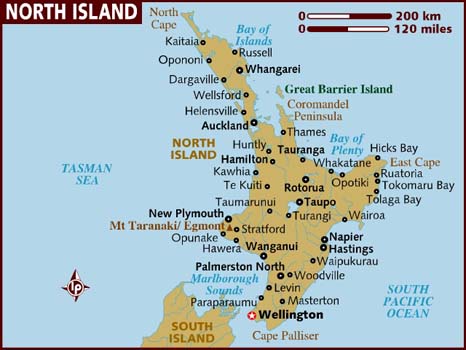
We took the ferry in Wellinton on February 22nd and drove from Picton to Nelson, then up to Cape Farewell with a stop in Abel Tasman National Park. Then back to Nelson, St.Arnaud with a visit to the Nelson Lakes. From there on to the Westport, Punakaki, Hokitika, Franz Josef, Fox Glacier to Jackson Bay. Back to Haast over the pass to Wanaka. The coming weeks we will travel to Queenstown, Milford Sound down to Invercargill and make our way back up along the East Coast.
As promised some more pictures from our visit to Napier.
Lots of 1900’s cars in Napier during the Art Deco WE.Andy took us along for a guided tour from Napier. Thank you Andy and Sue for letting us stay 3 days in your beautiful house!The whole town was in Great Gatsby style !…in the rain but..also some sunshinePouring rain on our first swingbridge in Waiohine Gorge.A KaKa bird eating away on a toast he managed to steal from the plates of a cafe guest in Pukaha Mount Bruce National Wildlife Centre.Stefan reading the manual of my camera…Takahe, a flightless bird, looks a lot like its cousin the Pukeko.We are in Kiwi Country ! We saw the Kiwi bird at the Pukaha centre where they protect the Kiwi by taking the eggs and incubating them. This is called Operation Nest Egg where eggs and chicks are protected from predators. The Kiwi is also a flightless bird, with hair-like feathers, strong legs and no tail. Kiwis are mostly nocturnal so very difficult to spot during the day.There are 5 species and all are threatened with extinction.The parliament buildings in Wellington, with the Beehive that houses the Cabinet and the offices of its ministers. We were able to get a free guided tour of the buidlings.View over Wellington from Mount Victoria.We also visited Weta Cave where the movies Lord Of the Ring, Avatar, Great Adventures of TinTin are digitally mastered. It was a learning experience to see how much craftsmanship there is involved in these creations.The Interislander ferry waiting for us to come aboard at 8AMIt was a beautfiul day crossing the Cook Strait.Views on the Queen Charlotte drive to Nelson.Views over Pelorus Sound.On our way to Abel Tasman National Park.
On our way to Abel Tasman we stopped to admire Rawhiti Cave.Rawhiti Cave, also known as Manson Cave, is 40m wide and 20m tall. The ceiling is densely covered in stalactites which become increasingly finer deeper down into the cave.
More pictures in the next blog from beautiful Abel Tasman and the West Coast.
Ilse vroeg me smalend: “Wat is de titel van jouw bericht?” Wat denk je van “Sommige van mijn beste foto’s”? ( Alle foto’s zijn genomen met een iphone 6)
Ik verschil van mening natuurlijk, en daarom:
Op de kamping:
Van dit …… naar dit in 60 seconden. Leuk!De lokale kip: de Weka, eens bijna uitgeroeid door de Maori, maar nu in vele kampplaatsen aanwezig.Strandwandeling op Farewell spit, een broedparadijs voor vogels. Ik heb het gevoel genegeerd te worden…Na een klimtocht van een uurtje bereikten we een mooie grot: Rawhiti cave. Eens heel populair bij de colonisten maar na de aardbeving van 1932 niet meer zo gegeerd. We waagden dus hier ons leven!De stalagtieten zijn vergroeid met mos, wat blijkbaar op niet veel plaatsen in de wereld voorkomt.Ilse tussen de drakenschubben – volgens een oude Maori overlevering stortte de draak brandend neer en bleven alleen zijn schubben nog over.Alles klaar voor bedtijd (zo rond 21:00 uur 😉 )En we zaten zo gezellig in ons huisjeHeel soms zijn de campeerplaatsen niet meer dan een parking. Hier zijn we in Nelson, waar we de volgende morgen om 8:00 uur bij de transmissie specialist moesten zijn. Er zijn wel toiletten en wasplaatsen voorzien.Op weg naar de Jan van Gent vogelkolonie op de Cape Kidnappers, 9 km bij laagtij langs het strand (en 9km terug). Onze timing was perfect.De Maori hebben een voorliefde voor de letter A, zeg dit maar eens snel drie keer na elkaar.Selfie bij de Huka Falls, de Waikato rivier die een olympisch zwembad in 11 seconden vult. 220 kub / sec)Ilse bij de piste: een kalk en silica afzetting in het Wai-O-Tapu thermaal park, The Terraces genaamdDe dampende champagne pool in hetzelfde park. Mag toch iets frisser voor mij.
Dit was de enige dag tot nu toe dat we echt slecht weer hebben gehad. Maar dat hield on niet tegen!
In Tasman National park, de krekels waren oorverdovend!
Zo goed de Jan van Genten kunnen vliegen en duiken in zee, zo slecht kunnen ze landen. Het vraagt meestal een drie of viertal pogingen vooraleer ze op de grond staan. Ook een crash landing gezien – net niet overkop gegaan- maar helaas niet op film.
February 21st, Tuesday,library of Wellington. Tomorrow we will take the 9AM ferry to the South Island. We arrived here after spending some time in Napier with an ex-colleague from Stefan. It was great to spend some time in a nice house with all the luxuries :-)) and not have to worry about the next camping spot.
Before arriving in Napier we did the Tongariro Alpine Crossing walk. Really wonderful ! Tongariro National Park is the oldest National Park in NZ and UNESCO world heritage since 1991. In order to prevent the selling off to European settlers several Maori chiefs (Iwi) decided in 1887 to give the grounds to the Crown under the condition that it would remain a protected area. The Tongariro Alpine Crossing is widely regarded as one of the world’s best one-day hikes.(19.4KM) We started walkig at 8 AM and arrived at the car park at 1.15PM with a short stop to eat our lunch. We did not have any rain that day but the next 4 days it would rain off and on.
We were not alone on the crossing, about 700 people during a WE day do the crossing.Stefan on top of the world 🙂Almost blown away…
Descent to the Emerald LakesFinally the sun came out and we could enjoy our lunch at the Emerald Lakes.The sun makes everything so much prettier.The snow capped moutain is Mount Ruapehu, the one with the reddish colour is Mt. Ngauruhoe. You can see the path along which we walked.On the other side, almost there…Mahuia River in Tongariro National Park.
Our visit to Napier was a little rained out but we enjoyed the Art Deco WE, the old cars in town and all the people dressed up in Gatsby style ! We walked to Cape Kidnapper’s (20KM along the beach) and had a beautiful (rainy) view of the Black Reef Gannet colony.
The gannet (Jan Van Gent) colony on Cape Kidnapper’s.The grey ones are the chicks. They will all fly to Australia in April.Wet but happy to have reached the colony and view the birds so close.
The views were really beautiful too bad the sun was not there. The reality is soooo much better than the pictures.It was named by Captain Cook after an attempt by local Mäori to abduct one of his crew.The cape is home to the largest and most accessible gannet colony in the world.The NZ pigeon or Kereru.Napier in the back, Hawke’s BayNow, we are definitely in sheep country.
…and wine country!Mission Estate Winery was established in 1851 and one of the oldest wineries in New Zealand. It was started by french missionairies.Napier black sand beach.Napier has a lot of art deco architecture constructed after most of the town was destroyed with the Hawke’s Bay earthquake on February 3 in 1931(7.8 on Richter Scale)During the Art Deco WE people dress up in 1930’s costume and vintage cars are everywhere.
Monday, February 13th, Turangi library New Zealand. It has been raining since yesterday late afternoon and thus time to catch up on news, emails and blog ! I cannot believe we have been almost 3 weeks in New Zealand. The libraries are fantastic here, they are open all days from 9.30 till 17.00 and you can use their internet, room, toilets for free. Needless to say today the computer study room was packed with tourists, backpackers mostly from Germany and France. We have been travelling with our camper for 10 days now and it is really the best option for visiting New Zealand !
We stayed about 10days in Auckland with our NZ cruiser friends from the boat Aislado, Vaughn, Sylvia and their daughter Zara. We are very happy we could stay there and take our time to find a suitable campervan! During our time in Auckland we visited the city, did some shopping for the boat and vistited Waitakere Forest Park on the west side of Auckland. New Zealanders are very friendly and relax people, “no worries” is a standard answer. Also the traffic is less hectic than in Belgium, 100KM/HR is the max. speed anywhere.
Auckland city seen from the sailing boat Aislado when we were sailing in the bay.Auckland is definitely a “sailing city”, soooo many sailboats were out that day…Waitakere Ranges Regional park, west of Auckland.The ferns are just incredible !
We picked up our campervan “Burnie” early thursday morning and friday afternoon February 3rd we took the ferry to Waiheke island for a long WE. It was wonderful. We were lucky the weather was perfect, a little breeze, blue skies. Waiheke is an island just a one hour ferry ride from Auckland. It is full of famous wineries and good restaurants, beautiful walks and scenery. We enjoyed a great lunch at the Mudbrick restaurant with the voucher we had received from the girls for our Christmas !! Memorable for sure !!!
“Burnie” on deck of the Sealink ferry bringing us to Waiheke island.We must be in wine country. We visited Mudbrick and Man-O-War wineries.Mudbrick winery and restaurant.Having a memorable lunch at the Mudbrick restaurant.…with a great view…We visited “Headland Sculpture on the gulf”, a 2-yearly event on the coast of Waiheke. We did the exhibition walk of 2km, lots of people but beautiful views and works. This work is from Virginia King and is called Phantom Fleet, a fleet of filigreed and branching vessels that connect nautical, botanical and anatomical worlds.“White bird and white angel” from Semisi Fetokai Potauainehere.Stefan’s favorite: Phil Price, Forbidden Tree, is like no tree in the natural world, it moves with the wind, creates shade but drops no leaves. It needs no water but is alive with movement.Michael Tuffery, Trailing Tangaroa, aluminum frame and rubber jandals.Views during our walk on Stony Batter Historic Reserve.Walk in Stony Batter Historic reserve.Stefan and “Burnie” on one of the many stops.Stefan the happy tramper 🙂
The Pukeko bird or purple swamphen.Pukeko bird.The australian magpie in NZ.Variable Oystercatcher.
We came back from Waiheke on the 7th of February and drove for about another hour to just before Hamilton. From Hamilton to Rotorua, Lake Taupo, Wai-O-Tapu and now in Turangi. The scenery along the way is just beautiful.
Whakarewarewa State forest park near Rotorua with redwood trees 60m high and planted in 1901.View in Whakarewarewa forest.Whirinaki Forest Park was like a fairy tale park… Frodo and Gandalf around the corner.After our walk in Whakarewarewa forest we soaked in one of the natural hot pools of Rotorua. The water was around 37-40 degrees Celsius.Lady Knox Geyser in Wai-O-Tapu (Sacred Waters) thermal wonderland.Champagne Pool.The artist’s palette, yellow from the sulphur...green from arsenic…
Active boiling mud pool.The Huka Falls or “great body of spray”, here the Waikato river funnels into a narrow chasm before plunging over a 9m shelf.
Koru spiral – “new life” symbol for the Maori
We are currently in Napier library finishing this blog and looking forward to the Art Deco festival in the next days. We will go south and hope to take the ferry to the South Island in Wellington around February 27th.
Belgium: It is sunday, January 8th, it is a foggy and cold morning while I am looking at the last pictures we took in Apataki…
November 12 2016: Apataki
Picture taken from our last anchorage in Apataki, november 2016.One last time climbing in the mast…Taking off the mainsail and all the halyards under clear blue skies.Cleaning off the salt and the rust.Almost ready to go on land… The exterior is ready.Our last sunset on the water !Sanuk being pulled out of the water on an adjustable hydraulic trailer. Alfred is driving the tractor while Pauline (his wife) is making sure everything is going well. Tony is underneath the boat adjusting the pads.Slowly but surely…Almost there… Tony and a helper are adjusting the metal plates for the trailer wheels.Finally on the hard…Sanuk on the hard ! We were lucky she was taken out of the water early in the morning on the 10th of November because afterwards the wind picked up and changed direction making it impossible to take out another boat that day and the day after!
We take the three days that we are on the hard in the carenage to thoroughly clean the boat on the inside. All the walls get a bleach solution treatment to prevent mold from growing. All lockers get emptied, cleaned and refilled.
While I was cleaning I found a little gecko on board ! They are good to have on board because they eat insects. I wonder if he will be still there when we return.
After 3 days on the hard, cleaning and preparing the boat for the 6 months on land, we were ready to fly to Papeete. It was a gorgeous sunday morning ! No wind, blue skies, the water was like a mirror…
The boat on the right will take us to the airport of Apataki.The day we left, the sea was like a huge swimming pool.“mamie” gave us each a flower wreath before we left. We will be back the end of April.Stefan is ready to leave.The sign for the boatyard in Apataki town…
Ready to leave for Papeete in the 16 seater.View out of the plane, flying over the atoll of Rangiroa. To the left the ocean, on the right the lagoon.
Flight Papeete -> Los Angelos -> New York
After a couple days in Papeete we left for New York to visit with our daughter Meliena (living in Boston). Stefan and I spent a beautiful day at the “9-11 Memorial” in New York City. A total difference from the gorgeous nature in French Polynesia but we enjoyed the City for the day!
The National September 11 memorial and museum is a tribute to the 3000 victims of the 2001 terrorist attacks.
Part of the antenna which stood on top of the twin towers.The foundation of one of the old towers.Billboard: Curious what 2017 will bring for the world order with the new leader in place. They both seem to have their doubts.
Het is zover – “de grote oversteek” van Moorea naar Huahine. Voor het eerst wordt er echt gevaren, weg van de kust, weg van de bewoonde wereld, met enkel de wind en de zee als constante. Rond 15 uur ‘s middags wordt het anker gelicht en gaan we door de passe de Stille Oceaan op. Er staat een discrete bries tussen de 10 en 15 knopen wat maar net voldoende is om al zeilend goed vooruit te geraken. Stef vindt dat uitstekend weer om zijn Oranje “Code 0” zeil uit te halen en eens te testen of de stikster degelijk werk heeft geleverd bij de reparatie.
Het oranje code 0 zeil met de witte herstelling van de zonneschade. So far so good.
De boot kreunt en haalt nu een gezapige 5 knopen. Moorea glijdt weg aan de horizon. We gaan aan tafel maar al het geschommel en de pillekes tegen de zeeziekte hebben duidelijk een invloed op de appetijt van de bemanningsleden. Dus erg veel gegeten wordt er eigenlijk niet. Alhoewel, de Kapitein laat de deining niet aan zijn hart komen en trekt een blik Pilchards in tomatensaus open dat vervolgens goed gemutst naar binnen wordt gewerkt (kwestie van de hoeveelheid reserve-proviand uit het vooronder gradueel af te bouwen).
Ook al hebben we electrische winchen, het kan geen kwaad om de spieren af en toe wat te oefenen. Hier bij het hijsen van het grootzeil.
De nacht valt en we verdelen de wachten. Ik kijk er eigenlijk wel naar uit om in het relatieve donker (het is bijna volle maan) wakker te blijven en de koers in de gaten te houden en kies dus voor de “hondenwacht”, tussen 0 en 3 uur ‘s nachts. Zoals te verwachten was duurt het natuurlijk geen half uur of de wind sterkt stevig aan (toch in mijn definitie) en komt wat scherper aanwaaien. Stef had gezegd: “als er iets is, moet ge niet aarzelen en maak je me maar wakker”, maar bij de scouts hebben we geleerd om “onze plan te trekken” en voor alles permissie gaan vragen bij het hogere gezag is niet echt aan mij besteed, dus maak ik wat beperkte koerscorrecties en hou op die manier de wind in de zeilen. Uiteraard buiten de waard gerekend, want de skipper heeft subiet gemerkt dat er aan het stampen en rollen van de boot wat is veranderd en verlaat zijn warme kooi om polshoogte te komen nemen. Na kort overleg, een blik op de GPS en een kleine aanpassing aan de stand van het grootzeil zag hij dat het goed was…
Eigenlijk is zo’n nachtelijke zeiltocht een bijna mystieke ervaring. Je zit alleen in de stuurhut, met enkel de sterren, de maan en het spel van wind en golven als gezelschap. Pure natuur die je na een tijd in een soort trance brengt en waardoor de uren eigenlijk snel voorbijglijden. Rond drie uur neemt Stef over; we fluisteren wat en werken het logboek bij. Ik kruip in bed, val als een blok in slaap en wordt pas wakker op het moment dat ’s morgens de motoren worden gestart omdat de wind het laat afweten.
We spelen wat gezelschapsspelletjes en slapen wat bij tot we rond 14 uur de lagune van Huahine binnenvaren en vrijwel onmiddellijk ankeren om rustig wat te kunnen eten en snorkelen. Huahine bestaat eigenlijk uit twee eilanden binnen één koraalrif. Na de afwas beginnen we aan het laatste stuk van de overtocht en varen we binnen de turkooizen lagune naar Faré, het hoofddorp op de noordkant van het eiland. Net voor zonsondergang vinden we een ankerplek en genieten met geel-rood-oranje tinten van een prachtige ondergaande zon.
De Windsong, een zeil cruiseschip dat we regelmatig tegenkomen
Dag 10 Huahine
Na een stevig ontbijt (pancakes met esdoornstroop) en een mok sterke koffie staan we om 10 uur aan de wal en huren een paar fietsen.
FAQ 9 – Fietsen bij tropische temperaturen, is dat wel een goed idee?
Dat valt uitstekend mee zolang ge u niet laat inspireren door het vuur en de ambities van de gemiddelde Vuile Brakée. Noem het “slow biking” als je wil.
Wie had gerekend op een Cube 29er met een Shimano XT versnellingsgroep en hydraulisch bediende Magura remmen als vaste zekerheid, vist achter het net… We zijn in Polynesië en fietsen doe je met een bike die het midden houdt tussen een meisjesfiets uit de jaren 70 en een Chopper uit Easyrider. Een stalen frame met dikke zware banden, enkel een torpedorem om onheil te voorkomen, géén versnellingen en een stuur in “longhorn” formaat als pikant (beter: pikerend) detail. Het geheel lichtpaars geverfd, kwestie van vooral niet op te vallen.
Enfin niet geklaagd, beter op de fiets dan te voet. We doen een prachtige rondrit op het eiland, met een tussenstop op een “pearl farm” en bezoeken nog een prachtige Marae (Maeva, met Visitor’s Centre) aan de kust. Alhoewel het oude geloof van de Polynesiërs animistisch van inslag was, worden we ook hier vriendelijk verzocht om het bordje met “A tatara ti to, tatou tia’a” te respecteren en onze schoenen buiten te laten staan (waarvoor “Mouruuru” ofte “dank u”). Gelukkig lopen we enkel blootsvoets om het delicate weefwerk van bladeren op de vloer niet te beschadigen en niet om godsdienstige redenen. Elegante hutten en boten bouwen, de Polynesiërs hebben er een handje van weg.
stenen vis fnuik op de rivier
Na een groepje heilige blauwogige alen in een riviertje om moed te hebben gebeden, rijden we de eerste (en enige) col van het eiland op om vast te stellen dat onze gebeden niet zijn verhoord… De weg slingert zich opeens naar boven met een stijgingspercentage van tegen de 15%, een oefening in nederigheid voor een minder geoefend fietser, we stappen af en duwen onze loodzware hippy bikes naar boven, zuchtend, puffend en nat van het zweet. Ook Stef ziet af, hij heeft wel versnellingen, maar sleurt een aanhangwagentje met gerief mee naar boven.
Na te voet (op een hongerige maag) een 200-tal hoogtemeters te hebben bemeesterd worden we navenant beloond met een absoluut verbluffend uitzicht op de andere kant van het eiland.
We koesteren ons met de wetenschap dat het vanaf nu alleen bergaf zal zijn en we ons dus rustig tot helemaal beneden kunnen laten glijden over blinkende asfalt. Quod non!
Wat volgt zal een legende worden in de annalen (let op de dubbele “nn”) van ons nageslacht: Mevrouw mijn Echtgenote slaagt erin om haar torpedorem volledig op te smoren, het ding is misschien wel geschikt voor huis- tuin- en keukengebruik, maar voor het controleren van de daalsnelheid schiet de achteruittraprem volledig tekort. De naaf braakt donkere zwarte rook uit en Ilse gilt “Katie, pas op… uw fiets staat in brand…”. Gelukkig roept ze dat net voordat de rem finaal de geest geeft en wordt het ijzeren ros zonder ongelukken tot stilstand gebracht. Ik sta ermee te lachen, tot blijkt dat ook mijn torpedorem rook afgeeft. Résultat des courses: we klommen te voet naar boven en mogen nu ook te voet naar beneden.
De rest van de dag genieten we van de uitzichten. Huahini is een zacht, vrouwelijk en vruchtbaar eiland. De natuur gedraagt er zich naar. Abondant groen, afgewisseld met prachtige vergezichten. Het eiland wordt niet voor niets “l’authentique” genoemd, het is één grote tropische tuin.
Na een laatste krachtinspanning duiken we de bar op het strand vlak bij de boot binnen, net op Happy Hour. Alles bij elkaar hebben we een 30 km gefietst onder de tropenzon. Terwijl Stef en ik de fietsen en de boodschappen wegbrengen bestellen de dames hun eerste Mai Tai bij de ondergaande zon. Het zal niet bij één drankje blijven en de vermoeienissen van de dag én het feit dat we over de middag niks gegeten hebben zijn alras vergeten…
Karel en Stefan begroeten de vele fotografen, maar het was helaas voor de zonsondergang achter ons. Ook loopt net een bevoorradingsschip de atol binnen.
Dag 11 Huahine
Grotendeels een rustdag. We slapen uit, maken briochebrood en sterken de inwendige mens met een stevige portie spek met eieren.
Er wordt gekeuveld, gelezen, gescrabbeld en vooral veel gediscussieerd over de spelregels en hun verreikende consequenties. Voor de liefhebbers: vervoegde werkwoorden zijn tegenwoordig Scrabble-fähig, er zijn een pak woorden met Q’s, Y’s en X’en, maar je kan ze best op voorhand instuderen want als een woord niet wordt aanvaard ben je onverbiddelijk je beurt kwijt.
In de late namiddag verleggen we ons van het levendige Faré naar het zuiden van het eiland. Door een kleine inschattingsfout van de Kapitein – Stef maakt bij het navigeren énkel en alleen schoonheidsfoutjes – moeten we na een uurtje op zee rechtsomkeer maken en de lagune opnieuw binnenvaren. De route buiten de lagune, langs de zeekant, brengt ons immers niet tot bij de snorkelplek Point Hiva die we voor ogen hadden. Onder het motto “we go with the flow” beslissen we om voor anker te gaan in een prachtige baai (Bourayne Bay) die we een dag eerder met de fiets hebben aangegaan.
De Admiraal spot in de verte een aanlegboei op een idyllische plek en we beslissen om ons daar aan vast te leggen. Zo’n maneuver lijkt in theorie makkelijk, tot je daar op het net tussen de rompen aan de voorplecht staat en die boei zo’n 2 meter lager onder je bootshaak doorglijdt. Bovendien weegt dat ding lood met al die doordrenkte meertouwen die absoluut geen zin hebben om uit het zilte nat gehesen te worden. Enfin, mits enige ruggenspraak tussen de dekknechten en hun baas, een tweede poging en wat gevloek ligt de boot aan de boei vast. Rest nog de telkens weerkerende endurance-test…
Ilse gaat er een aan de haak slaan… Met Karel zijn hulp!
FAQ 10 – Wat is dat nu weer, die endurance proef?
Stefan staat gekend als een voorzichtig schipper en zijn boot wordt enkel toevertrouwd aan aanlegboeien wanneer hij er zeker van is dat er bij frisse bries (5 bft) of matige wind (6 bft) geen ongelukken van kunnen komen. Lees: de boei en bijhorend betonblok moeten de 15 ton wegende Sanuk netjes op zijn plaats kunnen houden.
De proef is simpel: we meren aan en dan wordt er 10 seconden met beide motoren op volle kracht achteruit aan het meertouw en de boei getrokken om zeker te zijn dat de zaak muurvast zit. Tijdens die operatie knarsen die touwen en blijf je maar beter uit de buurt want er staat op dat moment nogal wat spanning op de landvasten. Laat ons het houden op: “een veiligheidstest uitgevoerd (en uitgevonden) door de Kapitein, gekruid met een toets van vanille en geblancheerd in een saus van testosteron”.
Voor de taalpuristen: zo’n aanlegboei wordt in het Frans dood lichaam of “corps mort” genoemd. Het blijft dus ietwat luguber naar mijn mening: met twee motoren liggen trekken aan een lijk; het beeld van de vierschaar is nooit ver weg.
Nu de boot netjes gezekerd is profiteren we van de totale afwezigheid van golfslag in de baai om de mastlamp die de voorplecht verlicht te vervangen. Stef kruipt in een harnas en laat zich door zijn echtgenote de mast inhijsen (met behulp van de elektrische winch weliswaar). Een broos moment waarop de skipper zich volledig overgeeft aan de nukken van zijn levenspartner. Ik tracht het geheel te filmen als een timelapse (het duurt allemaal nogal lang), maar dat mislukt jammerlijk omdat de batterij van mijn iPhone het voor bekeken houdt.
Enkele honden blaffen en Stefan en ikzelf dagen ze uit door te huilen naar de volle maan, gedurende 10 minuten weerklinkt over het meer niets dan honden- en mensengejank tot we ermee ophouden en aan tafel gaan om uitgebreid te dineren onder een volle maan.
Na de maaltijd zetten we wat muziek op en luisteren we tot bedtijd naar Leonard Cohen. Zijn lage en donkere stem (do you want it darker?) past perfect bij de sfeer in de baai en zorgt voor een meesterlijk meditatief moment. We laten het allemaal over ons komen en genieten van de rust en de natuur om ons heen. Het water zit vol leven, de vissen foerageren en springen af en toe naar insecten. In de jungle klinkt de roep van een ons onbekende vogel (volgens kenners verwant aan de Polifinario) en langs de oever vaart een Polynesische visser voorbij.
Onder de maan blinkt de rimpelloze lagune Over de luwte van de lagune schuift moede de maan Onder de maan in de luwe lagune schuift de kano naar zee Langs het hoogtij, langs het laagtij schuift de kano naar zee schuift met de schuivende maan de kano naar zee Zo zijn ze gezellen naar zee de kano de maan en de man Waarom schuiven de maan en de man getweeën gedwee naar de zee?
… om te gaan vissen! (vrij naar Melopee van Paul Van Ostaijen)